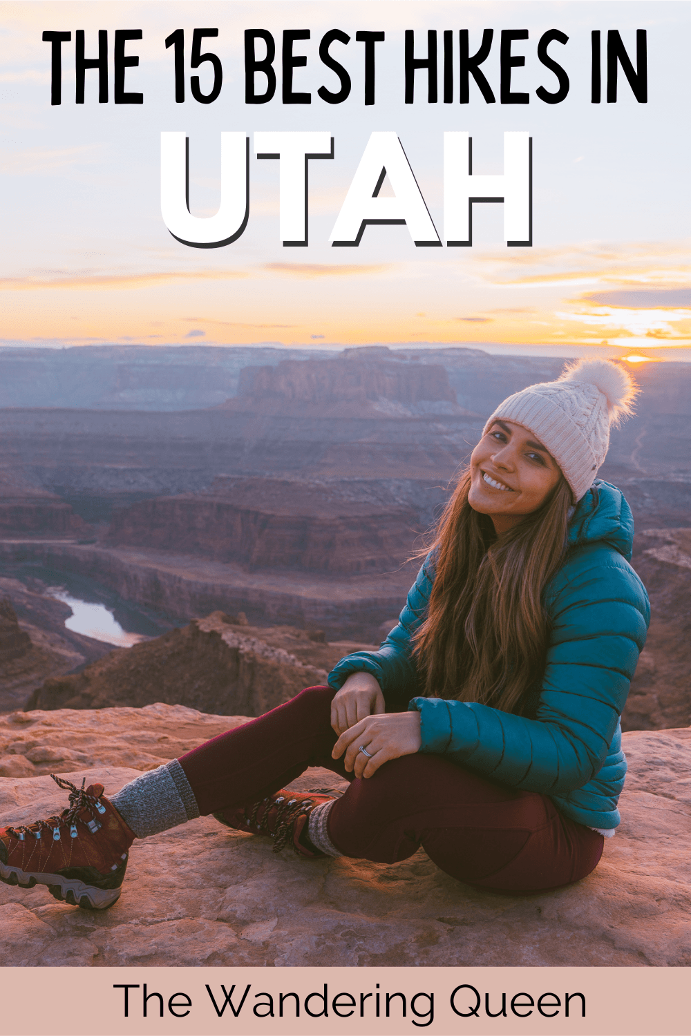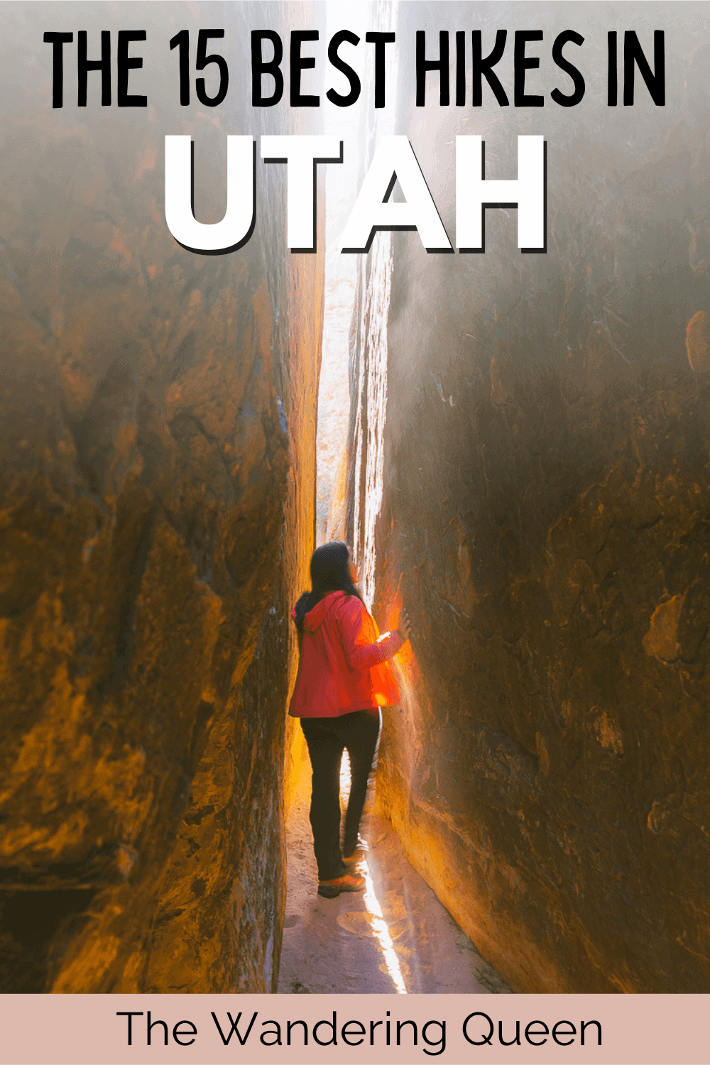
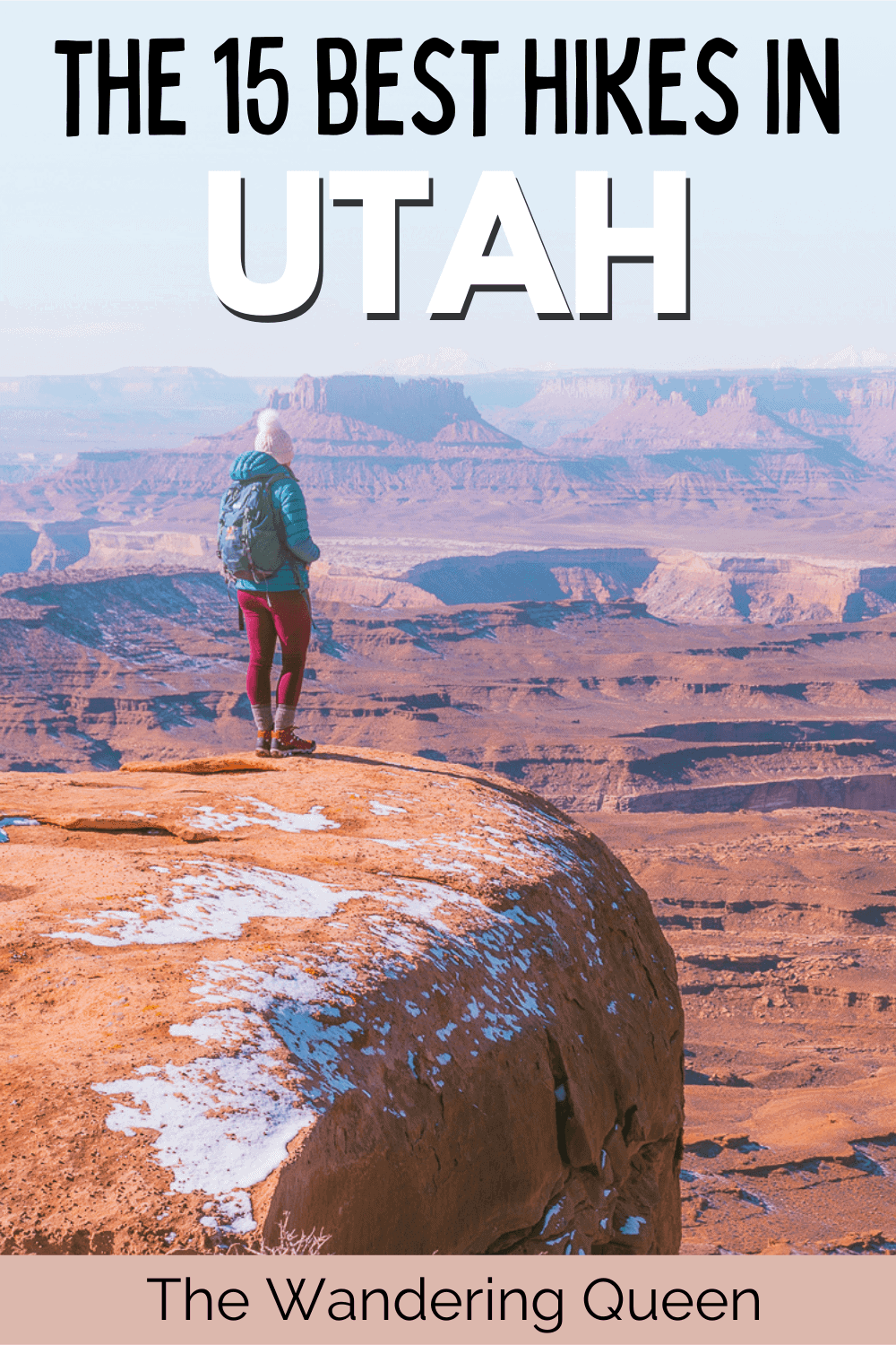
The 15 Best Hikes In Utah
I visited Utah for the first time a few years ago when someone suggested seeing Zion National Park. I was really hoping to visit the Grand Canyon instead, but I couldn’t get a backpacking permit. So I went with visiting Zion and Bryce Canyon National Park. OMG, was I stunned at the beauty of Utah. I couldn’t believe that this place even existed! The bright orange swirls of canyons, buttes, and hoodoos, really made me into a hiking addict. This trip sparked my interest in the outdoors, and now I come back to Utah regularly to explore it even more! So check out below all the best hikes in Utah! All five national parks are listed, and I have even sprinkled in some fun unknown areas.
Disclosure: This post contains affiliate links. If you click one of them, I may receive a small commission (for which I am very grateful for) at no extra cost to you.
Download my free Outdoor Photography Guide
Map Of Best Utah Hikes
You can get to Utah by flying into Salt Lake City, Las Vegas, or Grand Junction airport. I have flown to all three cities to get to Utah. It just depends on which areas you are mainly hiking in and the prices of the flights.
What To Pack For Utah Hiking
- Sunscreen: Super important and it is part of the ten essentials! >Buy Sunscreen
- Chapstick: This one has SPF so your lips won’t get burned! >Check Out This Chapstick
- Hiking Boots/Shoes: If you use tennis shoes, you can easily hurt your toes by hitting a rock by accident (Trust me, I have done it so many times before). Hiking boots helped tremendously. They grip so well on the red rocks. >Check Out My Hiking Shoes
- Hiking socks: Having the correct socks helps prevent getting blisters. Smart Wool is probably my favorite brand out there. >Buy Hiking Socks
- Water Reservoir: Water reservoirs help prevent dehydration while hiking. The great thing about this reservoir is that it doesn’t have a plastic taste. >Here Is My Water Reservoir
- Water: Stay nice and hydrated.
- Sunglasses: It can get sunny in the summer and winter when hiking Utah, so make sure to pack some sunglasses. I forgot mine and it was a pain! >Check Out These Sunglasses
- Snacks: The best snacks are jerky, nuts, and energy bars. >>>Check Out These Snacks
- Camera: The Sony A6000 was one of the first cameras I started traveling with. The Sony A6000 is an excellent camera for people that want to start improving at travel photography. >Buy Sony Camera Here
- First Aid Kit: This is one of the first things I bought when I first started going on adventures. It is super portable. >Buy This Awesome First Aid Kit Here
- Day Pack to carry all your things: When you hike Utah, you need a good backpack to carry all your gear. REI has some great beginner backpacks. >Buy This Great Quality Backpack
- Headlamp: A headlamp is an absolute must in case you get stranded in the dark! It is a lot more portable and easier to use than a flashlight. >Buy A Headlamp Now
- Leggings or Hiking Pants: I always wear leggings while hiking because it is what I feel most comfortable with! >Click For My Favorite Hiking Leggings
- Breathable sweat-wicking shirts: Cotton shirts soak up your sweat when hiking, so make sure to wear something breathable. >Check out this awesome breathable shirt here.
- Mid Base Layer: If you are hiking in the Winter, Spring Or Fall, this might be a great idea. >Check Out My Sweater Here
- Sports Bra: For women. >Check This One Here
- Jacket: I always have a jacket in my backpack, even if it is hot. I do it just in case of an emergency. >Buy My Favorite Jacket
- Rain Jacket: The worst feeling in the world is being wet and cold while hiking. >Check Out My Rain Jacket Here
- Tripod: This is an optional item, but it is excellent for getting the ideal sunset pictures. >Check out this tripod
- Knife: I always carry a knife in my backpack just in case. >Check Out My Knife Here
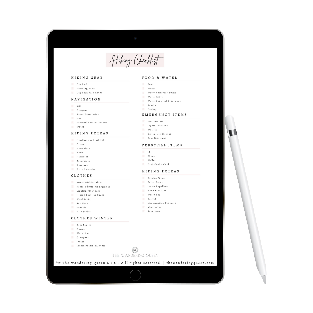
Claim your FREE Hiking Checklist
Ready to start hiking? Grab my free hiking checklist and never forget anything at home!
Best Hikes In Utah
Best Southern Utah Hikes
Angels Landing
- Distance: 5.0 miles,
- Elevation Gain: 1,630 feet,
- Route Type: Out & Back
- Difficulty: Hard
- Trail Guide: Link
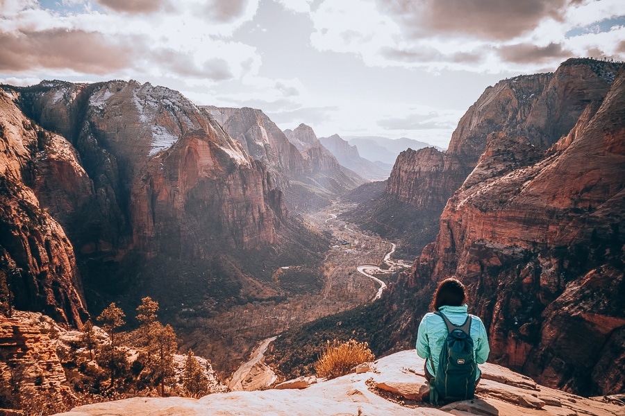
Angels Landing is a special hike for me because this trail converted me into a hiking junkie. Zion National Park was the first national park I ever saw, and I was blown away!
This trail is world-famous and for a good reason. Some areas are pretty sketchy and have chains to help you get to the viewpoint. You walk on a narrow walkway with steep dropoffs on both sides of you. This is definitely not for the faint of heart or for people with small children. But if you can get to the viewpoint without having a panic attack, the view is totally worth it!
If you go in the winter, please have good hiking shoes and walk slowly. We saw someone almost fall off the ledge when he slipped while power walking, but luckily a rock caught him near the edge—one of the most frightening experiences of my life. Be careful!
Read More: 10 Best Hikes in Zion National Park | Top Trails & More
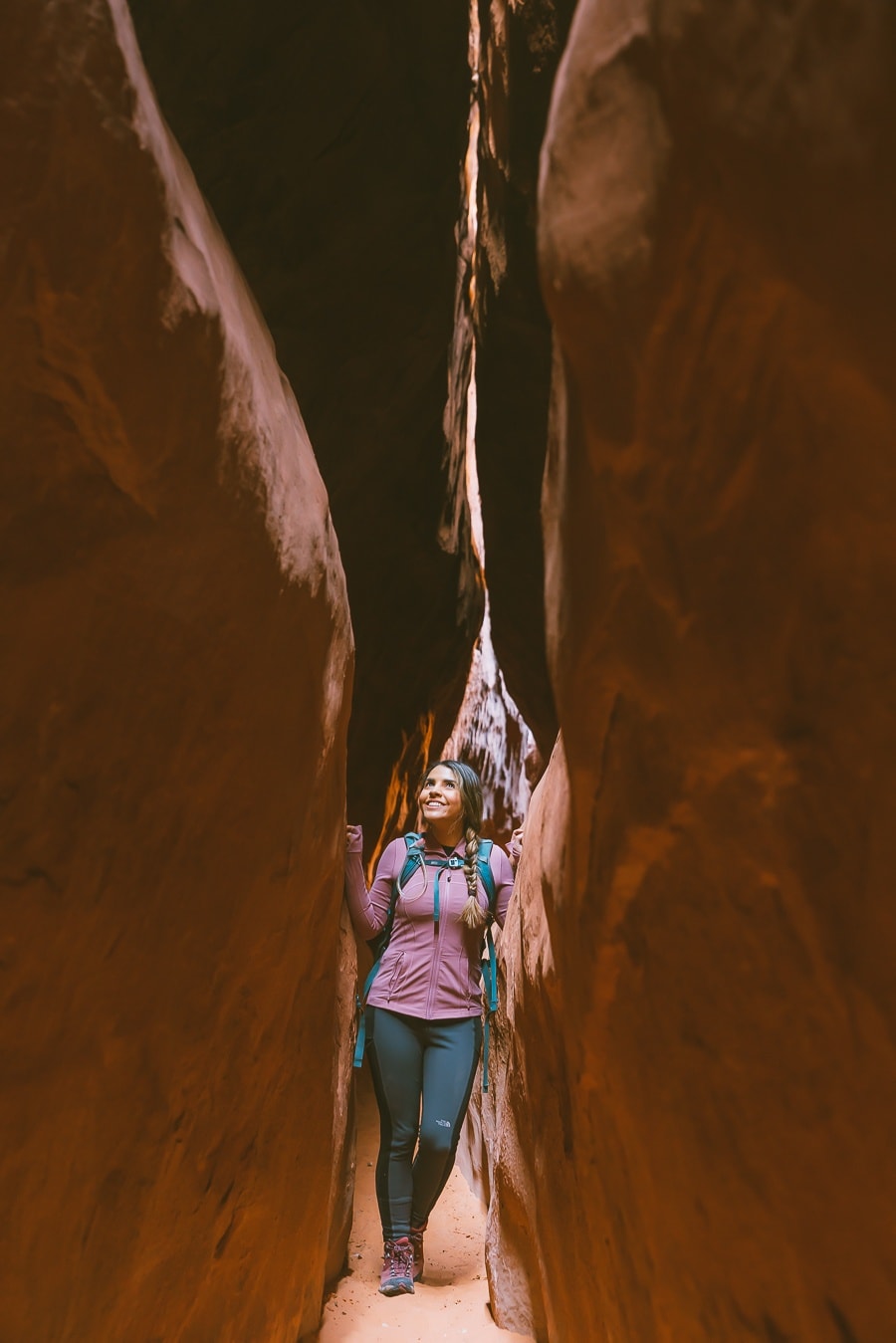
The Narrows
- Distance: Up to 15 miles,
- Elevation Gain: 1,017 feet,
- Route Type: Out & Back
- Difficulty: Moderate
- Trail Guide: Link
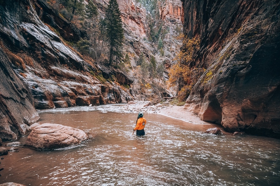
The Narrows is probably one of the most interesting hikes I have ever done. It is one of a kind and absolutely breathtaking. I have never seen pictures that have captured its full beauty. To see it in person is on another level and should be on everyone’s bucket list.
As shown in the picture above, you have to walk in water that could go up to your waste. In the summer the water feels fantastic but in the winter (when I went) it was freezing! So we rented a dry suit before heading out there. You can rent the gear here. I also recommend having a walking stick as there are many rocks in the water and you can easily lose your balance.
Read More: 13 Most Beautiful Slot Canyons in Utah
Navajo Loop Trail And Queens Garden Trail
- Distance: 2.9 miles,
- Elevation Gain: 629 feet,
- Route Type: Loop
- Difficulty: Moderate
- Trail Guide: Link
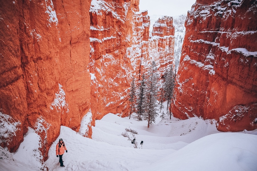
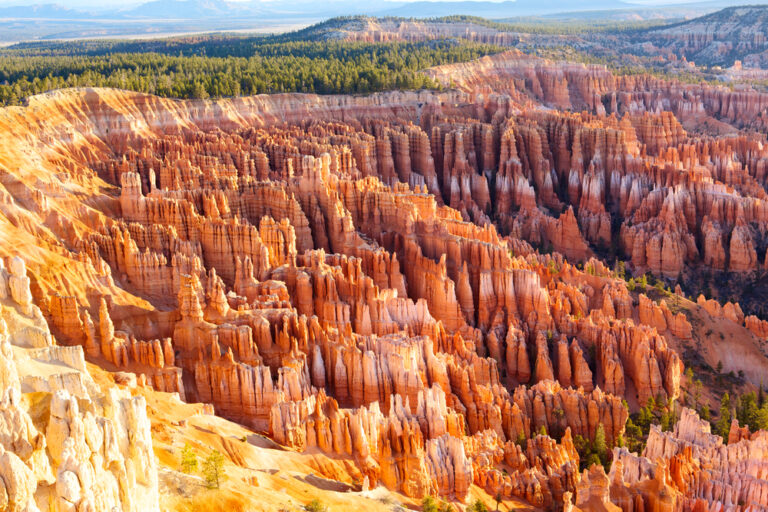
Bryce Canyon is one of the most picturesque places I have ever seen. The bright orange hoodoos in the contrast of the white snow really made me question if I was dreaming. We only explored the park for the day and decided to hike the most popular trail: The Navajo Loop and Queens Garden Trail. You really can’t go wrong with this trail or with any of the hikes in the park. Bryce Canyon is a pretty small park, but it packs a punch when it comes to beauty.
Read More: The Ultimate Bryce Canyon Winter Guide
Best Hiking In Utah: Central
Leprechaun Canyon
- Distance: 2 miles, round trip
- Elevation Gain: 141 ft.
- Route Type: Out and Back
- Difficulty: Moderate
- Trail Guide: Link
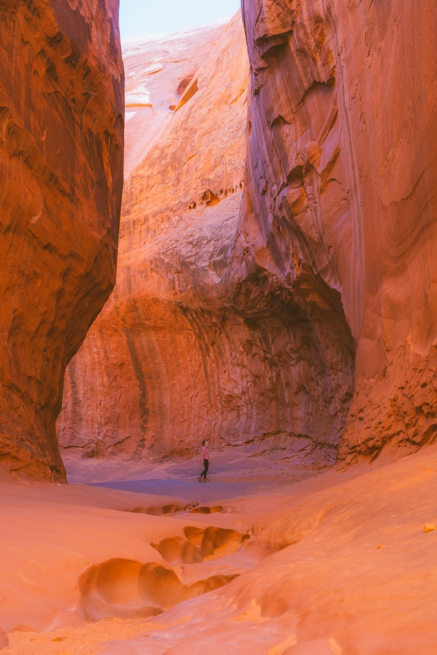
Leprechaun Canyon is probably the least known trail on this list, and it is such a joy to do. We explored this trail on a weekday, and we didn’t see a single soul. I usually hike in Washington State, where I see a few people, but this trail had no one! It was fun to hike this all on our own, but it was eerie how quiet it was.
Anyways, this trail is fantastic for anyone that wants to avoid the crowds and looking to add some slot canyons to the mix. It is so short and easy to do, but the trail is out in the middle of nowhere.
Read More: The Ultimate Moonscape Overlook Guide + Some Helpful Tips
Cassidy Arch
- Distance: 3.1 miles
- Elevation Gain: 666 ft
- Type of Route: Out and Back
- Difficulty: Moderate
- Trail Guide: Link
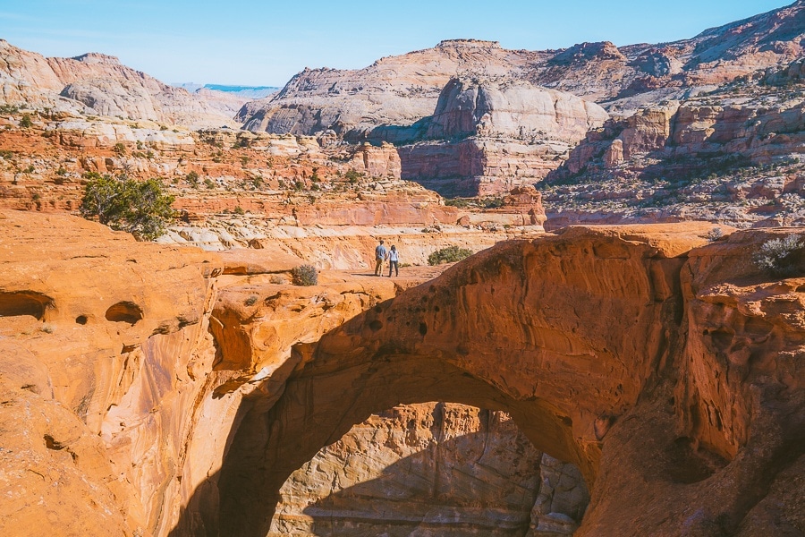
My favorite hike in Capitol Reef National Park is, of course, Cassidy Arch. This trail was so fun and had outstanding views. We even saw climbers repelling down the canyon while we sat and ate lunch.
Capitol Reef is the least visited national park in Utah, and it showed while we were here. It felt like a ghost town in the winter, but we didn’t mind! I am all about seeing outstanding views with no crowds.
Hickman Bridge
- Distance: 1.7 miles
- Elevation Gain: 426 ft
- Type of Route: Out and Back
- Difficulty: Moderate
- Trail Guide: Link
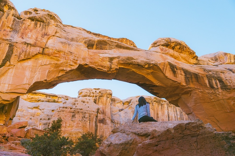
Hickman Bridge is another great arch hike in Capitol Reef National Park that was easy and short. You cannot get to the top of the arch, but the views from the bottom were still pretty sick!
This is an excellent hike for people of all ages. The views were incredible, and I loved how the canyon surrounded us. The area is enormous, so there are many options for finding a spot to eat lunch or take pictures.
Corona Arch Trail
- Distance: 2.3 miles,
- Elevation Gain: 469 feet,
- Route Type: Out & Back
- Difficulty: Easy
- Trail Guide: Link
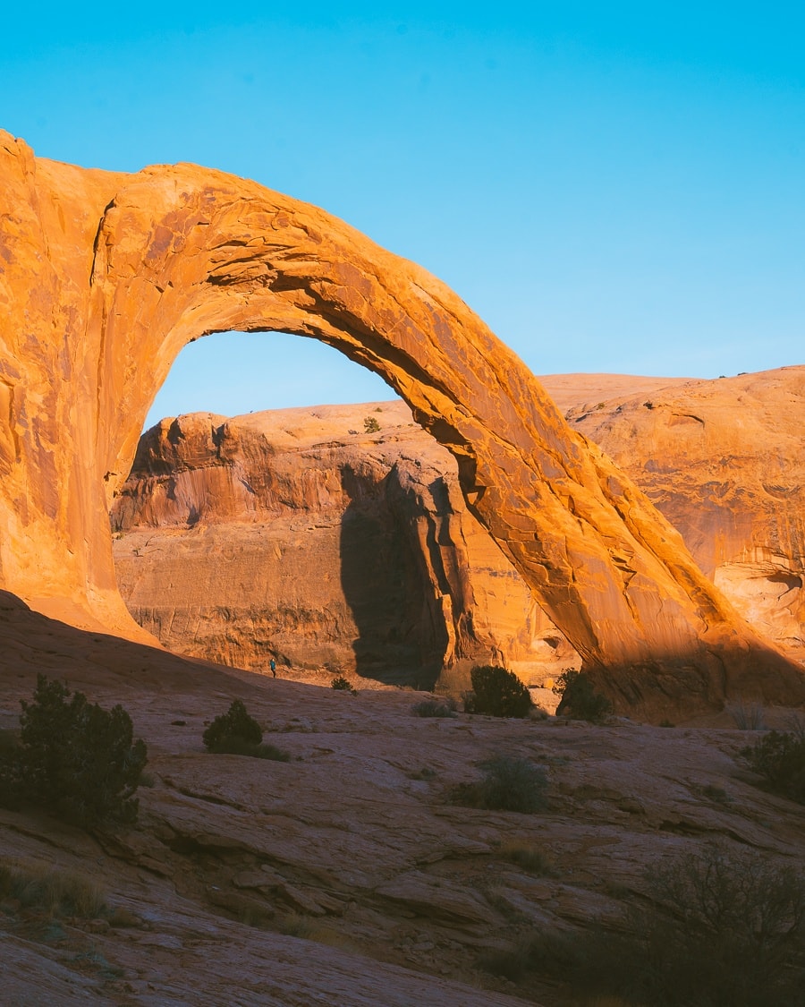
Corona Arch is a fun trail that is located near Moab. I am so glad I found this trail online because it was pretty easy, and I liked that it had a bit of scrambling to get up to the arch. There were also many dogs on the trail as it is dog friendly. We decided to hike the trail for sunset, and it was a great option for hiking back in the dark, as the trail is straightforward to follow with markings painted on the rocks.
Grab Your Free Car Camping Checklist! 🚗🌲
Ready to elevate your car camping game? Snag our essential checklist to ensure you’ve got everything you need for a stress-free, fun-filled adventure! Perfect for beginners and seasoned campers alike. Download now and hit the road prepared! 🌟🎒
Delicate Arch Trail
- Distance: 3.2 miles round trip
- Elevation Gain: 629 ft.
- Route Type: Out and Back
- Difficulty: Moderate
- Trail Guide : Link
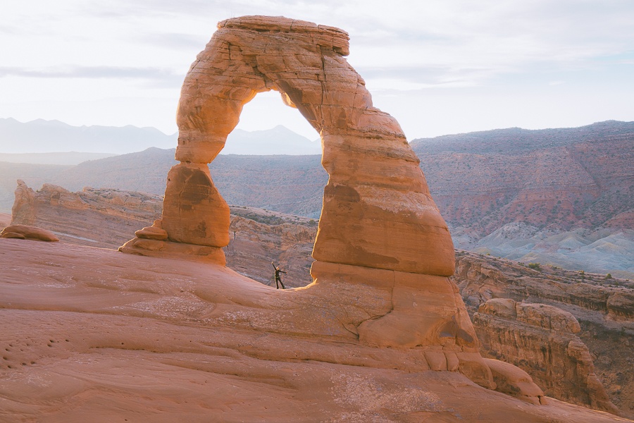
Anywhere and everywhere you go in Utah, you see a picture of this iconic arch: Delicate Arch. It is the symbol of Utah and one of the first things you think about when you read about this state. I had the chance to hike this trail for sunrise in the winter years ago. Hiking the Delicate Arch for sunrise did pay off as we were the only ones enjoying this beauty.
I have seen recent pictures of this hike, though, and there is usually a huge line to take pictures with this stunning arch. Try to get there early in the morning, on a weekday, and in the off-season if you want fewer crowds.
Devils Garden Loop Trail
- Distance: 7.9 miles, round trip
- Elevation Gain: 1,085 ft.
- Route Type: Loop
- Difficulty: Hard
- Trail Guide: Link
I had heard about the Devils Garden Trail many times before I hiked it but never really had this trail on the bucket list. After hiking it, I can now say it should definitely be added to your bucket list!
I didn’t read much about this before attempting it, so I didn’t know how amazing this loop was. It is FILLED with arches. There are 7 total, and I saw all of them. I loved this trail! There was scrambling, so make sure you bring good hiking shoes if you attempt the whole loop. You for sure need them here.
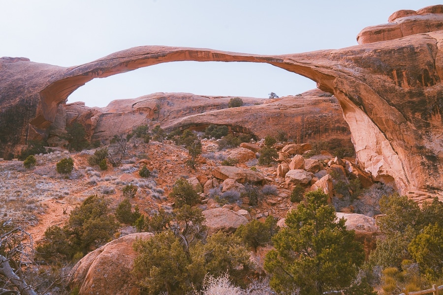
What I loved about this hike is that you can make it easy, moderate, or hard. For an easy trail, hike to Landscape Arch. Most people do this, including families with small children.
To make it moderate, hike to Double O Arch. This requires a bit of scrambling and jumping around rocks.
To make the trail difficult, do the whole loop. We barely saw people attempting the whole loop because it is long and can get sketchy in some areas. Bring good shoes! My husband almost fell because his hiking shoes were way too old.
Overall I really enjoyed trekking the whole loop. It was a fantastic, fun time, and I feel like everyone should attempt this trail.

Note: From April 1 to October 31st, 2024 Arches will implement a pilot timed entry system to help manage traffic and improve visitor experiences. I am so excited about this because the park was already crowded in the winter, so I can’t even imagine how it is in the spring and summer. Reserve your tickets here.
Double Arch And Landscape Arches Trail
- Distance: 0.6 miles, round trip
- Elevation Gain: 95 ft.
- Route Type: Out and Back
- Difficulty: Easy
- Trail Guide: Link
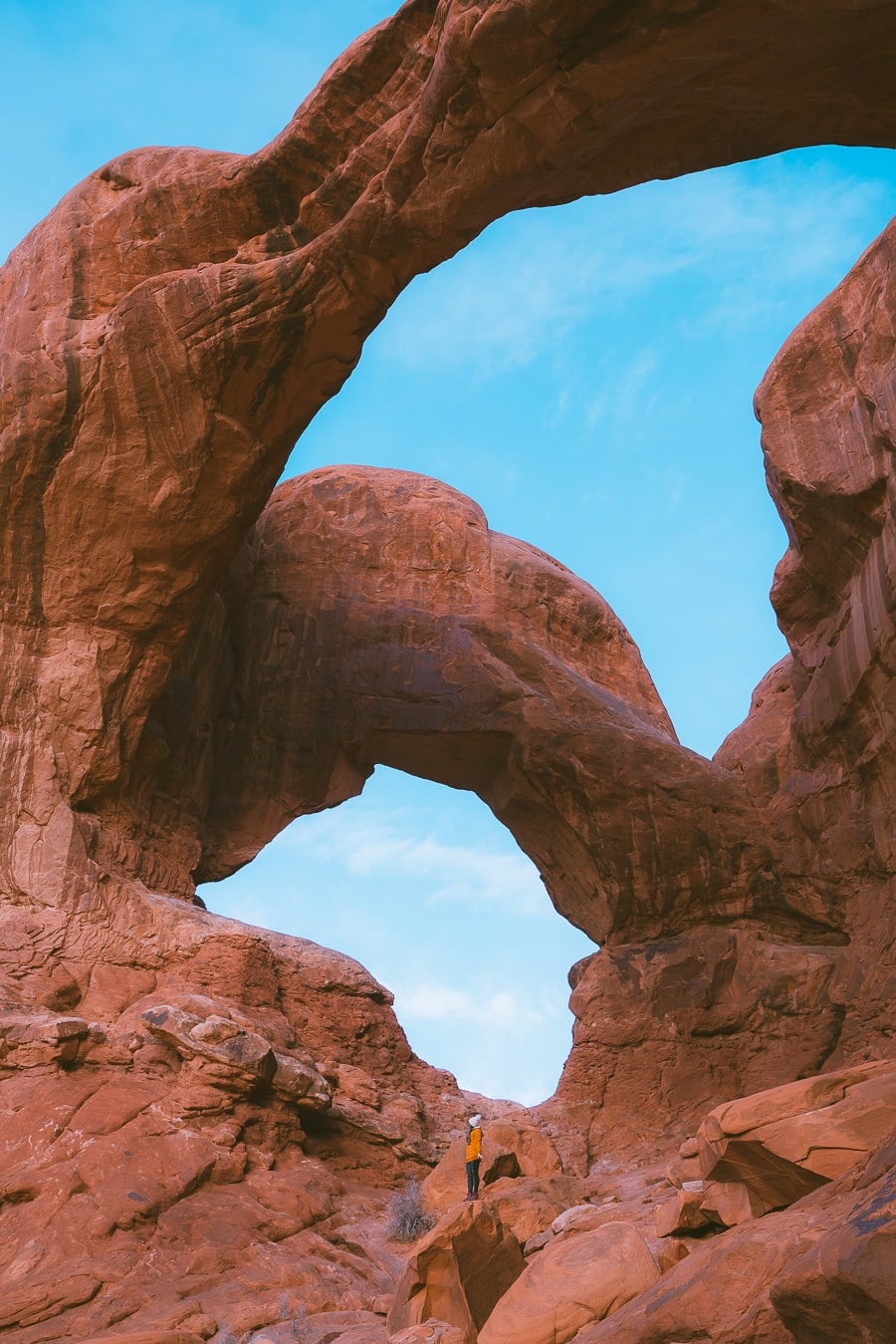
Double Arch and Landscape Arches are separate trails, but I wanted to combine them because both use the same parking lot, and both trails are pretty short and easy. Even though these hikes are effortless trails, I still enjoyed them because the views are phenomenal. If you are exploring Arches National Park, you must stop by here and enjoy these arches. You only need like an hour at most.
Park Avenue Trail
- Distance: 1.8 miles, round trip
- Elevation Gain: 298 ft.
- Route Type: Out and Back
- Difficulty: Easy
- Trail Guide: Link
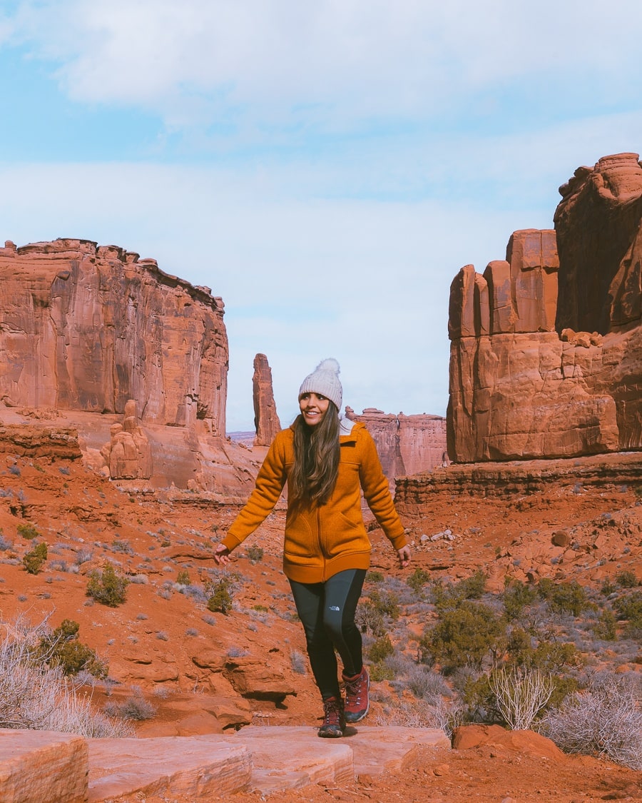
I had never heard of Park Avenue until I saw it on the Arches National Park map and decided to check it out. Wow, I am so glad I did! This trail is in between a plethora of canyons and buttes. Such a stunning yet easy hike, and it is located near the national park entrance.
Mesa Arch
- Distance: 0.7 miles, round trip
- Elevation Gain: 85 ft.
- Route Type: Loop
- Difficulty: Easy
- Trail Guide: Link
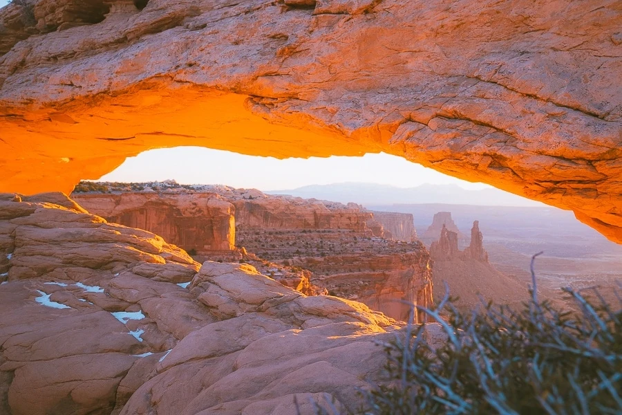
Mesa Arch is the most iconic viewpoint at Canyonlands National Park. People get up extremely early in the morning to get a glimpse of the glowing arch with the buttes in the distance. It is an awesome sunrise spot but let me warn you that it will be crowded! I went in the off-season and on a weekday, and there was still a ton of people. I didn’t care, though; I still enjoyed this fantastic view while I drank my warm cup of joe.
Chesler Park Loop Trail
- Distance: 10.4 miles, round trip
- Elevation Gain: 1,820 ft.
- Route Type: Loop
- Difficulty: Moderate
- Trail Guide: Link
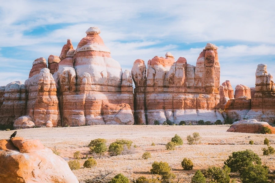
One of the most difficult trails on this list is Chesler Park Loop. I actually didn’t day hike this trail; I backpacked it for four days. I am so glad I did because the landscape in this area is out of this world. There is also a fun area where there are slot canyons which we explored in the early morning.
The surrounding spires jutting out of the ground looks fantastic during sunset. If you get a chance, backpack to this area but bring plenty of water (we ran out). However, if you can’t backpack it, hiking it is still a great option.
Murphy Point Trail
- Distance: 3.4 miles, round trip
- Elevation Gain: 147 ft.
- Route Type: Out and Back
- Difficulty: Easy
- Trail Guide: Link

Murphy Point trail is my favorite hike in the Islands in the Sky District in Canyonlands National Park. We hiked this trail in the early morning, and the views were glorious. There is almost no elevation gain, so the trail is pretty easy. This hike has fewer crowds than Grand Viewpoint Trail (one of the most popular trails in the park), and I felt like the views were better. The parking lot is pretty small, though, so I recommend getting there early.
Dead Horse Rim Loop Trail
- Distance: 5.2 miles, round trip
- Elevation Gain: 875 ft.
- Route Type: Out and Back
- Difficulty: Moderate
- Trail Guide: Link
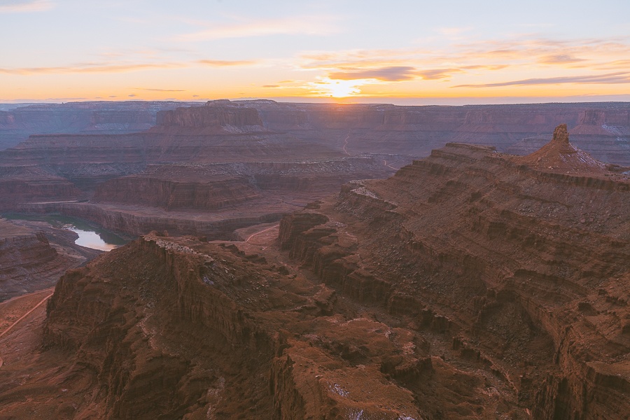
Dead Horse Point State Park is one of the dreamiest areas near Moab. The views of the canyons are incredible, especially during sunset. This state park is located near Canyonlands National Park and should be on your to-do list when exploring near Moab.
There are many hikes around this state park, one being the Dead Horse Rim Loop trail, but if that is too long, you can definitely make the trail shorter by only doing the East or West Side. Or if you don’t feel like hiking, you can definitely take in the views at the Dead Horse Point viewpoint.
Final Thoughts On Hiking Trails Utah
Thanks for reading about the best hiking trails in Utah. Check out some of my other Utah blog posts. I travel back to Utah every year for a good reason. This state is so fantastic:
- The 10 Best Hikes In Arches National Park
- Utah National Parks Road Trip
- The Ultimate Needles Canyonlands Backpacking Guide
- Tips On Visiting Goblin Valley State Park
- The Best Things To Do In Capitol Reef National Park
- The Best Hikes In Canyonlands National Park

Get my free National Park Checklist
When you join the newsletter!
Pin For Later: Best Hikes Utah