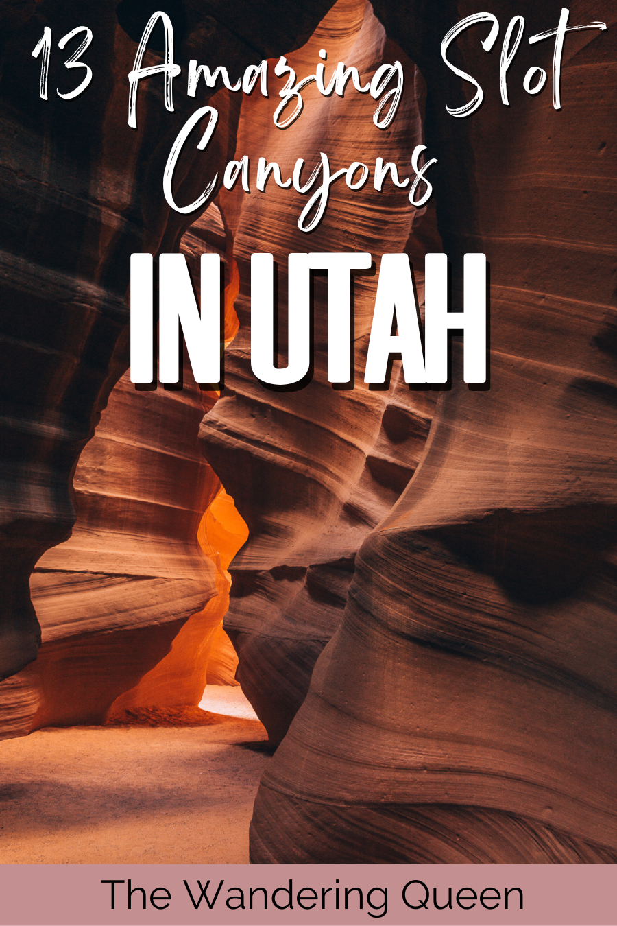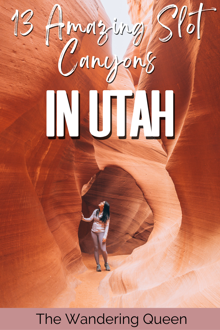
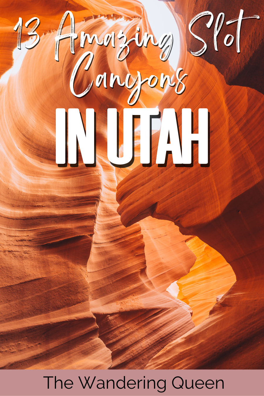
13 Most Beautiful Slot Canyons in Utah
Utah is full of terrific hiking spots, with five national parks in the state alone. Many of those beautiful hikes are found within the slot canyons in Utah, passing by beautiful rock formations.
Southern Utah has the largest amount of slot canyons in the world. Whether you’re a beginner or an expert in canyoneering, there are so many slot canyons in the area to choose from.
So, grab your best camera gear for hikers and start planning your trip to Utah’s many slot canyons near Moab and across the state.
Disclosure: This post contains affiliate links. If you click one of them, I may receive a small commission (for which I am very grateful for) at no extra cost to you.
Slot Canyons In Utah Map
Below are the best slot canyons of Utah on Google Maps.
Guide to Slot Canyons, Utah
Some of the best slot canyons are in Utah and scattered all over the state. You can go from the Moab slot canyons to the most photographed canyon in the United States. Find out which is the longest and which has the most interesting and peculiar rock formations below.
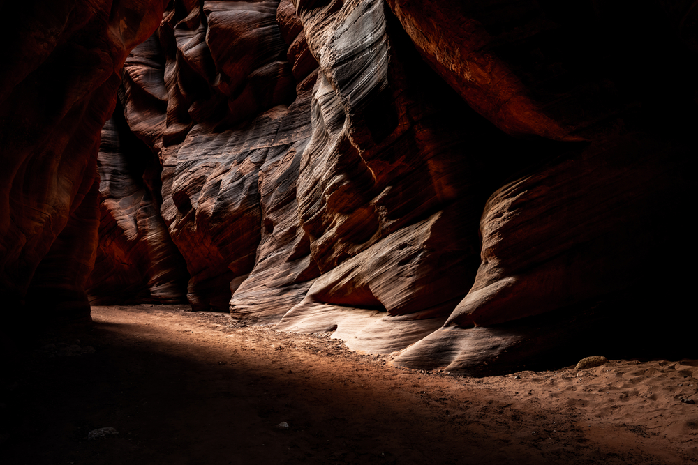
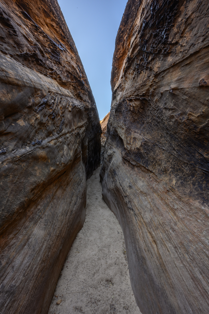
Best Slot Canyons in Utah
Leprechaun Canyon
- Location: North Wash
- Distance: 2,17 Miles
- Elevation Gain: 100 Feet
- Route Type: Out & Back
- Difficulty: Easy
- Trail Guide: Link
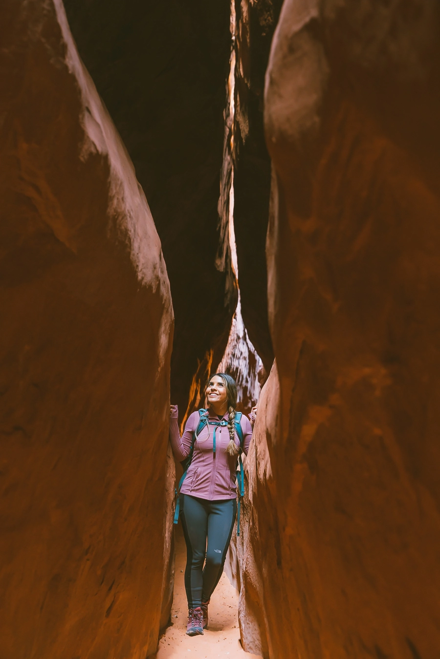
If you’re a movie buff, you might recognize these canyon walls a bit. Some scenes of 127 Hours were filmed here. But, even if you don’t recognize it from the Academy Award-nominated film, it is still an amazing slot canyon to explore and one of the best hikes in Utah.
These beautiful southern Utah slot canyons are relatively easy to reach. To get to the canyon, you need to take State Route 95 in the direction of Hanksville. After entering the Sandthrax Campground, a short dirt road northeast will lead you to a wash opening, where you’ll see a small slot opening to the starting trail.
The hike isn’t too difficult and splits into three forks. The right side fork is the easiest and is straightforward, whereas the middle and left fork is for more intermediate hikers and climbers. These smooth rocks are beautiful but can be quite crumbly and unpredictable, so be careful. It is especially tricky in the middle fork, where some areas become relatively narrow.
However, staying near the bottom allows for an easy hike, even for beginners. The best time to hike the slot canyons is between March and October. Around March, it is still a bit chilly but not as hot as the summer months yet.
Download my free Outdoor Photography Guide
Antelope Canyon (Upper and Lower)
- Location: Page, AZ
- Distance: 0,3 Miles
- Elevation Gain: 4 085 Feet
- Route Type: Loop Trail
- Difficulty: Easy
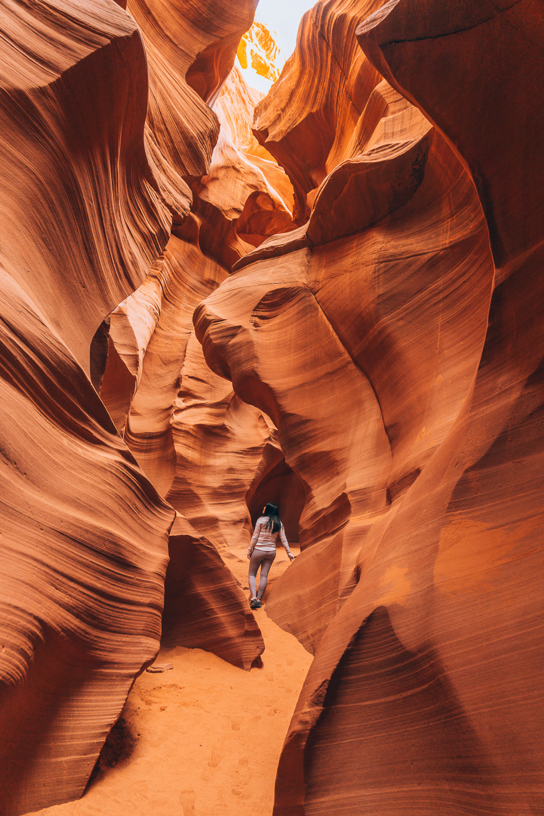
Antelope Canyon is the most well-known slots canyon in the United States. The reason for it will become apparent when you see the beautiful swirling rock formations boasting colorful shades. You’ve probably seen pictures all over of it as it’s also the most photographed slot canyon in the States.
The canyon is near the Arizona-Utah border, about a two-hour drive away, and is under Navajo Nation Parks and Recreation’s protection. This means that you cannot reach it by yourself and need to book a tour with an authorized tour company. This Antelope Canyon admission and tour ticket will make your journey there much smoother.
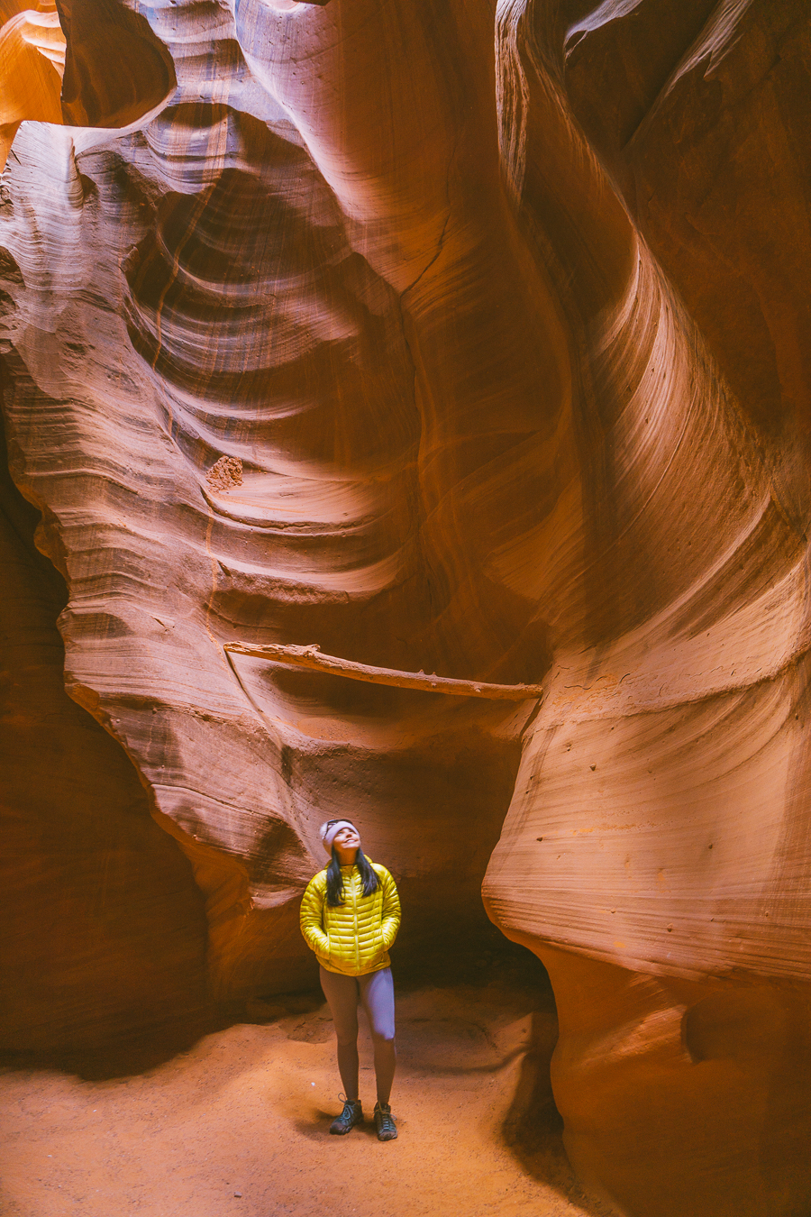
The terrain is mostly sand and rock and isn’t too tricky, especially since you’ll be going on a guided tour. There are two sections to the Antelope Canyon–Upper and Lower. Both upper and lower canyon hikes take about one hour, respectively. Both routes have fantastic sightseeing opportunities, too.
The Upper Antelope Canyon offers darker color walls. The best time to visit here is from the end of March to the beginning of October during midday. There is a beautiful display of ethereal sunbeams during this time, streaming through and cascading against the rock formations.
While cheaper and more shallow, the Lower Canyon is equally beautiful, with warmer colors covering the rocks. You’ll have to take metal stairs to get in and out of Lower Antelope Canyon, and it is a great option to avoid the crowds.
Little Wild Horse
- Location: Emery County
- Distance: 3.7 Miles
- Elevation Gain: 4 940 Feet
- Route Type: Out & Back
- Difficulty: Easy
Little Wild Horse is in San Rafael Reef in Emery. If you’re planning on hiking Goblin Valley State Park, you have to take a detour here. The slot canyon is narrow and makes for an exciting obstacle course-like hike that’s perfect for the whole family. You’ll have to navigate the canyons by twisting and turning between rocks.
To reach the canyons, you have to turn right onto Wild Horse Road before entering Goblin Valley State Park. After about 5.4 miles, you’ll see a paved clearing for a parking lot. Be sure to get there early as there are only 20 parking spots available.
The beautiful canyon is adorned with shades of reds, oranges, and browns, all in swirling formations with circular indents in them. The hike is a leisurely walk of about two-to-three-hours and is very easy to do. It is quite accessible and even dog-friendly.
However, if you want more of a challenge, you can try to make the 8-mile round trip. This six-hour trail, which includes Bell Canyon, is a wider and taller version of the same warm-toned rocks.
The best time to visit both trails is spring and fall. It is not recommended to go during the summer as there are some ankle-deep wading pools, and August is monsoon season.
The Narrows
- Location: Zion National Park
- Distance: 16 Miles
- Elevation Gain: 60 Feet
- Route Type: Out & Back
- Difficulty: Easy to Difficult
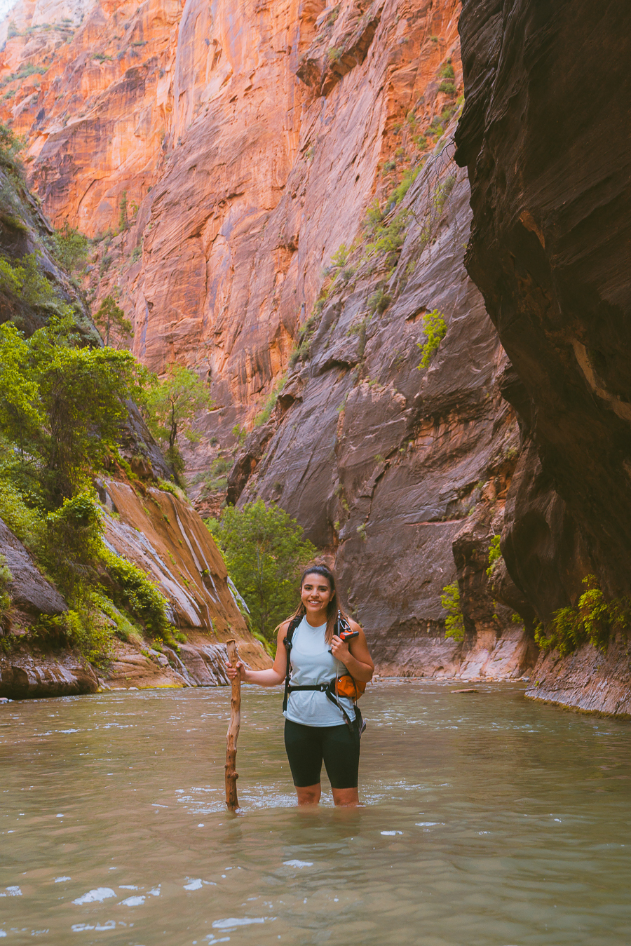
The Narrows is one of the best hikes in the world and is near Springdale in the Zion National Park. Depending on your fitness level, the trail has three hiking routes increasing in difficulty. This way, all nature-lovers will have an opportunity to catch a glimpse of the canyon’s beautiful rock formations.
The easiest trail, River Side Trail, is wheelchair accessible and only takes about one hour to complete the round trip. A more intermediate round-trip trail is the Bottom-Up Trail which takes about 1 to 6 hours to complete. Like the River Side Trail, The Bottom-Up Trail also starts at the Temple of Sinawava.
The most strenuous and longest hike is the Top-Down trail. It takes about 7 to 12 hours to hike one way, which is why some people do it over a couple of days instead. It is also completely dependent on the water levels and road access to Chamberlain Ranch. The best time to go is in late spring to summer as it yields lower water levels in the river.
If you’re a bit skeptical about going on your own or would like a guided tour instead, take this Zion Narrows hike from Springdale tour. It takes you on an eight-hour trip that can be customized according to the group’s skill level. Food, drinks, and specialized equipment are included for worry-free adventure.
Read More: The Best National Park in Utah – All 5 Ranked From Best to Worst
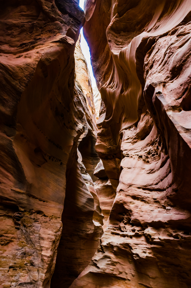
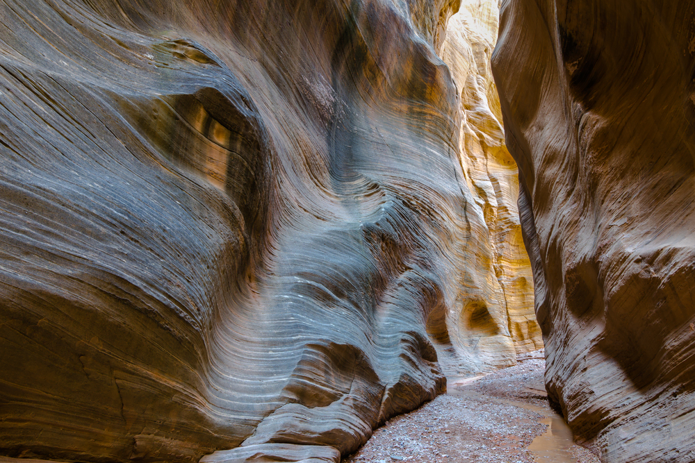
Zebra Slot Canyon
- Location: Grand Staircase Escalante National Monument
- Distance: 5.3 Miles
- Elevation Gain: -225 Feet
- Route Type: Out & Back
- Difficulty: Intermediate
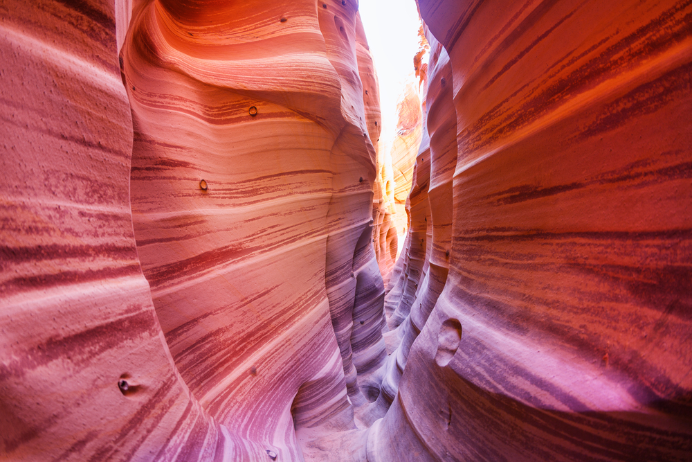
One look at these formations, and you’ll know exactly why this canyon got its name. The Zebra Slot Canyon in Utah is aptly named because of the stretching lines across the rocks. These vivid horizontal lines make for amazing pictures, but you’ll definitely have to work for them as this trail can be a bit more challenging to hike.
Zebra Slot Canyon is just outside the town of Escalante. Once in town, follow the Hole in the Rock Road Trail for about 7.8 miles to the third cattle guard. Here is where you’ll find the parking lot of the park and the start of your hike.
As you enter, the walls are very spaced out but quickly become narrower until you can’t even fit through walking sideways. Instead, you’ll have to press up against the walls to lift yourself up and scooch over. It’s a good idea to bring some water shoes with you as the canyon sometimes has waist-deep, pools that you’ll have to wade through.
The best time to hike this canyon trail is from April to November. But, it is also always a good idea to check the weather as July and August are prone to flash floods. The trail is quick and makes for a lovely day trip as it only takes about two hours to complete.
Grab Your Free Car Camping Checklist! 🚗🌲
Ready to elevate your car camping game? Snag our essential checklist to ensure you’ve got everything you need for a stress-free, fun-filled adventure! Perfect for beginners and seasoned campers alike. Download now and hit the road prepared! 🌟🎒
Spooky and Peekaboo Canyons
- Location: Escalante
- Distance: 3.5 Miles
- Elevation Gain: 697 Feet
- Route Type: Loop Trail
- Difficulty: Intermediate to Difficult
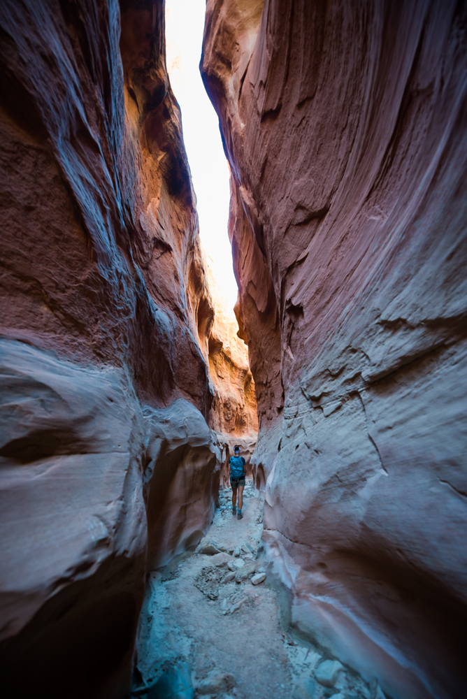
Peekaboo Canyon, like its name, is a fun trail with many obstacles and fun things to see along the way. Along your hike, find the red rocks forming into heart-shaped arch ceilings and obstacle course-like passages.
If you’re hoping for the feel of canyons like Antelope Canyon without the hordes of crowds, Peekaboo is a great alternative. It is about an hour away from Escalante and can only be reached by a four-wheel drive. To get there, take Highway 12 and turn right into Hole-in-the-Rock Road. Then simply drive the 26.2 miles on that road until you reach the Peek-a-boo Gulch Parking Area.
The trail is moderate to difficult because of a slippery ledge at the start, which can be dangerous if you fall. It is especially dangerous when wet. It takes between two to four hours to complete the route.
Kanarra Canyon
- Location: Kanarraville
- Distance: 1.6 Miles
- Elevation Gain: 600 Feet
- Route Type: Out & Back
- Difficulty: Moderate
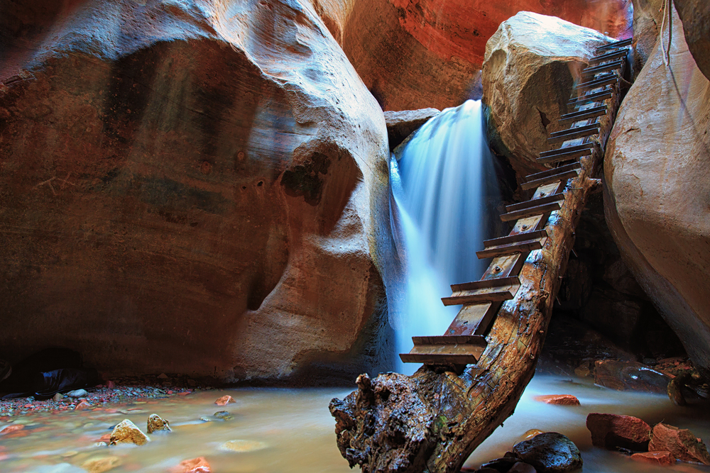
Kanarra Canyon is about one hour away from Zion National Park. Besides its breathtaking formations, this unique canyon also has two waterfalls inside. The first waterfall is at the start of the slot canyon, while the other is a bit further away.
Before you go, you need to buy a permit. But, be quick because these sell out fast and are limited. If you do get a pass, the hike itself is moderate and takes between two and six hours to complete. There are also a few obstacles along the way that could influence how difficult your hiking experience will be.
A good pair of hiking shoes are recommended as the day hike will have you trudging through ice-cold water at times. As you make your way to the second waterfall, the trail becomes more difficult. In addition to walking in water the majority of the way, you’ll have to climb a ladder up to the waterfall.
Be careful as the makeshift, wooden ladder may not be too solid. It is constantly outside and sees many visitors. This portion of the hike is possibly the most beautiful part, as a 15-foot-high rock-jam waterfall awaits its visitors. After this area, the canyon opens up to mostly flora and more rock formations. This is when most hikers stop and turn to head back.
Read More: The Ultimate Moonscape Overlook Guide + Some Helpful Tips
Willis Creek Slot Canyons
- Location: Cannonville
- Distance: 4,8 Mile
- Elevation Gain: 502 Feet
- Route Type: Loop Trail
- Difficulty: Easy
Compared to other canyons, Willis Creek Slot Canyons in southern Utah have a unique rock color. Instead of the warm colors seen in many other rock formations, this canyon has vanilla-toned rocks swaying in a wavy motion. In between these swaying motions are dark lines breaking the colors up.
These striped canyons are only 23-minutes from Cannonville and go on a few turns, but it is quite easy to get to. The easiest way to get there is to drive from Cannonville towards the Kodachrome Basin. From there, continue along Skutumpah Road until you arrive at your destination. You’ll have to make a few turns to stay on Skutumpah Road, but as long as you stay on it, you’ll find your trail.
This trail is one of the easiest to walk compared to most slot canyons on the list. It is family- and dog-friendly and so flat that a popular activity on the trail is horseback riding. The best time to go horseback riding is during midday to make the most of the sun among these tall stone walls.
Depending on your route, it can take from one to three hours to finish the trail. And, if you’re taking a horse ride, it can last up to several hours. The best time to visit Willis Creek is April through to November, as you’ll experience mild temperatures while you hike or ride.
Buckskin Gulch
- Location: Kanab
- Distance: 20.6 Miles
- Elevation Gain: 500-1500 Feet
- Route Type: Out & Back
- Difficulty: Intermediate to Difficult
Buckskin Gulch Slot Canyon is the longest and deepest continuous slot canyon in the US and possibly the world. The canyon walls are dark and made of Navajo Sandstone. The walls become increasingly taller the closer you get to the Paria River streambed towards the end. These can reach up to 500-feet-high.
If you’re really looking for a challenge, this is the hiking trail to take. It can take up to five days to complete the whole trail. Fortunately, there is a shorter day hike you can tackle through Wire Pass Trail that only takes about 4 hours and 30 minutes to complete.
The multi-day Buckskin Gulch Slot Canyon hike is quite difficult and needs a permit before you can even prepare for your trip. This is also because it is quite dangerous with threats of obstacles like waist-deep pools, quicksand, and rock jams.
The best time to go for both trails is between April and June and then again from September to November. While the five-day hike may be challenging, the Wire Pass Trail is very easy to do. The trail is a great hike for the whole family as it’s also kid- and dog-friendly.
Moonshine Wash
- Location: Green River
- Distance: 6,4 Miles
- Elevation Gain: 889 Feet
- Route Type: Loop Trail
- Difficulty: Moderate to Difficult
Moonshine Wash Canyon is a bit off the beaten path in the San Rafael Desert. The rocks are a warm tone and reflect beautifully against the sunlight. The rock formations are adorned with colorful hues of pinks, oranges, reds, and a few darker shades.
The canyon received its name during the prohibition era. Some bootleggers used this area’s spring for their still. But, this wasn’t uncommon. During the time, many Utah canyons in the San Rafael Swell and Robbers Roost area contained stills.
The canyons provide fun obstacles with chockstones and take about two to five hours to complete. The trail might be a bit difficult for hikers inexperienced in scrambling or hiking alone. Because the area is so remote, you won’t be bombarded with heavy crowds walking here even during peak times– spring, summer, and fall. During winter, it can become a bit dangerous as it snows here sometimes.
Ding and Dang Canyons
- Location: San Rafael Swell
- Distance: 5-6 Miles
- Elevation Gain: 700 Feet
- Route Type: Loop Hike
- Difficulty: Easy
Ding and Dang Canyons are another canyon near Goblin Valley and are just a few miles from Little Wild Horse Canyon. While less well-known, it is equally as beautiful with a few fun obstacles.
The stones have a few different hues and patterns to them, which keeps your trail interesting. Some areas have smooth brown stone, while others have dark patches intertwined. There are also a few chockstones and bodies of water for you to look out for on your trek.
As the name suggests, there are two canyons close by. Ding is the easier trail out of the two to climb and is usually what people take to ascend. Dang is a bit trickier and offers a few obstacles along the way. That is why it is mostly used to descend.
It takes about three to four hours to complete the trail. You can hike this trail any month or season of the year as it doesn’t snow. However, summers can be sweltering hot so bear this in mind when planning a trip.
Mary Jane Canyon
- Location: Moab
- Distance: 8.7 Miles
- Elevation Gain: 541 Feet
- Route Type: Out & Back
- Difficulty: Easy
If you’re looking for trails near Moab, it doesn’t get closer than Mary Jane Canyon. This canyon is just 20-miles from Moab and is a hidden gem near Arches National Park with a creek flowing through it.
Arches National Park has a few trails you can follow, and this one is a little tucked away if you don’t know what you’re looking for. To find it, you need to turn on River Road and continue for about 18.5 miles before turning into Ranch Road.
Keep driving this path slowly and carefully for about 2-miles past an active ranch. From the trailhead, simply stick to the creekbed for about 6.4 miles on foot. For all of your hard work, you’ll be rewarded with a waterfall at the end of the trail.
It is also an ideal trail for beginner hikers and takes about three hours to complete. It is family-friendly if you have older kids, and pets are allowed, too. The canyon walls have a reddish hue, and the greenery and flowing creeks make it an amazing hike in the summer. Be prepared and wear your water shoes as you’re likely to get your feet wet on this trail.
Burro Wash Slot Canyon
- Location: Capitol Reef National Park
- Distance: 8 Miles
- Elevation Gain: 994 Feet
- Route Type: Loop Trail
- Difficulty: Difficult
Burro Wash Slot Canyon is a sandstone canyon hidden in Capitol Reef National Park’s Waterpocket Fold. The closest town to Capitol Reef Park is Torrey, only 8-miles away.
You need a permit to hike this canyon in addition to the small entrance fee charged by Capitol Reef National Park. However, it will be worth the money once you see the towering rocks with varying shades of light and dark browns along the trail.
Depending on which side you approach it from, you’ll be met with varying difficulties. One side of the canyon is for the more experienced canyoner, while the other can accommodate more novice hikers. Starting from South Draw Road requires some technical gear as you climb, rappel, swim, and wade through the rocks. For a more moderate experience, start from the Lower Trailhead on Notom-Bullfrog Road.
The best time to visit is during spring and fall as temperatures are more pleasant. You may encounter a few areas where you’ll need to trudge through the water. In summer, you might meet a few deep pools you’ll have to wade through.
Hike the Best Slot Canyon in Utah
Utah has many slot canyons to hike through, whether you’re going as a family or as a solo hiker. Each canyon also has its own interesting rock formations, shades, and wildlife accompanying the trails, so you’ll never get bored.
Hike the breathtaking Antelope Canyon to see beautiful swirls and halos of light, or take a multi-day trip through the towering dark walls of the Buckskin Gulch. If you’re looking for a trail equally as beautiful as Antelope but more remote, the Zebra Canyon may be more suitable. These are just to name a few that stand out. There are still plenty more to choose from.
So, why don’t you take a Utah National Parks road trip and visit the most beautiful slot canyons and hikes that the state has to offer.


Claim your FREE Hiking Checklist
Ready to start hiking? Grab my free hiking checklist and never forget anything at home!