
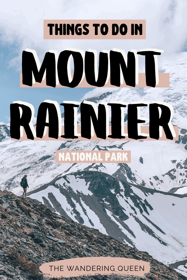
The 19 Absolute Best Mt Rainier Hikes
For many years I dreamed of Hiking Mount Rainier National Park. I had heard so much of its grand, powerful views. I finally got to experience this one-of-a-kind national park after waiting for so many years. I was surprised at how many trails there were with so many different views! I am not going to lie, I thought all the trails would only have views of Mount Rainier. But there are views of lakes, rivers, fire lookouts, surrounding mountains, and waterfalls! I loved spending time at this national park, and so I decided to create this excellent blog post with the Best Mt Rainier Hikes in the park. Get ready to fall in love with this outstanding mountain 🙂
Disclosure: This post contains affiliate links. If you click one of them, I may receive a small commission (for which I am very grateful for) at no extra cost to you.
Download my free Outdoor Photography Guide
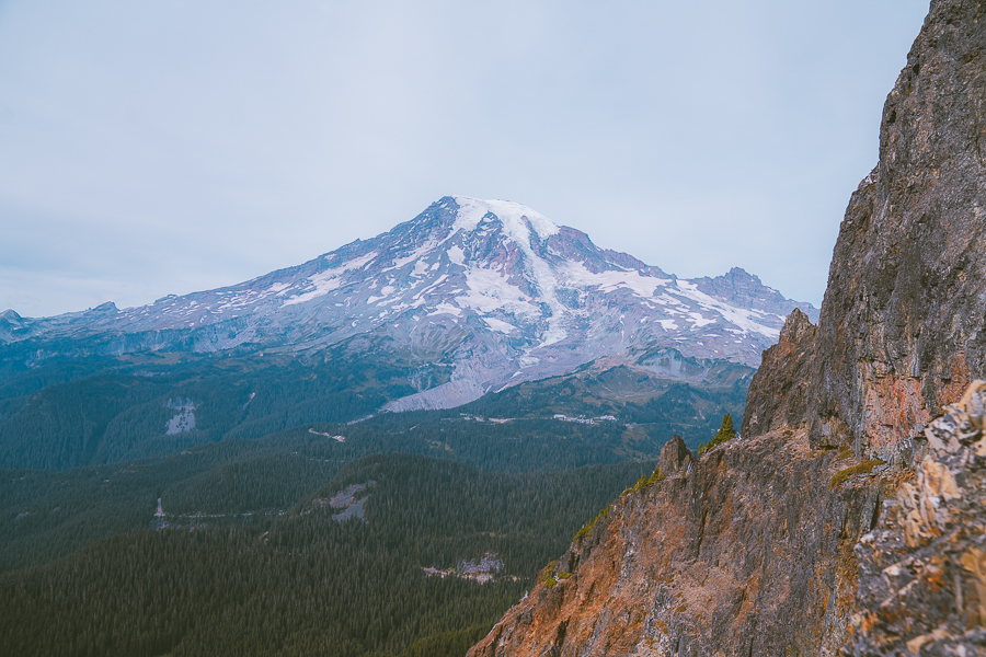
Mount Rainier National Park
Related Posts
Where Is Mount Rainier Located?
Mount Rainier is located in Washington State and is southeast of Seattle. Most people either fly into Seattle or Portland to see this wonderful national park.
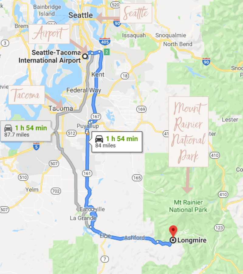
- Seattle to Longmire: Around a 2-hour drive, 96 miles
- Tacoma To Longmire: Around a 1 1/2 hour drive, 65 miles
- SeaTac Airport To Longmire: Around a 2-hour drive, 84 miles
- Portand To Longmire: 2 1/2 hours, 144 miles
Mount Rainier Map
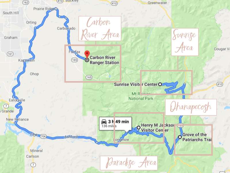
Above are the four different areas of all the Mt Rainier trails locations. Please note that this is not the exact area location. I guestimated and made my map to help you picture the different areas. For the official Mount Rainier Map Click Here.
Mt Rainier Trail Map
I have created a google map with all of the hiking trail locations. Print this map before your trip as there is limited service. If you want the official Mount Rainier National Park Map Click Here.
Best Time To Go To Mount Rainier National Park
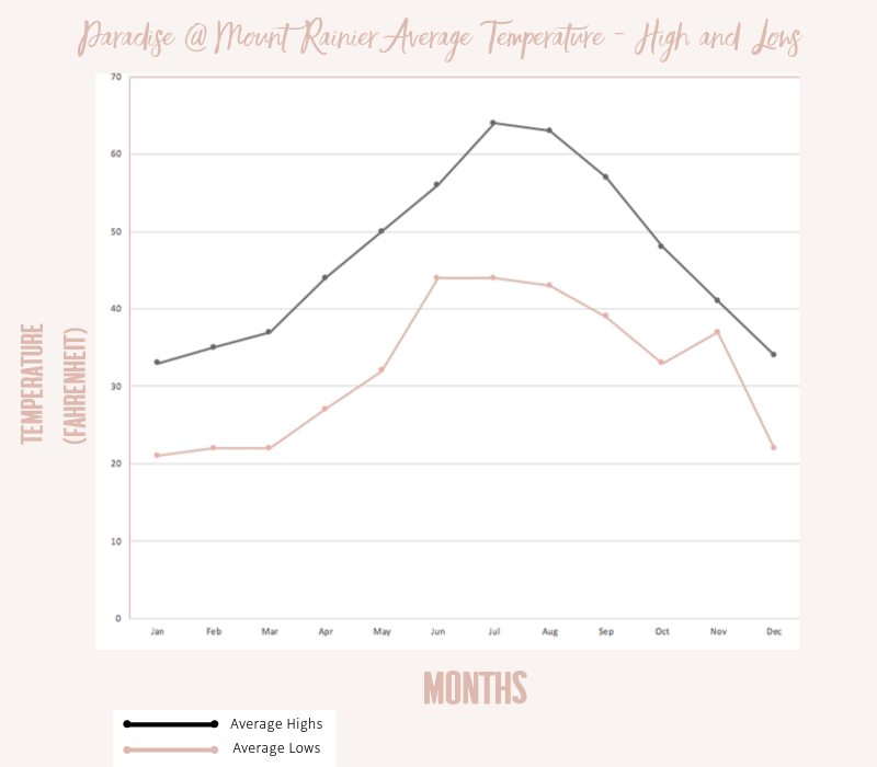
Above I show the average temperatures of the Paradise area in Mount Rainier National Park. Paradise is higher in elevation (5400ft), but it is the most popular section in the park.
- July-August: Hiking Mt Rainier in July is the absolute best time to visit. The wildflowers burst into action and paint the landscape with many extraordinary colors. Please note that this is the most popular time to visit, which means more crowds.
- September-October: This a great time to avoid the crowds and see the bright fall colors. But be wary as there might be snow which can be dangerous.
- November-March: There is a ton of snow around this time of year. But that doesn’t mean the park is closed. You can ski, snowshoe, and snowboard! Please note that the Nisqually Entrance, in the southwest corner of the park, and the Carbon River Entrance are the only entrances open.
- April-June: This is when there are no crowds, but you need to check conditions. Trails and roads might still be closed.
Read More: Best Time to Visit Mt Rainier: Weather + Fun Activities
What To Pack For Mount Rainier Hiking
- Bug Spray: The bugs are insane here! Bring some good bug spray. >Buy Some Here
- Sunscreen: One of the ten essentials! I always bring this with me. >Buy Sunscreen
- Hiking Boots/Shoes: If you use tennis shoes, you can easily hurt your toes hitting a rock by accident (Trust me I have done it so many times). Make sure you bring good shoes when you hike Mount Rainier. >Check Out My Hiking Shoes
- Hiking socks: Having the correct socks helps prevent blisters while hiking at Mt Rainier. Smart Wool is probably my favorite brand out there. I also love how they now have pink socks too 🙂 >Buy Hiking Socks
- Refillable water bottle: I always bring a Hydroflask on all my adventures. They are on the heavier side, but I know for a fact they will not break. I have had a few cheap water bottles break on me before. >Check Prices Now
- Water Reservoir: You probably need more water than a water bottles worth. The Great thing about this reservoir is that it doesn’t have the plastic taste. >Here Is My Water Reservoir
- Water: Stay nice and hydrated.
- Sunglasses: It can get sunny, so make sure to pack some sunglasses. >Check Out These Sunglasses
- Snacks: The best snacks are jerky, nuts, energy bars, and extra food. >>>Check Out These Snacks!
- Camera: The camera I have linked was one of the first cameras I started using on my travels. The Sony A6000 is an excellent camera for people that want to start improving at travel photography. >Buy Sony Camera Here
- First Aid Kit: This is one of the first things I bought when I first started going on adventures. It is super portable. >Buy This Awesome First Aid Kit Here
- Day Pack to carry all your things: The REI bag I have linked, we have had for seven years now, and it is still going strong! >Buy This Great Quality Backpack
- Leggings or Hiking Pants: I love wearing leggings while hiking because I love how comfy they are. Here are my leggings. >Click For My Leggings
- Breathable sweat-wicking shirts
- Sports Bra: For women >>>Click Here
- Jacket: It can get pretty chilly all year long. Bring a Jacket! >Buy My Favorite Jacket
- Rain Jacket: When hiking in Washington, you need this in case it starts pouring on you, which is always a possibility in the PNW. >Buy A Great Rain Jacket Here
- Tripod: This is an optional item, but it is excellent for getting the ideal sunset pictures. >Check out this tripod
- Fire Starter and Matches: This is just in case of an emergency. >Buy These Stormproof Matches Just In Case
- Compass: I always carry this with me, just in case. >Click Here To Buy
- Knife: You never know if you will need it. >Buy My Knife Here
- Headlamp: A headlamp is an absolute must in case you get lost, or you take longer than you thought you would to complete a hike. Trust me, it happens even to me. >Buy A Headlamp Now
- Trekking Poles: I recommend these for people with bad knees like me. >Buy The Poles Shown In My Picture
- Crampons: If you are hiking outside of the summer months, I highly recommend always having this in your backpack. >Buy My Handy Dandy Crampons
- Bear Spray: I always carry bear spray with me, just in case. >Buy Bear Spray Here
- Mount Rainier Map: A map is essential so you don’t get lost. I usually bring with me AllTrails+ map on my phone, and I have many of the Washington area maps. I love National Geographic’s maps. They are good quality. >>>Check It Out Here
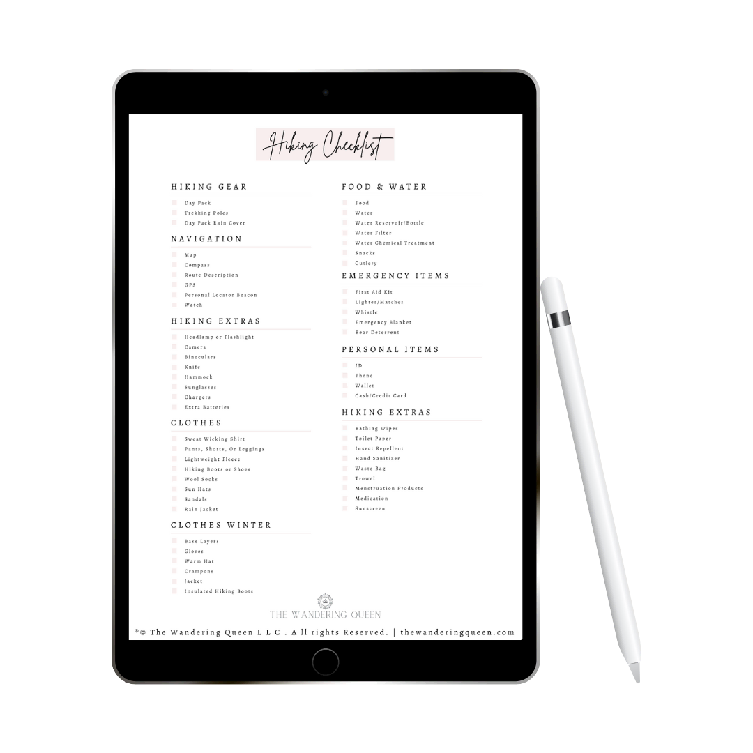
Claim your FREE Hiking Checklist
Ready to start hiking? Grab my free hiking checklist and never forget anything at home!
Where To Stay Near The Best Mount Rainier Trails
- Paradise Inn: This hotel is located inside the national park at Paradise. It is next to the best trail in the national park: Skyline Trail. >Check Prices Here
- Alexander’s Lodge: This cute historic Lodge was built in 1912! It features a restaurant, fireplace, and little outdoor yurts. >Check Prices Here
Read More: Where To Stay In Mt Rainier National Park
Driving And Gas
There are no gas stations inside the national park but in neighboring towns. I have seen some gas stations with outrageous prices near the park.
When it comes to the roads, most of them are pretty good to use any car. The only area that is a little crazy is the Carbon River Area. The road is a mess, so a 4×4 is probably best. You can get up there in a regular car but take your time.
All About The Crowds When Hiking At Mount Rainier
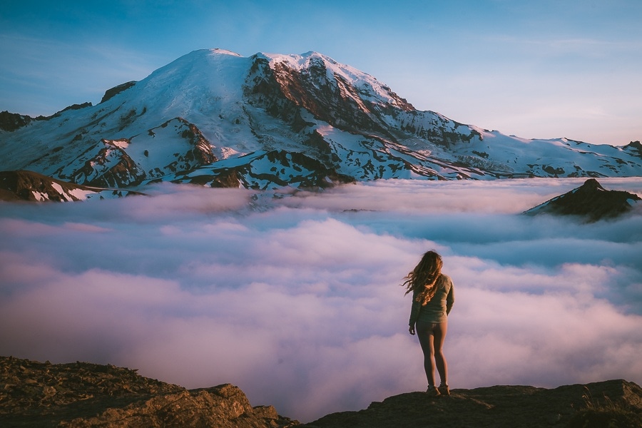
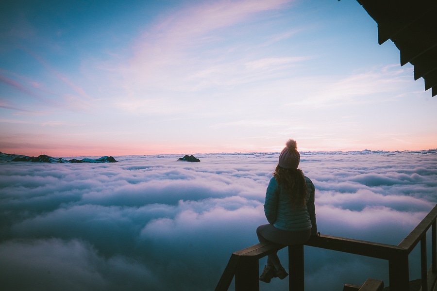
Let’s face it. Mount Rainier is a very crowded national park. But since I live here, I have figured out how to avoid crowds. Either get there early or get there late. I usually do a lot of sunset hikes, and it has worked pretty well for me. Not many crowds and beautiful cloud inversions at times. Even if you don’t want to do a sunrise or sunset hike, I highly suggest getting to the gate extremely early. I have heard horror stories of people waiting for hours just to get into the park.
A Note On Trash On Washington Hiking Trails
This year there has been a more significant number of people hiking the trails in Washington. While this makes me happy that more people are connecting outdoors, it makes me sad that the trails are trashed in the process.
Please pack out EVERYTHING you pack in. That includes orange peels, sunflower seeds, etc. Let’s keep our trails beautiful for years to come. And please do NOT feed the animals (yes squirrels and marmots are included).
Want To Read More On Leave No Trace? Check Out This Post
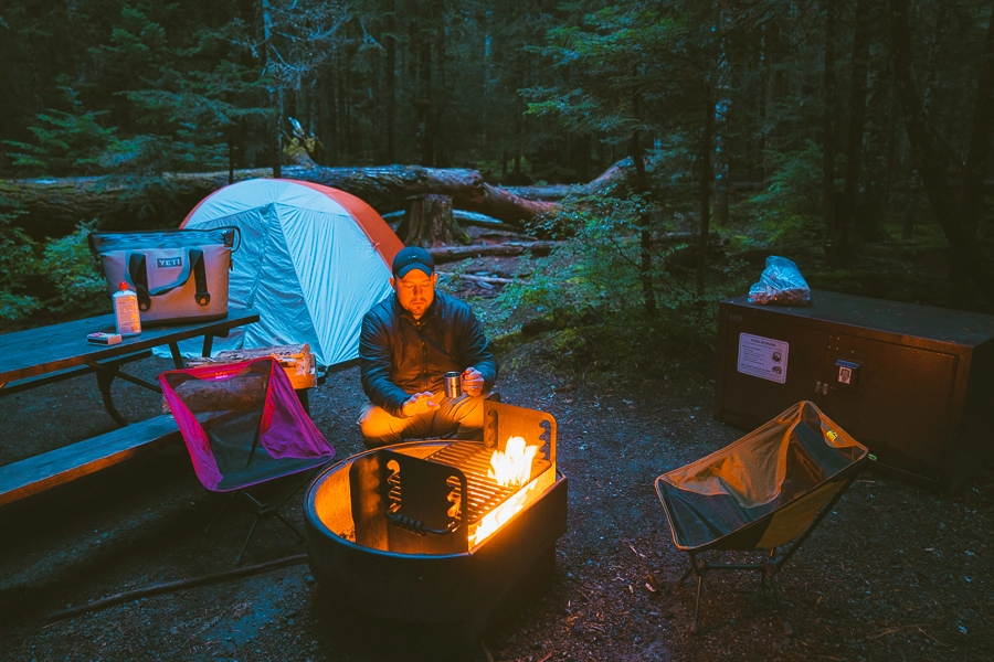
Camping At Mount Rainier
There are four campsites at Mount Rainier National park. For more information on the campsites, click here:
- Cougar Rock: Located in the Southwest Corner. We stayed here. I do want to note what I observed. We got here Thursday morning in September. It was almost empty, and we took the best spot. Friday morning, there was still some spots available. Friday night, there were no spots available. Hopefully, this will help you decide when to arrive.
- Ohanapecosh: Located in the Southeast Corner
- White River: Located in the Northeast Corner
- Mowich Lake: Located in the Northwest Corner
Mount Rainier Entrances
There is a $30 vehicle entrance fee that is valid for seven days. It is always best to buy the annual national park pass though. >>>Buy One Here
There are four entrances to get to Mount Rainier, and they are:
- Sunrise Entrance: Northeast
- Nisqually Entrance: Southwest
- Stevens Canyon Entrance: Southeast
- Carbon River: Northwest
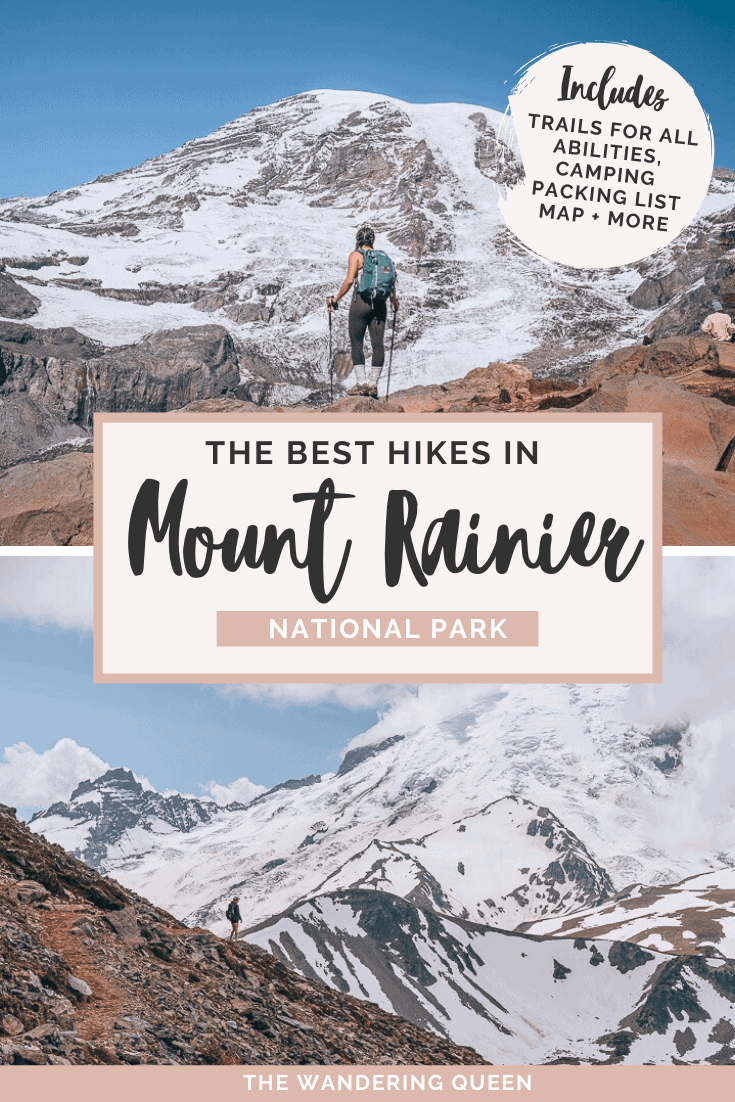
The Best Mt Rainier Hikes
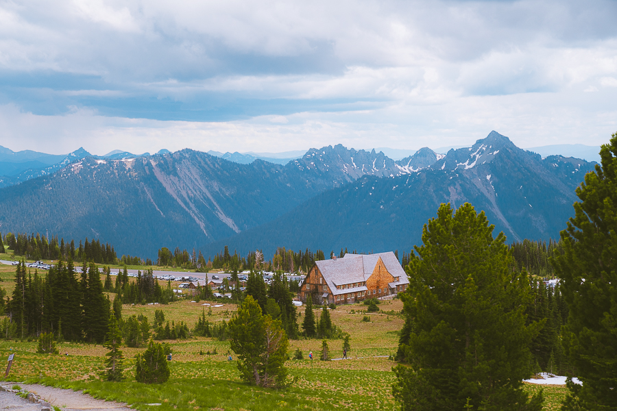
The Best Hikes In Paradise Mt Rainier National Park
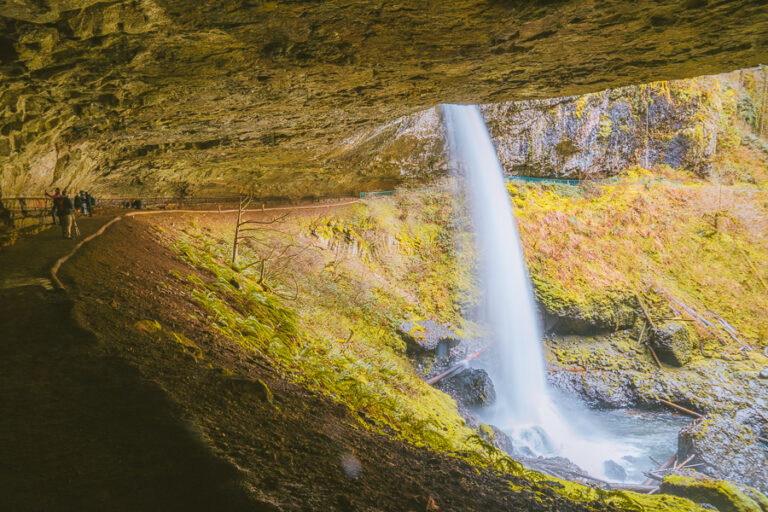
Narada Falls
- Distance: 0.2 Miles Roundtrip
- Elevation Gain: 72 ft
- Difficulty: Easy
- Trail Guide: Link
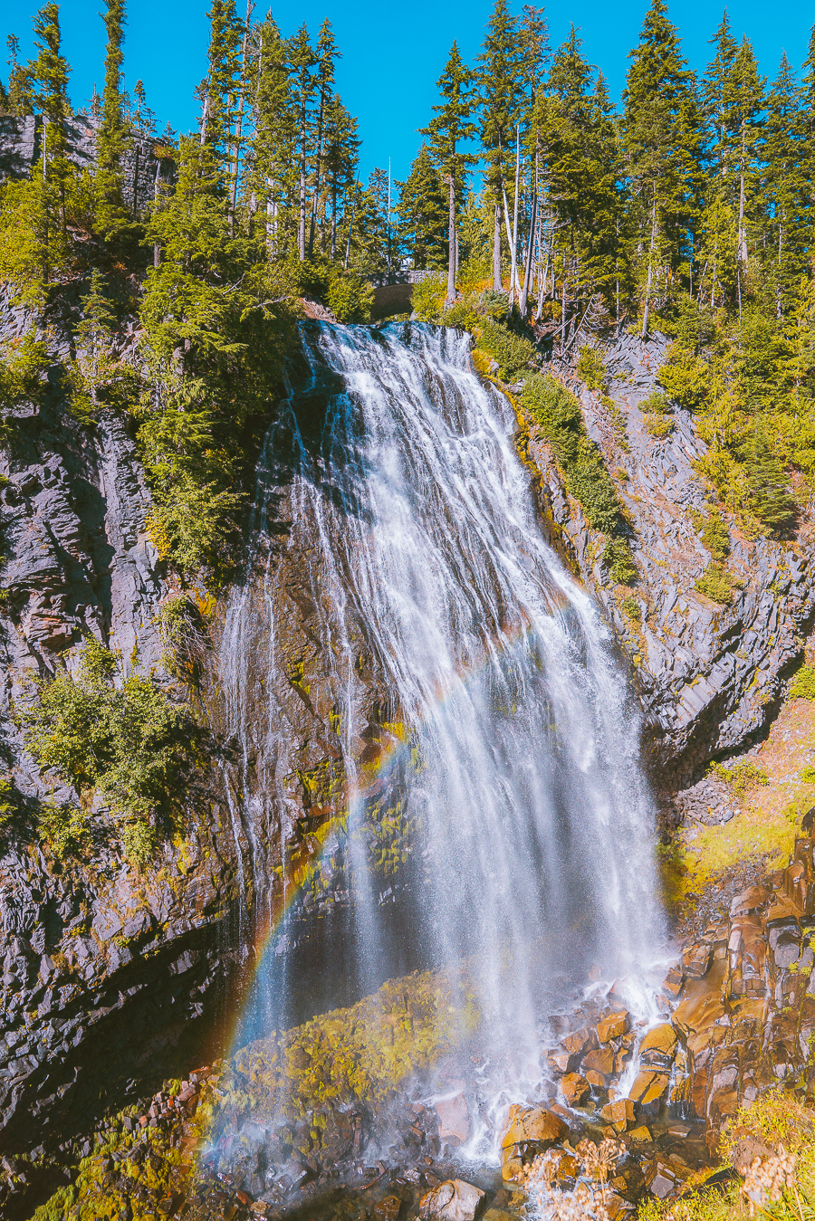
Narada Falls is the easiest trail on this list. It is perfect for the whole family, especially if you love waterfalls. The trailhead is on the way to Paradise and the parking lot is relatively small, but since the hike is very short, you can probably find a parking space soon as the turnaround is quite fast.
The trail descends down the stairs to the waterfall. It is pretty wet, so be careful!
All the best views in the state
100+ WA Hikes
Embark on Washington’s best trails with our eBook! Inside, find top hikes, expert tips, and stunning views, making every adventure unforgettable. Dive into the beauty of Washington’s outdoors now!
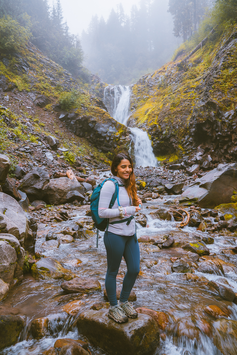
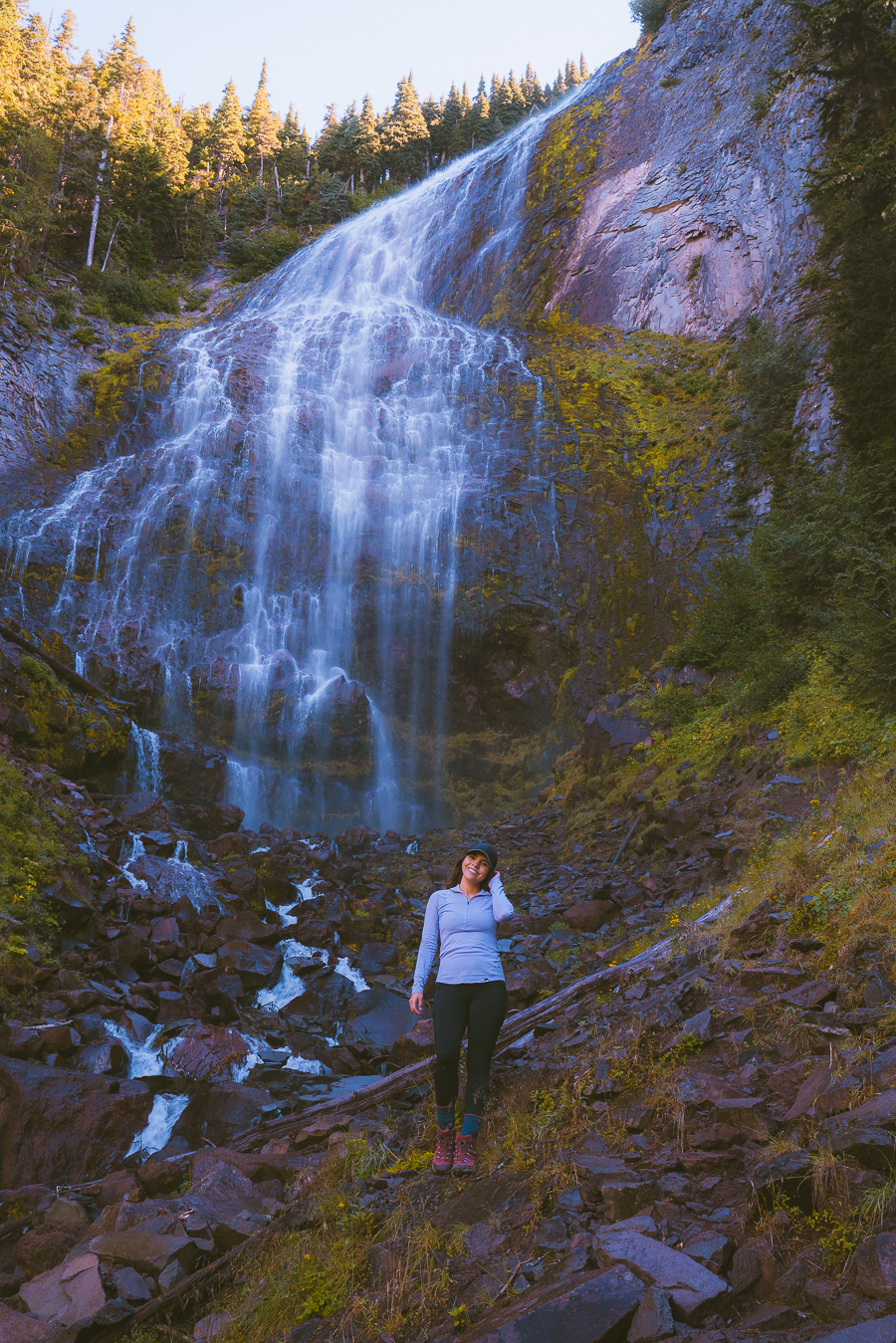
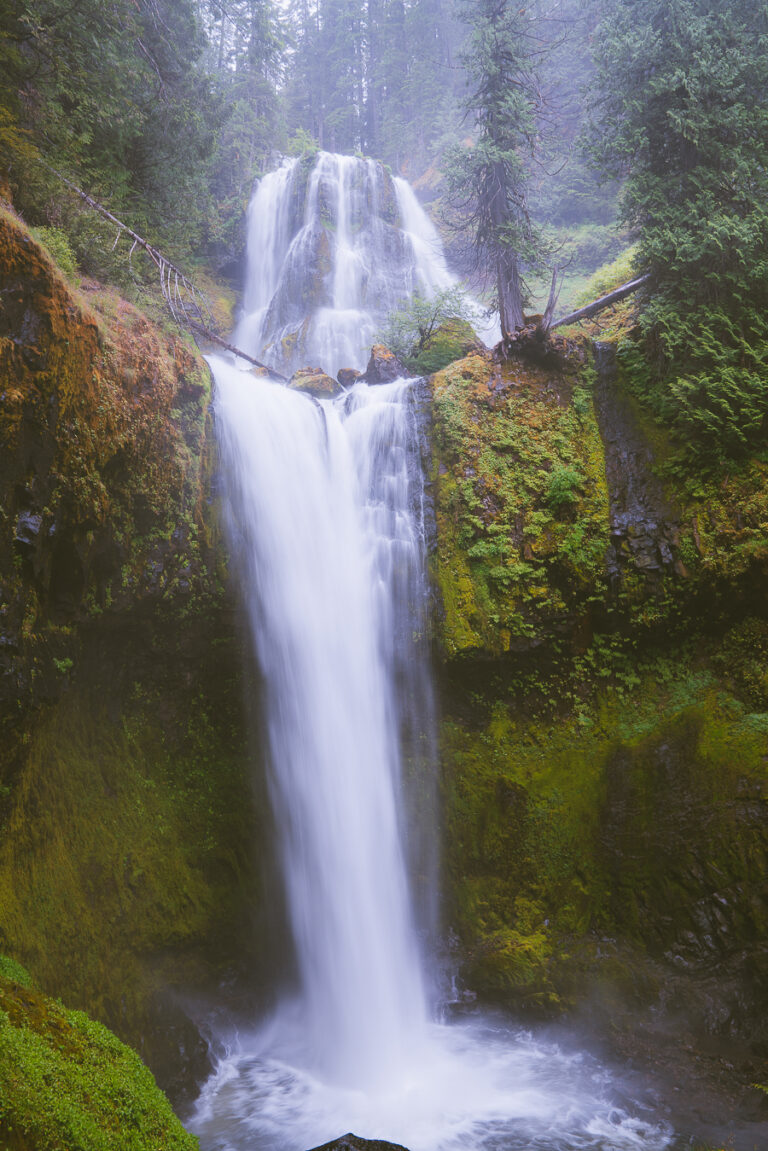
Comet Falls Trail
- Distance: 3.5 Miles Roundtrip
- Elevation Gain: 1,286 ft
- Difficulty: Moderate
- Trail Guide: Link
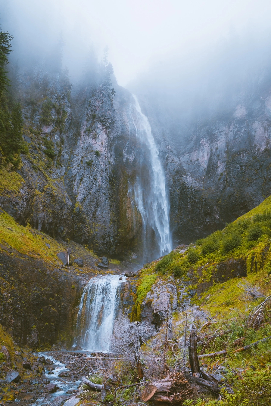
This was our first trail in Mount Rainier, and we were pleasantly surprised! In the first section of the trail, you walk through a thick forest. You run into so many waterfalls throughout the hike. Comet Falls was extraordinary, and it has so far been my favorite waterfall in Washington (Sorry Sol Duc Falls!). I usually take mountain or lake views over waterfalls, but this one did impress me.
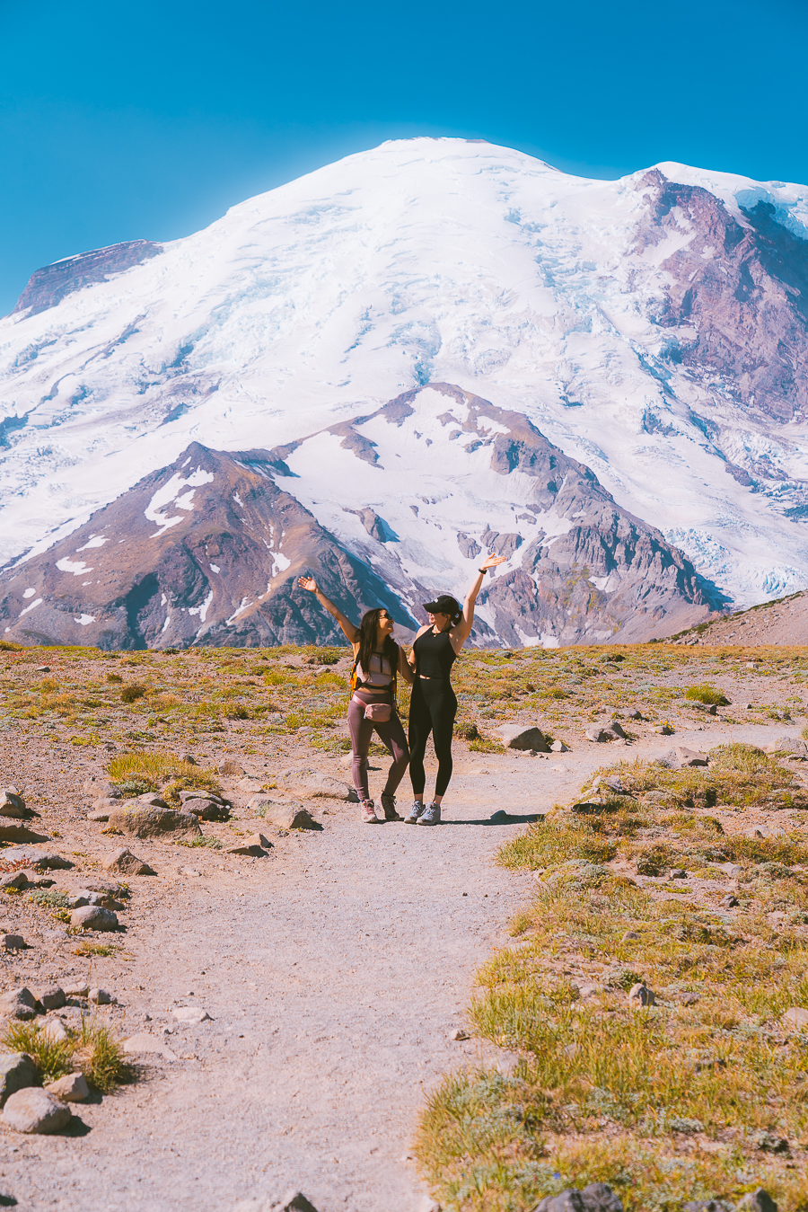
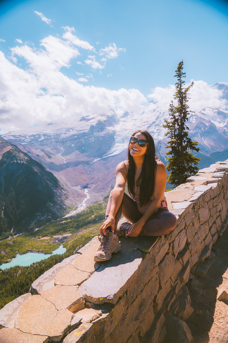
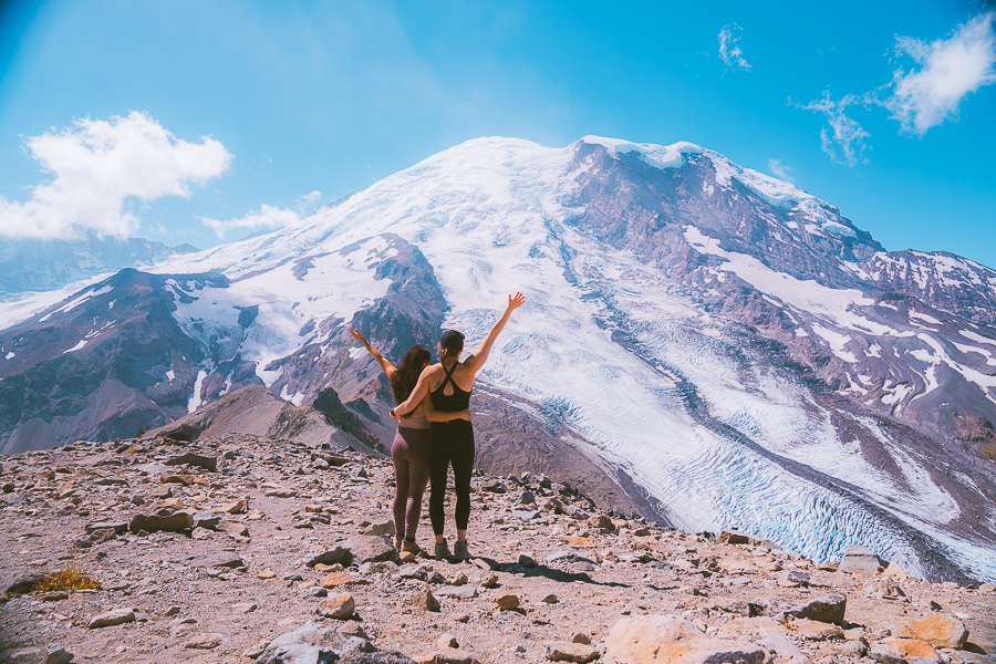
Skyline Trail Loop
- Distance: 5.7 Miles Roundtrip
- Elevation Gain: 1,788 ft
- Difficulty: Moderate
- Trail Guide: Link
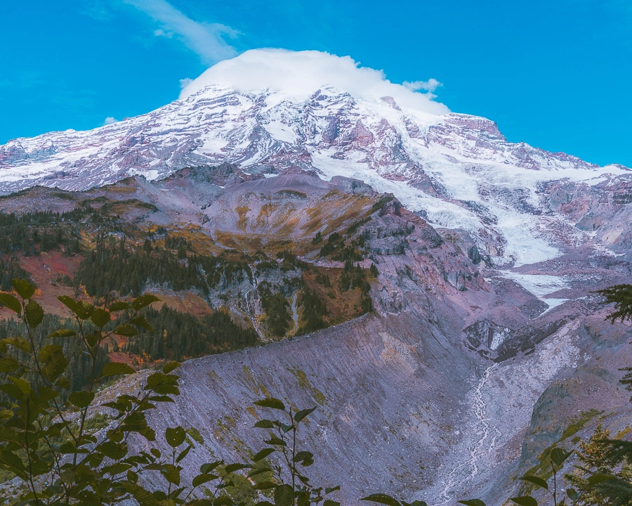
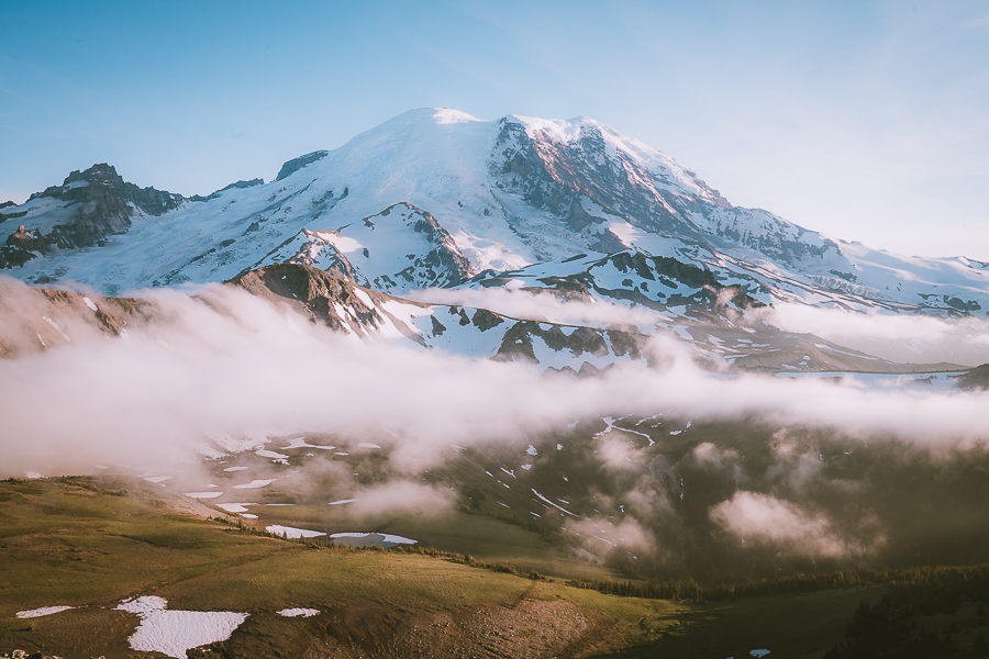
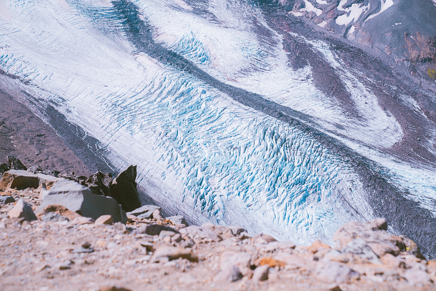
The Skyline Trail is the must-do trail of Mount Rainier! It is the one trail that everyone told me I needed to complete. After hiking it, I understand! The views are incredible throughout the whole trail. Mount Rainier is pretty much staring at you the whole time. I will warn you that pretty much everyone knows that this is the best trail in the park, so you won’t be the only one hiking it.
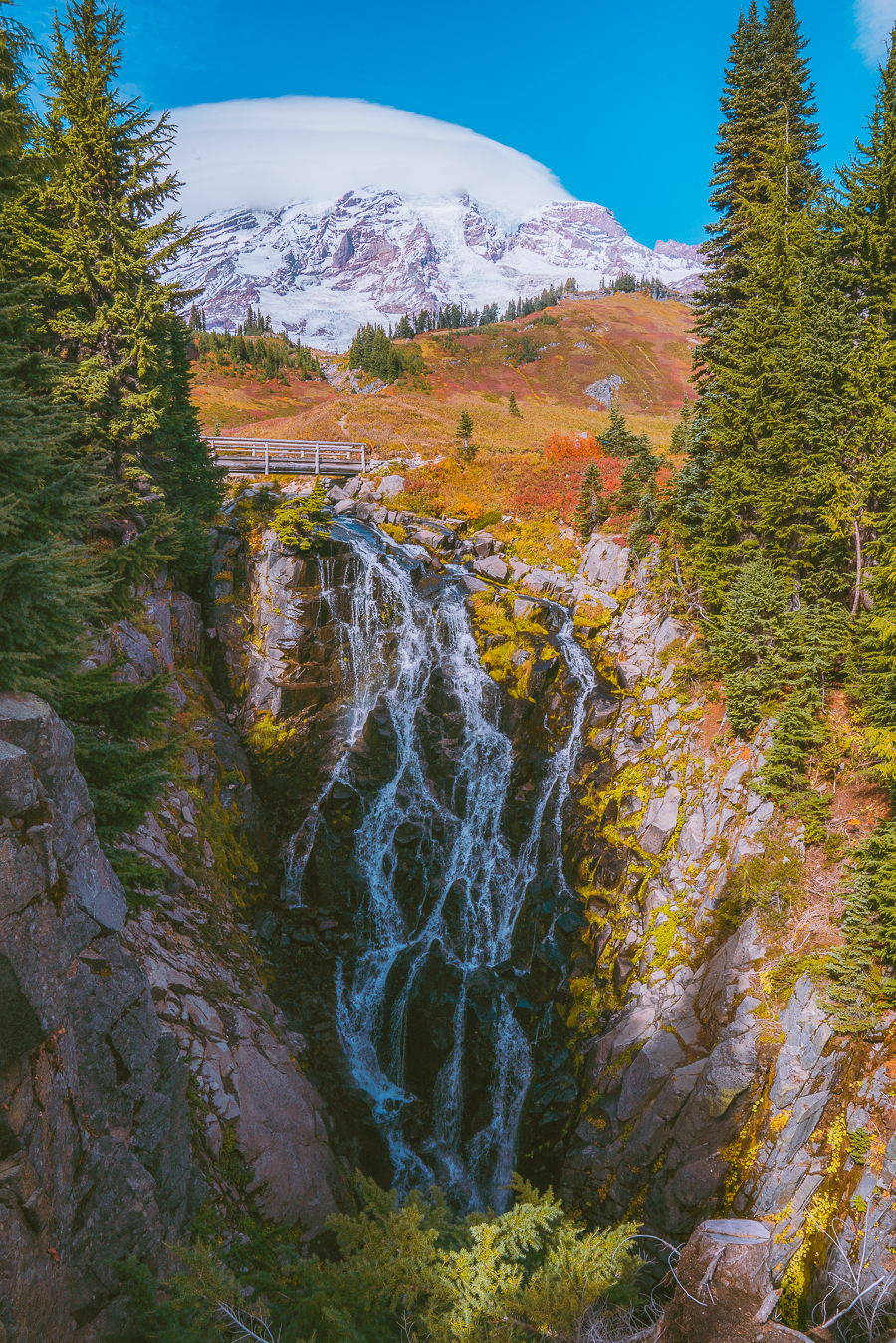
I will also say that since the trail is so high up in elevation, you have to have good weather to enjoy this trail. If it gets too cloudy, you will be hiking with absolutely no views. We tried to hike this trail THREE times. The trail was foggy the first two days, and luckily in the last day, it cleared up a few hours. Then right after the picture above was taken, the clouds came back, and we were hiking down with no views.
If you are too tired to hike the whole trail make sure to stop and see Myrtle Falls. It is less than 1 mile round trip from the parking lot.
The best views points are Panorama Point, Myrtle Falls, and Glacier Vista.

Note: Always have lower elevation alternatives if the weather seems iffy and always bring a jacket with you even if it is hot. The weather changes drastically. We saw so many people on the trail in shorts and all of a sudden the fog came in, making it a very cold and miserable hike.
Bench And Snow Lakes Trail
- Distance: 2.2 Miles Roundtrip
- Elevation Gain: 446 ft
- Difficulty: Moderate
- Trail Guide: Link
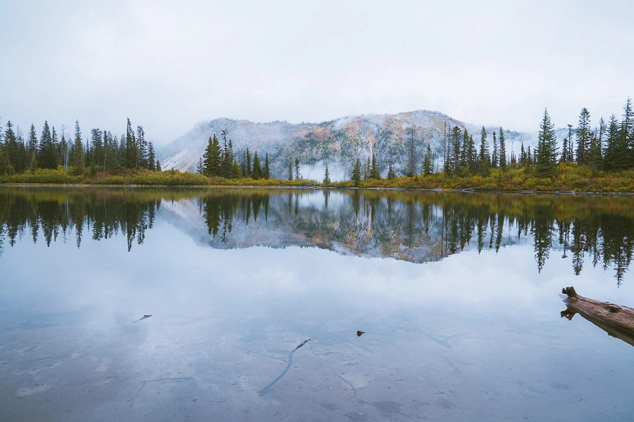
This was a trail that the ranger recommended to us when Skyline Trail wasn’t visible. I enjoyed this trail, and I am so glad we had a chance to experience these two lakes! First of all, we went in the fall, and the autumn colors were starting to show up on the trail. It was magical. It was my first fall hike ever! Being from Texas with no Fall colors, any colorful fall trail gets me pumped!
The first stop was Bench Lake, and I loved how glassy, and reflective the lake was. There was no wind, and you could see the fog dancing around the trees and mountains. I loved it!
Read More: 16 Best Things To Do in Mount Rainier National Park, Washington
After enjoying Bench Lake, we made our way to Snow Lake. Snow Lake has more of green color to it. Sadly when we went, there were no views of Mount Rainier.
Even with no views of Mount Rainier, I feel like this trail is worth it. There are other surrounding mountains, and hills that capture the essence of Washington.
Mazama Ridge Snowshoe
- Distance: 6.0 Miles Roundtrip
- Elevation Gain: 900ft
- Difficulty: Moderate
- Trail Guide: Link
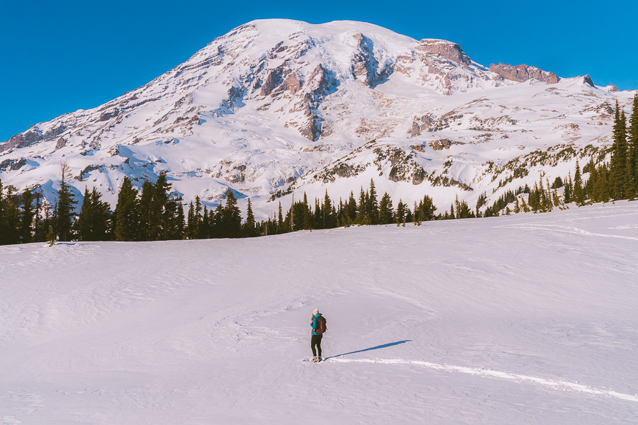
Did you know that you can visit Mount Rainier in the winter? Visiting this place when it is fully covered in snow is truly magical. One of my favorite snowshoes in Washington is Mazama Ridge! This snowshoe is pretty steep initially, but there is almost no elevation gain once the trail is on the ridge. Don’t let that fool you, though, as snowshoeing can be pretty tricky. You can go as far as you want on the ridge. We ended up only hiking around 4 miles. It is such a fun trail! Be careful with avalanche chutes and talk to a ranger before attempting this trail.
If you want to hike here in the summer, you definitely can. Just add it to the end of the Skyline Loop trail.
Download my Washington Hiking Checklist!
Nisqually Vista
- Distance: 1.1 Miles Roundtrip
- Elevation Gain: 180 ft
- Difficulty: Easy
- Trail Guide: Link
Nisqually Vista is one of the most popular hikes in Mount Rainier and is easier than the well-known Skyline Loop Trail. If you want less elevation, less mileage then this is a great trail but I feel like Skyline is still a lot better. There is a viewpoint of Mount Rainier at the end, but most of the trail is covered. The trail is paved.
Pinnacle Peak/Saddle
- Distance: 2.9 Miles Roundtrip
- Elevation Gain: 1,584 ft
- Difficulty: Hard
- Trail Guide: Link
Do not let the mileage fool you! Pinnacle Peak is a very difficult, sketchy hike. I do want to distinguish between the Pinnacle Peak and the Pinnacle Saddle.
Pinnacle Saddle is up to the maintained trail. It is steep, but the trail is easy to follow and feels safe. I feel like most people should turn around when they get to the saddle. You will come up to a sign that says “End of Maintained Trail”.
The Pinnacle Peak is a different story. The trail is pretty sketchy, there is a lot of loose rock, which can be very dangerous, and it is even steeper. I started to get a little scared towards the top especially because rock was crumbling and falling downhill below me. Only proceed to the peak if you are an experienced hiker.
Both hikes are breathtaking, of course, and have some of the best views of Mountain Rainier. Another bonus is that we saw fewer people on this hike.
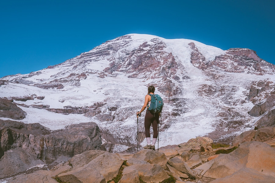
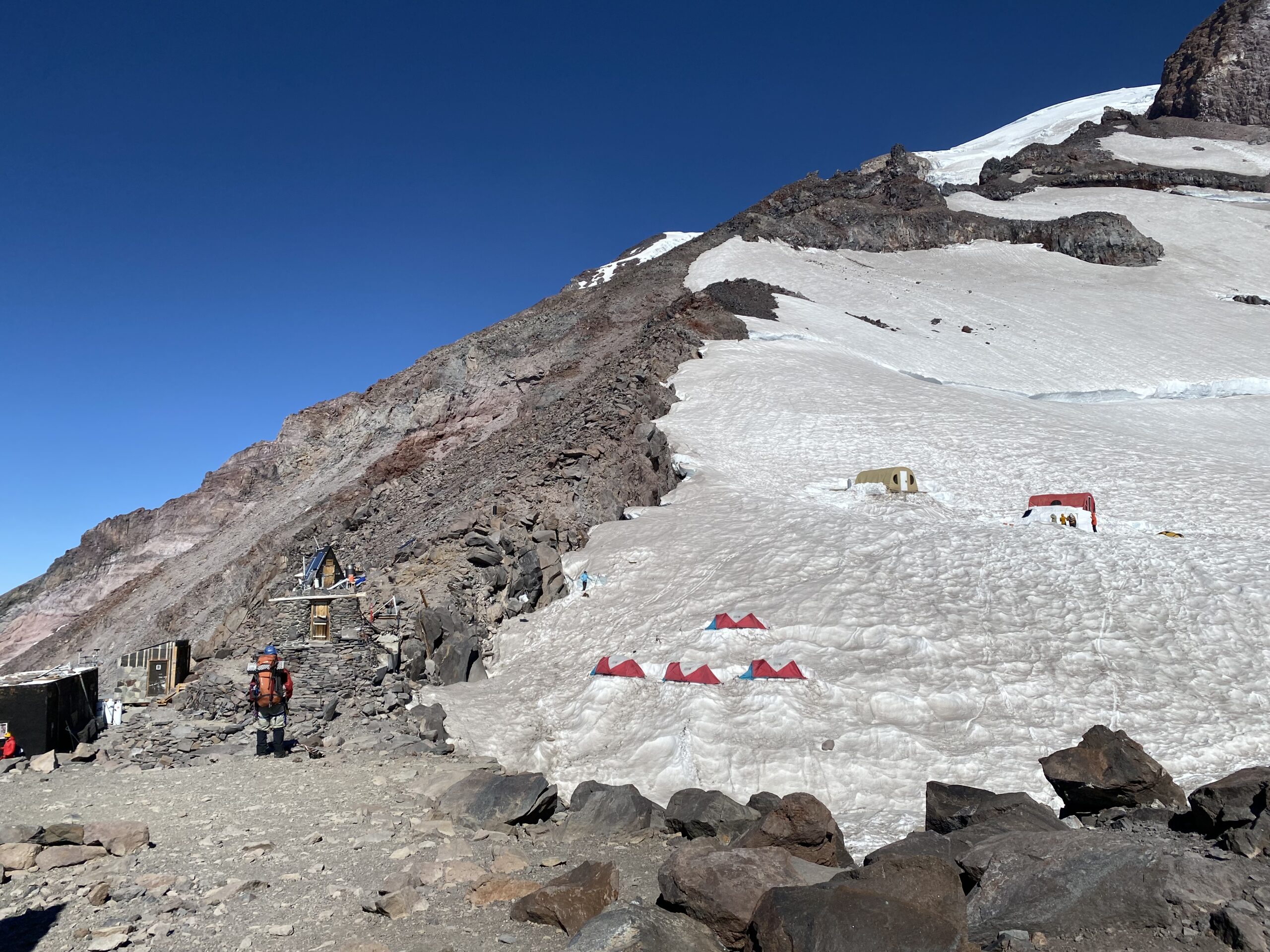
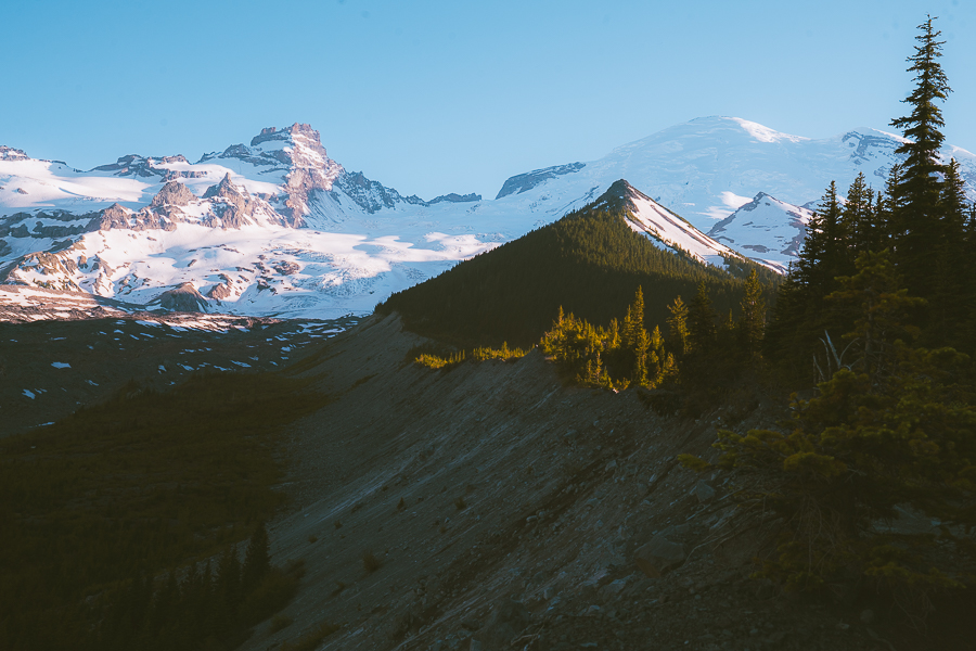
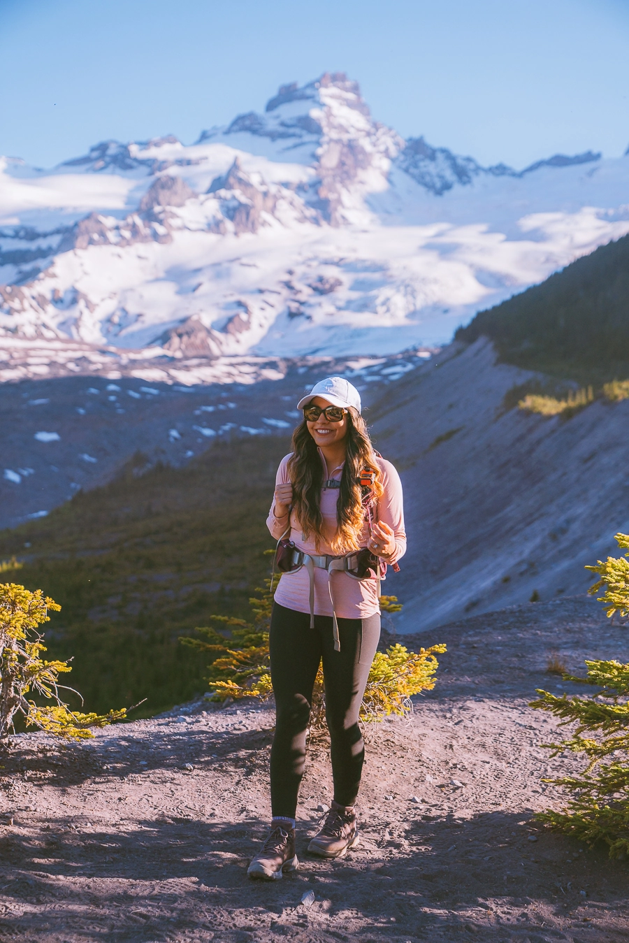
Camp Muir Trail
- Distance: 8.8 Miles Roundtrip
- Elevation Gain: 4,665 ft
- Difficulty: Hard
- Trail Guide: Link
Camp Muir is the highest you can go without a climbing permit. Many people are drawn to this area and are curious and want a glimpse of the people that are summiting Mount Rainier. It is a difficult hike but it feels oh so rewarding. There is usually snow on the trail except in August so bring crampons!
The Best Hikes In Sunrise
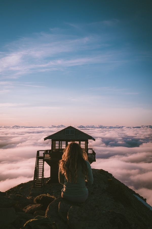
Mount Fremont Lookout Trail
- Distance: 5.7 Miles Roundtrip
- Elevation Gain: 1,112 ft
- Difficulty: Moderate
- Trail Guide: Link
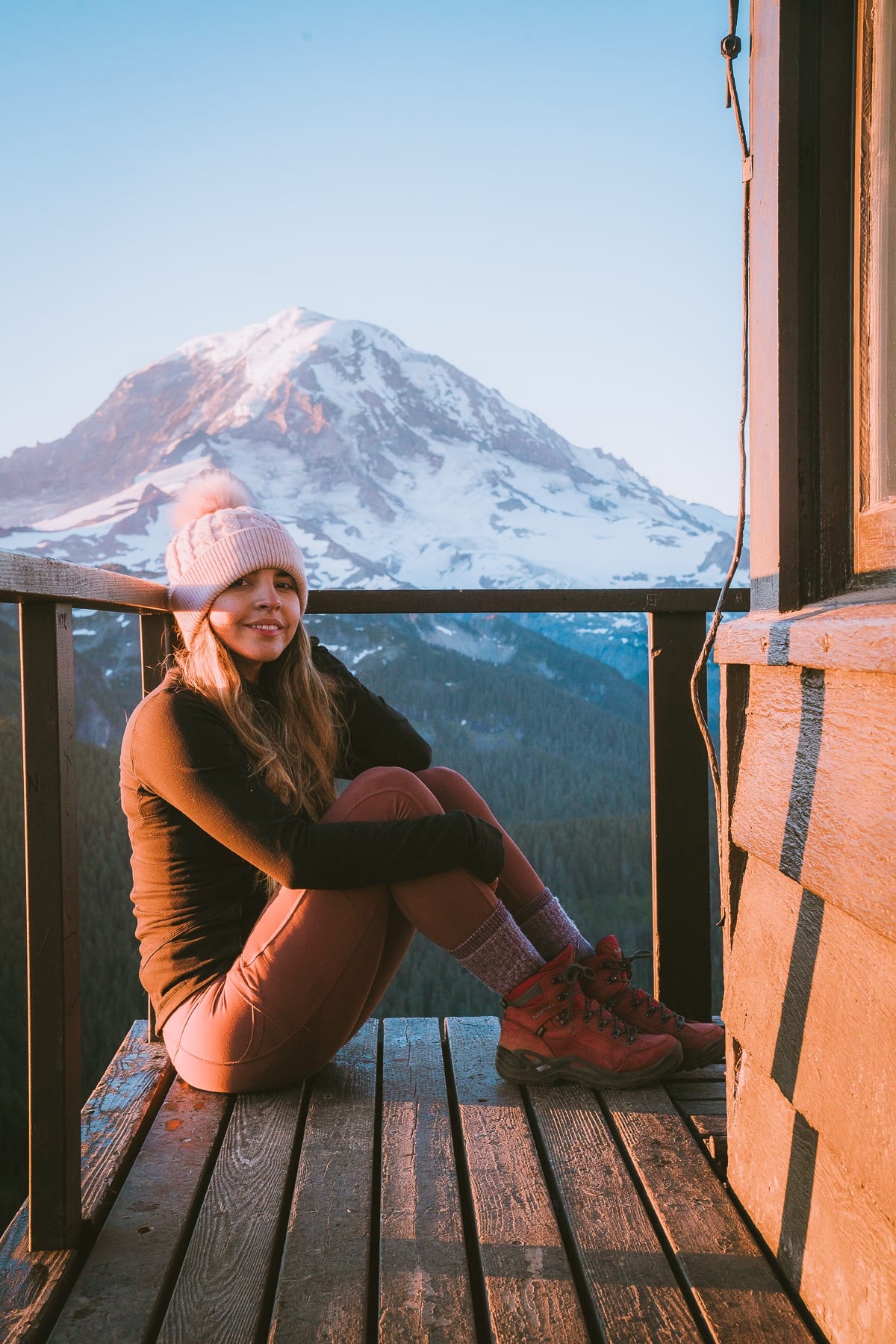
Mount Fremont lookout is one of the best spots for sunset. The trail is easy enough to hike back with a headlamp. The fire lookout is a great spot for pictures, and it is one of my favorite hikes in Mount Rainier National Park. The lookout was built in 1934 and has views of Grand Park, Redstone Peak, Skyscraper Mountain, and Berkeley Park.
Read More: Mount Fremont Lookout Trail | Ultimate Amazing Hiking Guide
Sourdough Ridge Trail
- Distance: 2.9 Miles Roundtrip
- Elevation Gain: 557 ft
- Difficulty: Easy
- Trail Guide: Link
If you want a relaxed version of Mount Fremont Lookout then try this trail out. The ridge has fantastic views of Mount Rainier throughout, and you will definitely stop every few feet to take pictures. Eventually, you will hit a junction where you can head to Burroughs Mountain trail to the left, or you can turn right and head to Fremont Lookout. If you have had enough of hiking for the day, you can turn around. This is an excellent trail for the whole family. The views are stunning throughout the whole trail.
Emmons Moraine Trail
- Distance: 4.1 Miles Roundtrip
- Elevation Gain: 931 ft
- Difficulty: Moderate
- Trail Guide: Link
One of the least-known hikes on this list is the Emmons Moraine Trail. It features a bright blue turquoise lake in the distance, the stunning Mount Rainier, and a gushing river and forest. We did this hike right before sunset, and there was not a soul on the trail. It is not as well known as the other hikes on this list. If you want to make it more challenging, you can add the Glacier Basin Trail.
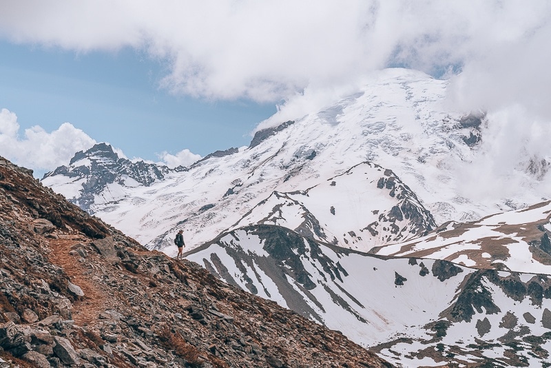
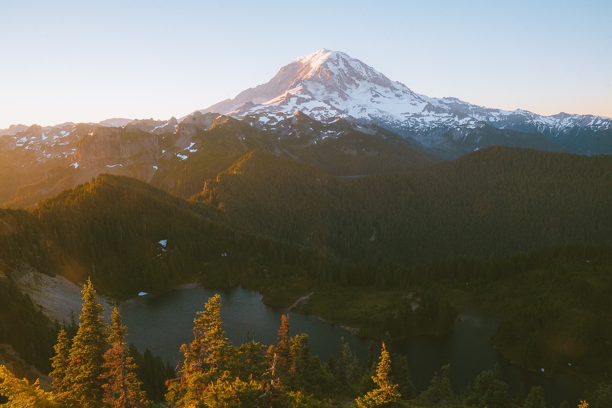
Burroughs Mountain
- Distance: 9.4 Miles Roundtrip
- Elevation Gain: 2,562 ft
- Difficulty: Hard
- Trail Guide: Link
 Burrows Peak #1
- view of the loop trail
Burroughs Mountain Trail is my new favorite hike at Mt. Rainier National Park. It is a more difficult version of Fremont Lookout. I love how it has a fantastic view of the glaciers and how there are three peaks. So you can essentially do Burroughs Peak #1 and head back to the car.
I really think it is worth it to get to Burroughs Peak #3. I will warn you that it is steep and long! But the view at Burroughs #3 is totally worth it.
I also think it is best to hike the loop trail instead of the out and back. The loop trail is a part of the Sourdough Trail and the Burroughs Mountain Trail, and on the way back, you get fantastic views of a bright blue lake and wildflowers.
Naches Peak Loop Trail
- Distance: 3.5 Miles Roundtrip
- Elevation Gain: 659 ft
- Difficulty: Moderate
- Trail Guide: Link
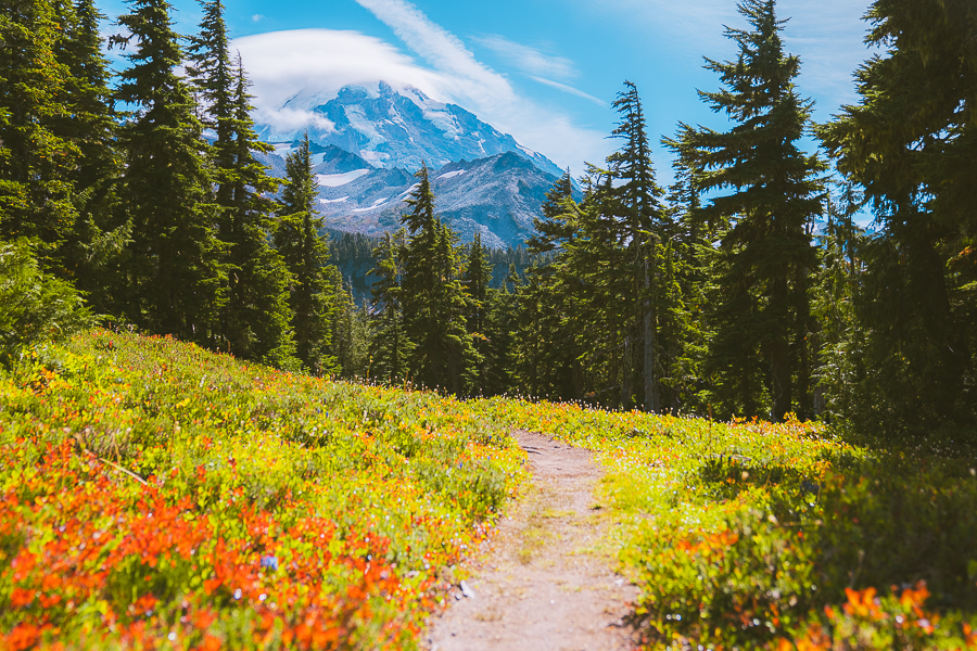
Naches Peak Loop trail is a great spot to see the wildflowers and outstanding views of Mount Rainier. It starts at Tipsoo Lake. The hike is pretty moderate and is best in July or August. Hike this trail going clockwise to get the best views. This is one of my favorite easy hikes in Washington.
Crystal Lakes
- Distance: 6.0 Miles Roundtrip
- Elevation Gain: 2,300 ft
- Difficulty: Hard
- Trail Guide: Link
The Crystal Lakes Trail is a hidden gem in Mount Rainier National Park that promises a rewarding experience for those willing to tackle its challenges. This trail is steep and uphill the entire way, making it a rigorous but fulfilling hike. It’s a great spot for backpacking if you’re looking to spend a night under the stars.
Despite the elevation gain, I was pleasantly surprised to see many kids on this trail. It goes to show that with a bit of determination, even young adventurers can enjoy this hike! The trail is well maintained, with fewer rocks and tree roots compared to other trails in Washington, which makes the climb a bit easier on your feet.
A significant portion of the hike is under the shade, offering a cool respite from the sun. As you ascend, you’ll reach the Upper Crystal Lake, which, in my opinion, is the better of the two lakes. The views here are absolutely stunning and make the challenging hike worth every step.
If you’re up for a strenuous yet rewarding adventure, Crystal Lakes Trail is a fantastic addition to your Mount Rainier itinerary.
The Best Hikes In Ohanapecosh
Grove Of The Patriarchs Loop
- Distance: 1.1 Miles Round trip
- Elevation Gain: 52 ft
- Difficulty: Easy
- Trail Guide: Link
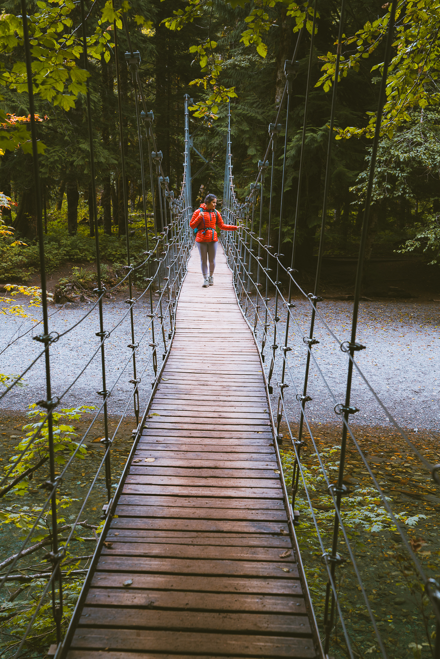
If you are looking for an extremely easy trail to do with the family, then the Groves of the Patriarch is a great choice. The trail takes you through a path with Douglas-firs, hemlocks, and cedars. Some of the trees are nearly 40 feet in diameter and more than 300 feet tall. There is even a tiny suspension bridge to enjoy.
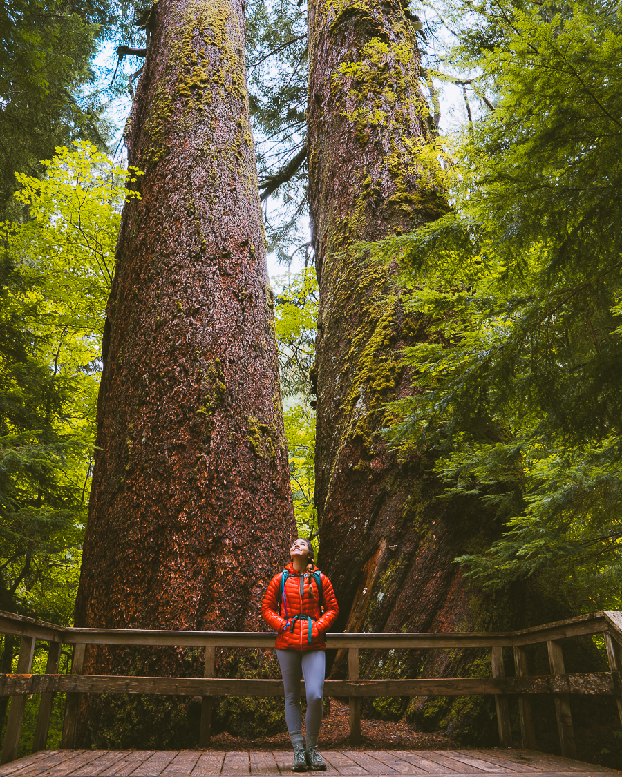
Note: As of November 2021, this trail is closed due to the suspension bridge suffering extensive flood damage. Check the U.S. National Park Service Website for up-to-date information about this trail.
Silver Falls Loop Trail
- Distance: 2.9 Miles Roundtrip
- Elevation Gain: 518 ft
- Difficulty: Easy
- Trail Guide: Link
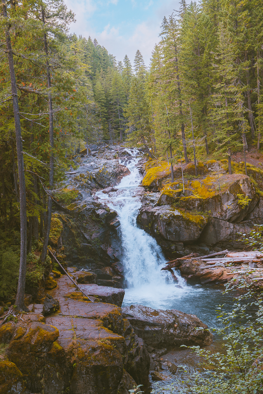
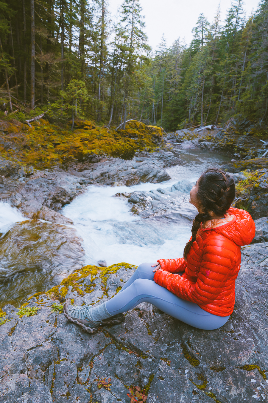
We did this hike right after the Grove of the Patriarchs, and we were pleasantly surprised at how much we enjoyed it! The Grove of the Patriarchs was extremely crowded while this easy hike had nearly no crowds! We enjoyed walking next to the river and getting a different angle of the river. The river was crystal clear with a hint of green. Take your time on this trail as I felt like there were multiple viewpoints we really enjoyed.
Best Hikes In Carbon River and Mowich Lake
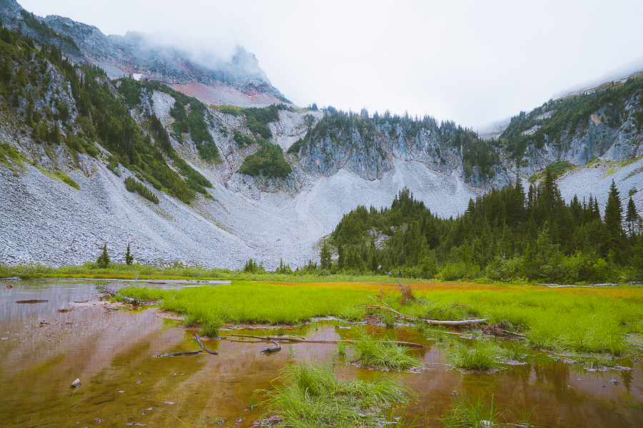
Spray Park Trail
- Distance: 6.9 Miles Roundtrip
- Elevation Gain: 2,198 ft
- Difficulty: Moderate
I love this trail! What I love about it is that there is an epic waterfall and it has stunning views of Mount Rainier at the end. It is pretty epic. It is also on the less popular side of the mountain, so it doesn’t get as crowded as the other trail.
The Spray waterfall is around the trail’s midpoint, and you need to cross a river to get to the waterfall, so bring good shoes and trekking poles.
When you get towards the end of the trail, there is a meadow, and it will either be filled with wildflowers, fall colors, or blueberries. We ate so many yummy blueberries while we took all the pictures. It is a fantastic trail.
Tolmie Peak Fire Lookout
- Distance: 5.6 Miles Roundtrip
- Elevation Gain: 1,541 ft
- Difficulty: Moderate
- Trail Guide: Link
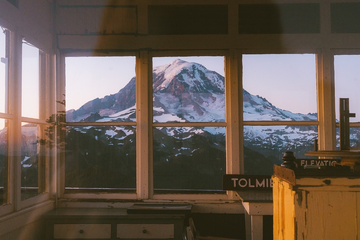
Tolmie Peak Lookout is the second fire lookout in this list. What is so fantastic about this hike is that you get lake views and of course Mount Rainier views. It is known for beautiful wildflowers and vivid orange leaves in the fall. I also recommend this trail during sunset or sunrise as you might get a colorful pink and orange view of Mount Rainier all to yourself.
Wonderland Trail
- Distance: 85.8 Miles Roundtrip
- Elevation Gain: 24,547 ft
- Difficulty: Moderate
- Trail Guide: Link
Not everyone is down to do the Wonderland trail as it takes a few weeks to do but it seems like it is worth it! You have to prepare in advance and get permits to do this long trek. The trail circles the entire mountain. It is on many people’s bucket lists (including mine) and if you want to read more about it check this website out.
My Favorite Hikes
After living in Washington for a few years, I have certain hikes that I would do over and over again. My favorite hikes at Mount Rainier include Fremont Lookout, Tolmie Peak, Spray Park, and the Skyline Divide.
Easy Hikes At Mt Rainier
The best hikes to do in Mount Rainier with the whole family include Sourdough Ridge, Grove Of The Patriarchs Loop, Burroughs Mountain, Nisqually Vista Trail, and Naches Peak Loop.
Final Thoughts On Best Hikes In Mount Rainier National Park
I hope this post was able to help you out on which hikes you should add to your bucket list. I have so many other great posts on other areas in the PNW you should check out next:
- Best Hikes In The Olympic National Park
- Best Hikes In Washington State
- The Best Hikes At North Cascades National Park
- The Ultimate Guide To Snowshoeing Mt Rainier National Park
- Fun Day Trip to Mount Rainier from Seattle

Get my free National Park Checklist
When you join the newsletter!
Pin For Later: Best Hikes Mt Rainier

Dam those places look breathtaking. I really want to hike at Rainier whenever I go to Seattle. Did you take the Sunrise Gift Shop image yourself? Is it done via drone? I don’t get how people get such good photos so high up from the air.
It was on the trail!