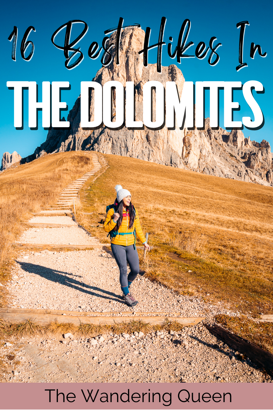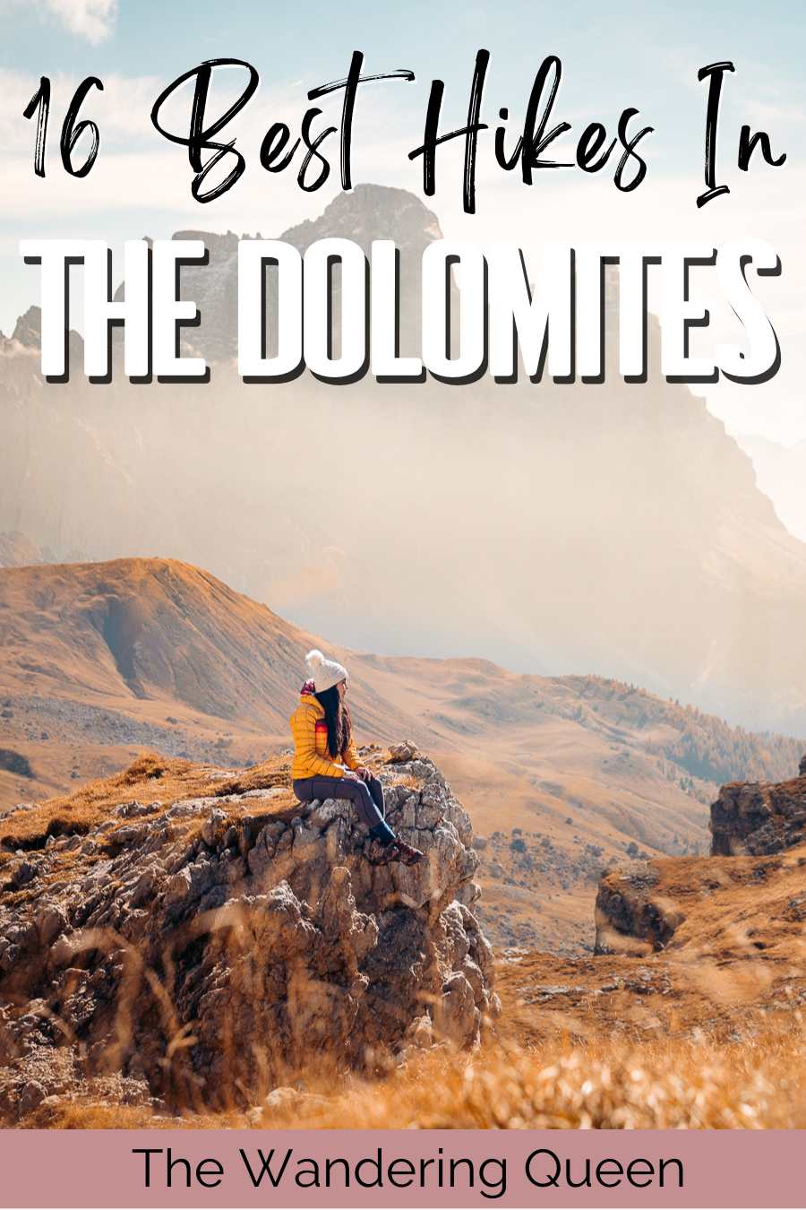
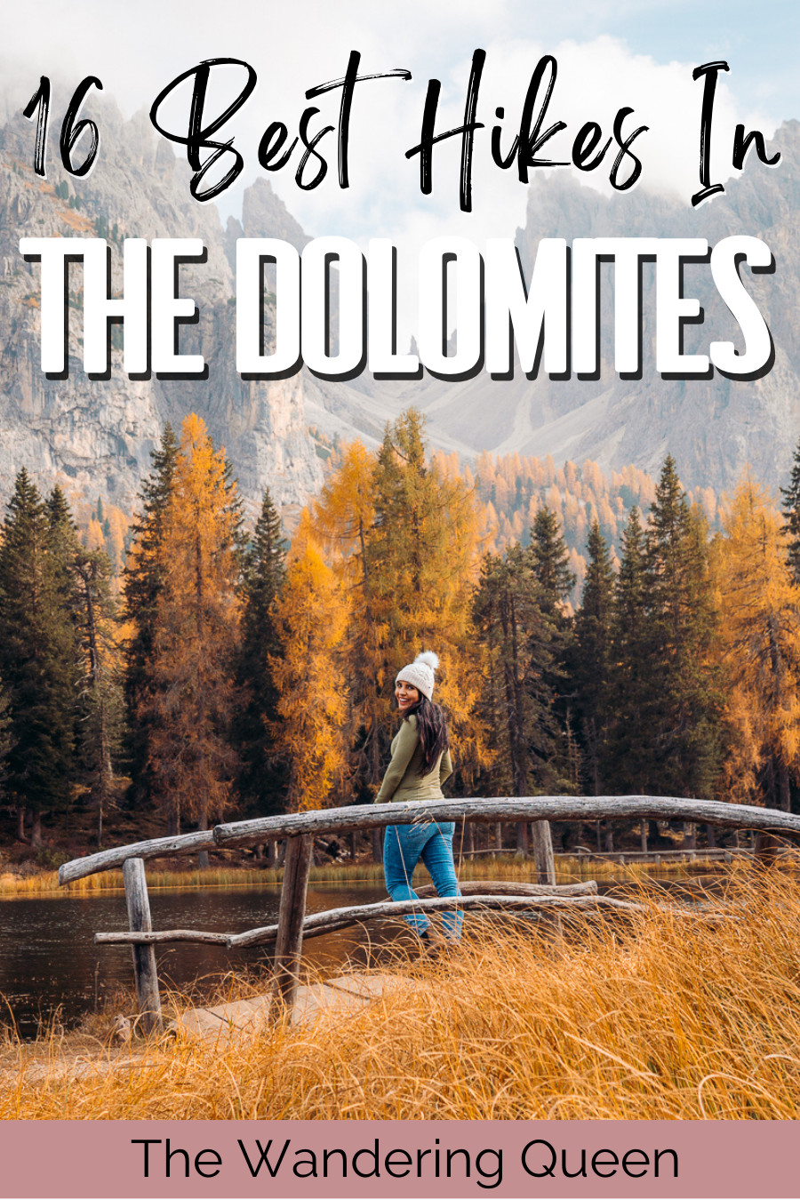
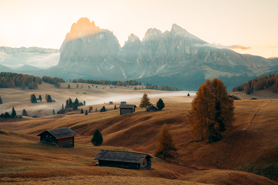
16 Best Hikes in the Dolomites, Italy: Hiking Trails To Try
Located in northeastern Italy and around 100 miles from Venice is a mountain range called the Dolomites. This is one of Italy’s most famous hiking ranges, as it has tons of trails, the most breathtaking views, and many small towns to explore.
That said, it’s hard to find which trails to take and how to get there without prior experience. This won’t be a problem for you, as this guide shows you some of the best hikes in the Dolomites, when to go, and how long to stay in this beautiful area.
If you’re looking for a longer stay when hiking the Dolomites, check out this 7-day Dolomites itinerary.
Disclosure: This post contains affiliate links. If you click one of them, I may receive a small commission (for which I am very grateful for) at no extra cost to you.
Map Of The Best Hikes In The Dolomites, Italy
Where To Stay
Ortisei
Linder Cycling Hotel: I highly recommend this hotel, which is where we stayed in Val Gardena. Breakfast was terrific, dinner was good, and the views were beautiful. I really enjoyed my time here. >Book Hotel Here
Cortina d’Ampezzo
HOTEL de LEN: This beautiful modern yet warm hotel with a fantastic restaurant. >Book Hotel Here
Booking.comTours Of The Dolomites
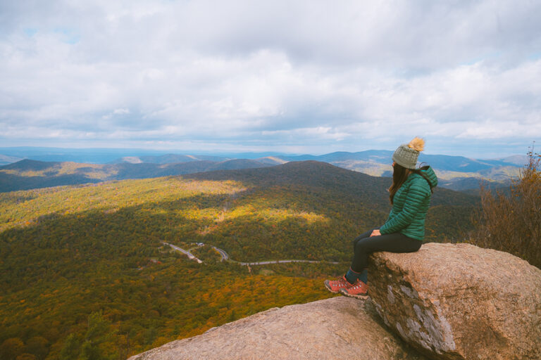
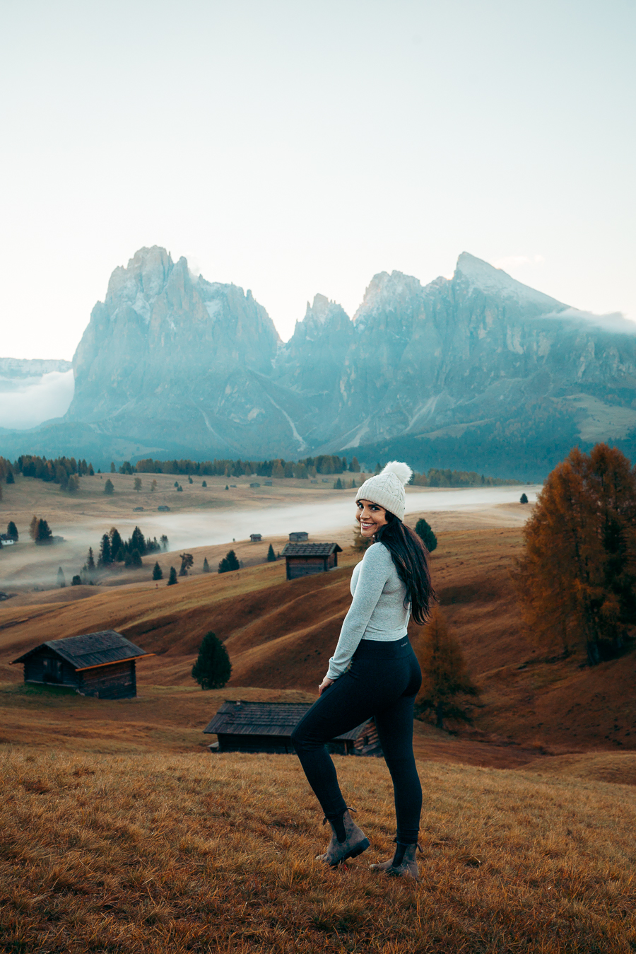
What To Pack For The Dolomites Itinerary
What to pack for the Dolomites depends on what time of year you go. Since I went in the Fall, I brought more layers, so I will list those layers below but will also list summer attire.
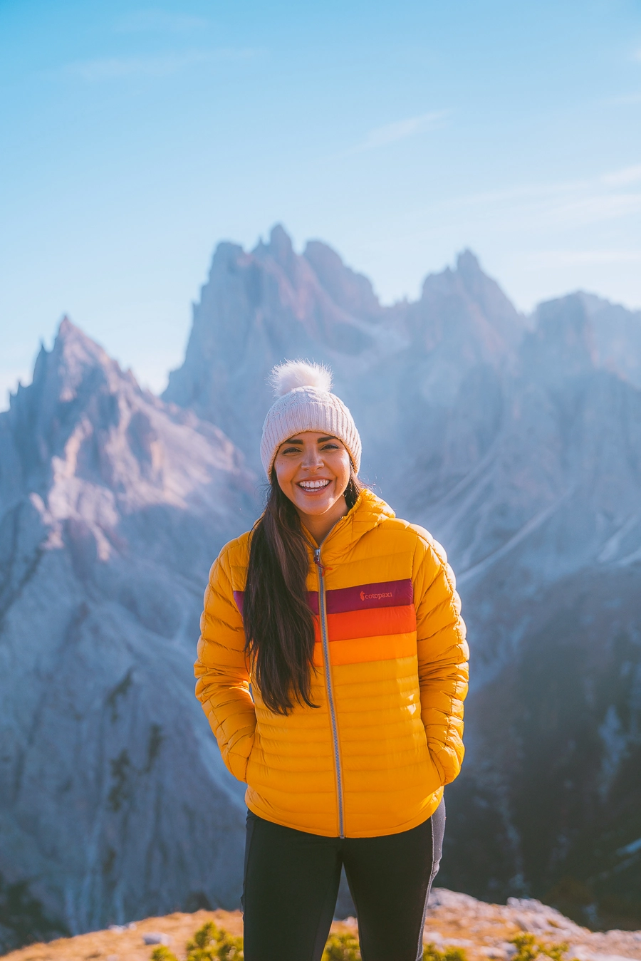
- Warm Jacket: I loved this jacket that I wore in the Dolomites. It kept me warm and looked terrific in my pictures. >Buy This Jacket Now
- Midlayer Sweater: I like to have a sweater just in case I get a little chilly outside. >Buy This Warm Sweater
- Leggings: I wore comfy leggings throughout the whole hiking trip. >Buy My Fav Leggings Here
- Base Layers: On the colder days, I wore these under my leggings and sweaters. >Buy Top Here >Buy Bottoms Here
- Hat: Depending on when you go, you can bring a beanie or a sun hat. I brought a beanie to keep my head warm in the Fall. >Buy Sun Hat Here >Buy Beanie Here
- Breathable Shirts: Try not to wear cotton because it soaks up your sweat. >Buy Shirt Here
- Hiking Backpack: To carry snacks, water, ten essentials, and a camera. >Click Here for my favorite backpack
- Water Bladder: Stay hydrated while hiking all around Italy. >Buy Water Bladder Here
- Fanny Pack: I Felt so safe carrying my passport in this pack. >Check It Out Here
- Hiking Boots: I used hiking boots on the more difficult trails like Lago Federa, and Tre Cime. It gave me so much support on the more difficult all-day hiking trail days. >Check Out These Merrel’s That I Wore
- Hiking Socks: Wool hiking socks prevent blisters on all-day hiking days. >Buy Some Here
- Cute Boots: I love walking around in the cute northern Italy towns. I have used the Blundstone boots for years on my travels! They are so comfy. >Buy The Comfiest Travel Boots Here
- Regular Socks: >Love These Comfy Socks
- Cute Sweaters: On the more chill days, I wore very comfy sweaters. In the summer you can wear comfy shirts. >Buy A Cute Sweater Here
- Jeans: In my itinerary below, I have a few days which are pretty chill and do not require hiking attire. >Check Out My Jeans
- First Aid Kit: In case you need a bandaid while hiking all around northern Italy. >Buy One Here
- Rain Jacket: The worst feeling in the world is being wet and cold while hiking. >Check Out My Rain Jacket Here
- Tripod: This is an optional item, but it is excellent for getting the ideal sunset pictures. >Check out this tripod
- Snacks: The best snacks are jerky, nuts, and energy bars. >>>Check Out These Snacks
- Sunglasses: It can get sunny all year long, so make sure to pack some sunglasses. >Check Out These Sunglasses
- Sunscreen: It was sunny at times, even in the Fall, and sunscreen is part of the ten essentials! >Buy Sunscreen

Claim your FREE Hiking Checklist
Ready to start hiking? Grab my free hiking checklist and never forget anything at home!
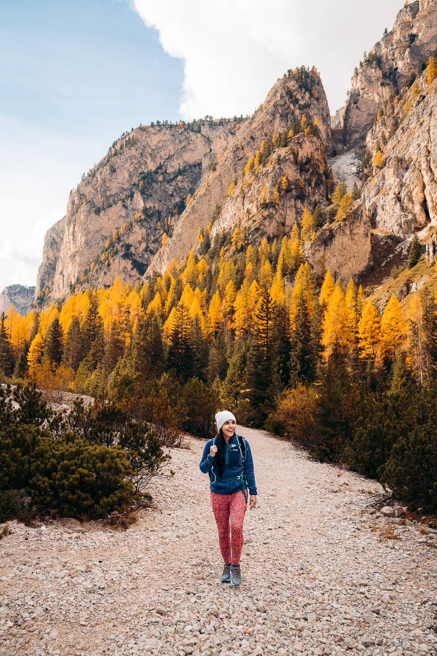
Best Dolomites Hiking Trails
That’s enough chit-chat. Here are some of the best Italian Dolomites hiking trails.
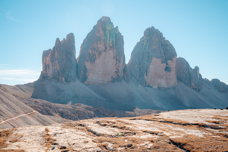
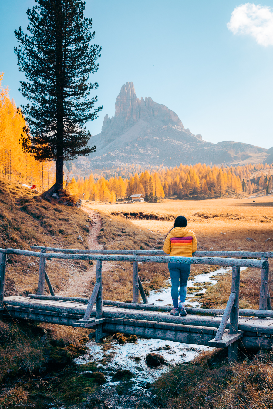
Tre Cime di Lavaredo
- Mileage: 6.2 miles (10 kilometers)
- Elevation Gain: 1,646 feet (502 meters)
- Time: Roughly 3.5 hours
- Difficulty: Moderate
- Type of Trail: Loop
- Trail Guide: Link
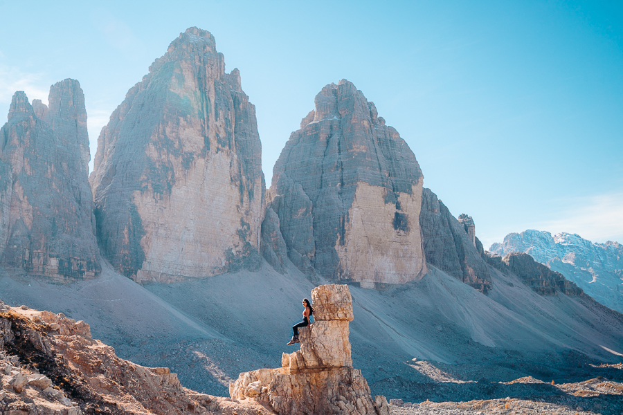
One of the most popular hiking trails on this list is the Tre Cime di Lavaredo hike. That’s because this hike has some of the best scenery in the Dolomites and features three mountain peaks. In fact, that’s exactly what Tre Cime di Lavaredo is in English.
However, this hike’s popularity means the route is bustling in the peak summer season. That’s why starting this challenging hike early is best to avoid crowds and experience the crisp mountain air and peaceful surroundings.
You’ll start the hike at the car park, where you have to pay $32 per person (cash only) for entry to the trailhead. It’s well worth it because parking before the toll booth means a long trek back to your car afterward.
Tre Cime di Lavaredo is a loop trail, starting at Rifugio Auronzo, to the left of the car park. It then heads north to Rifugio Lavaredo on a wide gravel path. The start of the hike is relatively easy, as the trail is mostly flat, running along the southeastern side of Tre Cime.
Along the trail, you can see beautiful views of the Auronzo valley. Keep trekking along, as you’ll soon get to Cappella degli Alpini, a stunning chapel. It’s a picturesque spot to take a break, but you can also just keep going. That’s because it’s just 10 minutes from Rifugio Lavaredo, you can refill your water and use the bathroom.
Once you’ve caught your breath, you’ll go up the ridge at Forcella Lavaredo and be blown away by the majestic view of hundreds of jagged peaks, a truly incredible experience. You’ll also finally be able to see Tre Cime di Lavaredo, three gorgeous peaks.
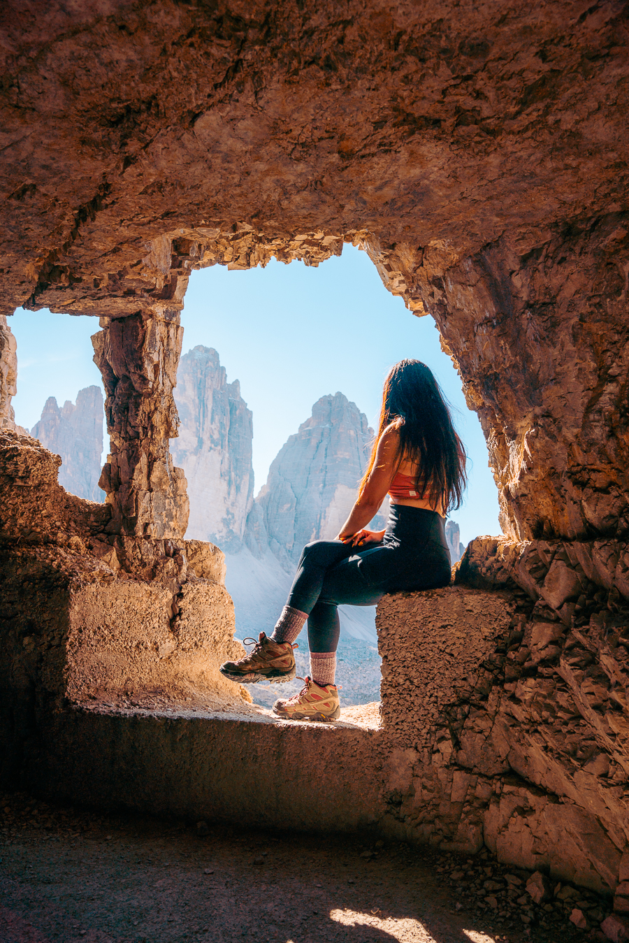
Lastly, the path drops below the peaks of Croda Passaporto and Monte Paterno to Rifugio Locatelli. This is honestly where you can get the best view of the three peaks!
The next part is probably the hardest as you walk up and down the valley to Malga Langalm. Thankfully, you can fill up on more drinks here. If you keep hiking, you’ll reach the Forcella Col di Mezzo ridge. Finally, you’ll end the hike in between flowering alpine meadows.
Cadini Di Misurina Viewpoint
- Mileage: 2.1 miles (3.4 kilometers)
- Elevation Gain: 744 feet (227 meters)
- Time: 1.5 hours
- Difficulty: Moderate
- Type of Trail: Loop
- Trail Guide: Link
Another great hike nearby is the trail from Tre Cime da Lavaredo’s start point Rifugio Auronzo to the viewpoint on Cadini Di Misurina. It’s relatively simple and a great place to take some awesome sunset photos after hiking Tre Cime.
You proceed along the Bonacossa path and have a slight incline around half a mile in. You’ll pass Monte Campedelle halfway into the hike before ascending to the viewpoint. If you have a moderate fitness level, this won’t be a struggle for you.
It’s worth the work because you’ll have some of the best Instagrammable material once you arrive at the viewpoint. However, you will have to deal with standing in line, as this is a popular trail during hiking season.
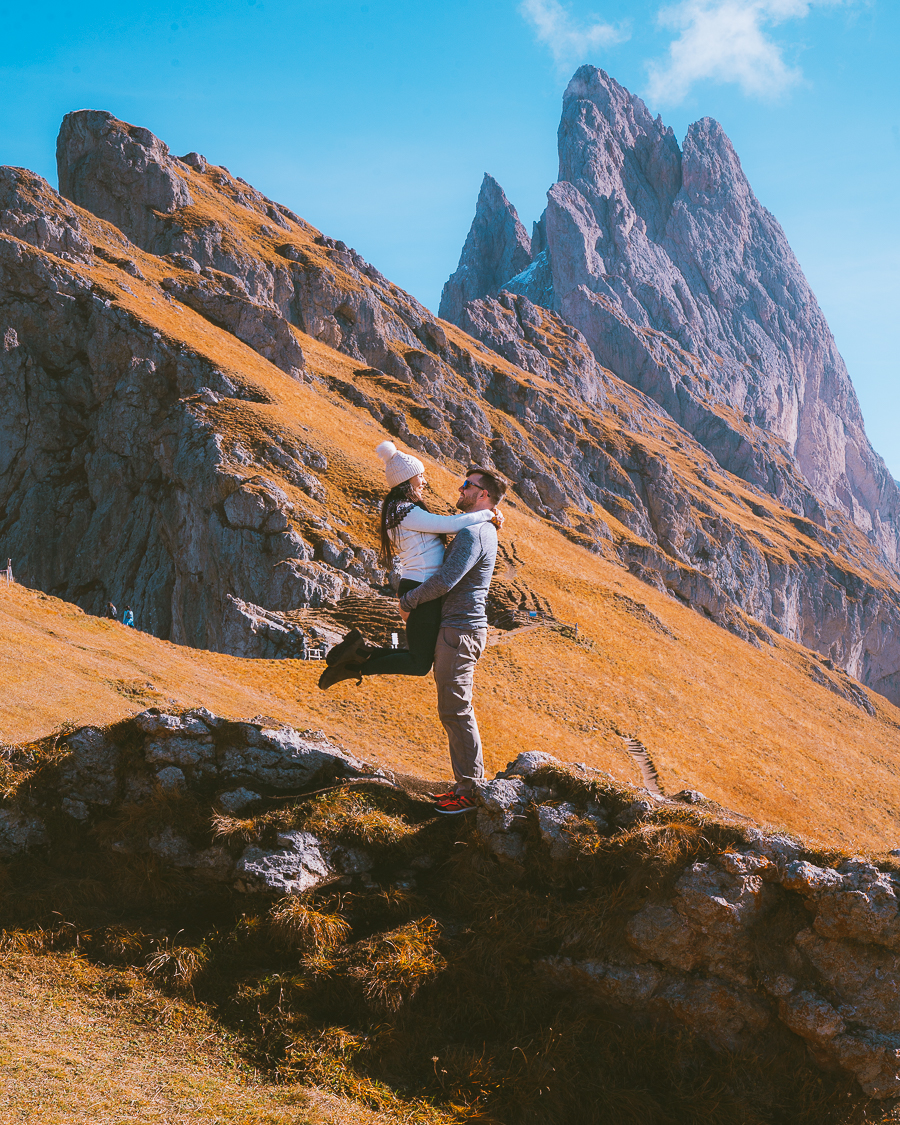
Seceda
- Mileage: 0.8 miles (1.2 kilometers)
- Elevation Gain: 360 feet (109 meters)
- Time: 30-45 minutes
- Difficulty: Easy
- Type of Trail: Loop
Another short, easy hike in the Dolomites is the trek from the cable car station up to the Seceda viewpoint. Seceda is a famous peak in the Dolomites with its jagged peaks and green meadows.
Luckily for you, this hike isn’t really challenging. A cable car takes you up over 2,300 feet from Furnes, so appreciate the view while you ride up. It takes around 10 minutes from the station to hike to the viewpoint for the ideal perspective and shot of Seceda.
The trail also gives you a panoramic view of the Dolomites, so take it all in. Now, if you wanted, you could always just walk back to the cable car station, but this looped trail is a simple way to make the most of this cable car ticket.
You can continue downhill along the ridgeline from the viewpoint, walking towards Seceda. Once you’re at the bottom of the hill, you’ll notice that the trail splits. You’ll want to stay left and continue on for around 10 minutes to Forcella Pana.
Then, you will have a much closer view of the pinnacles and a better photo opportunity. After you’ve got that perfect shot, head back to the cable car station for a cool-off drink.
Santa Maddalena Viewpoint.
- Mileage: 2.5 miles (4 kilometers)
- Elevation Gain: 554 feet (168 meters)
- Time: 1 hour and 20 minutes
- Difficulty: Easy
- Type of Trail: Out-and-back
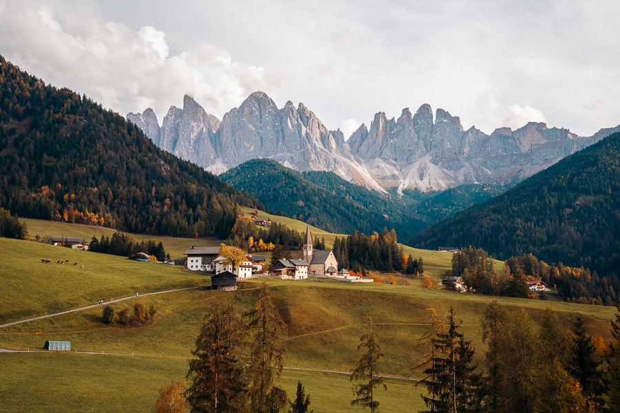
If you’re looking at all these amazing hikes and feeling a bit challenged, don’t worry. Here’s a great, short hike. Just because it’s easy doesn’t mean the Val di Funes hike doesn’t have amazing views.
In fact, it’s a very popular trail with a gradual ascent. One thing you should be aware of is parking in Santa Maddalena. This could annoy locals as the roads up to the viewpoint are private.
The hike starts in the village, where you’ll walk along Kirchweg up to the Fallerhof Farm. You’ll head up trail 26, which veers to a pathway to Santa Maddalena church. It’s free to enter, but if you want to continue to the viewpoint, head along Magdalenaweg road. It descends a bit, and soon you’ll reach the Plauer farm.
Here, you’ll cross a bridge over the Blauer Bach stream and find the Panoramaweg trail sign on your right. The hiking trail will ascend briefly for a few minutes before reaching the Santa Maddalena viewpoint.
Here, you can get the truly iconic imagery of the Italian Dolomites, with the Odle-Geiser range in the background and Santa Maddalena in the forefront. To get back, you’ll head down the same way you came along Panorama and Magdalenaweg.
Read More: The Perfect Dolomites Itinerary: 7 Day Dolomites Road Trip Itinerary
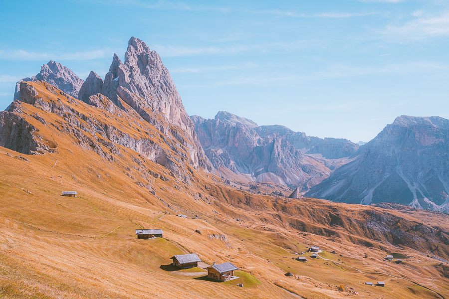
Alpe di Siusi
- Mileage: 5.2 miles (8.3 kilometers)
- Elevation Gain: 330 feet (100 meters)
- Time: 1 to 2 hours
- Difficulty: Easy
- Type of Trail: Out-and-back
Another world-famous view in the Italian Dolomites is the beautiful alpine meadows of Alpe di Siusi, otherwise known as Seiser Alm. It’s found in the South Tyrol area of northern Italy and is the highest alpine meadow in Europe.
To get here, you’ll need to hike up from Compatsch, where you’ll park. The car park called Parkplatz P4 is best for parking.
From there, you’ll head up the Campaccio or hiking trail 5 (on the signposts). For the most part, this hiking trail is a relatively gradual route, which only gets steep at the end.
Once you get to the viewpoint, you’ll get why the Dolomites have some of the most beautiful hikes in the world. With endless rolling meadows, alpine forests, and jagged peaks, Alpe di Siusi has it all.
Ending the hike is much easier, as you just have to walk downhill. But if you are worried about slipping, be sure to bring hiking poles.
Grab Your Free Car Camping Checklist! 🚗🌲
Ready to elevate your car camping game? Snag our essential checklist to ensure you’ve got everything you need for a stress-free, fun-filled adventure! Perfect for beginners and seasoned campers alike. Download now and hit the road prepared! 🌟🎒
Rifugio Averau And Rifugio Nuvolau
- Mileage: 2.5 miles (4 kilometers)
- Elevation Gain: 1,100 feet (335 meters)
- Time: 1.5 to 2 hours
- Difficulty: Easy
- Type of Trail: Out-and-back
Another brilliant Dolomites day hike nearby Cinque Torri is the hiking trail up to Rifugio Averau and Rifugio Nuvolau. In fact, you can even add it to the Cinque Torri trail, as they’re both easy hikes.
For the easiest route, take the chairlift up to Rifugio Averau and just hike to Rifugio Nuvolau. Otherwise, you can just hike from Rifugio Scoiattoli, just like the Cinque Torri route. It shouldn’t take long to get to Rifugio Averau, as it’s only 0.6 miles away from the starting point – and both rifugios are visible from Scoiattoli.
As long as you’re moving up, you’re good. Once you get to Rifugio Averau, you may notice that the trail is a bit busier. This is because of the previously mentioned chairlift up to the mountain hut.
Keep on trekking, as Rifugio Nuvolau has a higher vantage point for views. The hiking trail does get a bit steeper, but with that comes breathtaking vistas of the surroundings.
After 30 minutes, you should arrive at Rifugio Nuvolau and give yourself credit as you’ve reached the summit of Mount Nuvolau. Grab a beer and drink in the views (sorry, that was too good).
To get back, you’ll just need to retrace your steps to where you started, which shouldn’t take longer than an hour.
Vallunga
- Mileage: 5.5 miles (8.9 kilometers)
- Elevation Gain: 1,010 feet (308 meters)
- Time: 2.5 hours
- Difficulty: Moderate
- Type of Trail: Out-and-back
- Trail Guide: Link
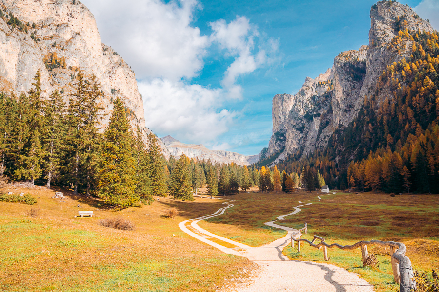
A brilliant area in South Tyrol is the Puez-Odle Nature Park, which has some of the best hikes in the Dolomites. One such hike is in the Vallunga Valley, near Selva di Val Gardena.
It’s a perfect Dolomites hiking trip for families, as it’s one of the easier hikes on this list. It has gradual ascents and lots of picnic tables for pitstops. Even if it’s just you and your partner, it’s still a brilliant hike in the Dolomites.
From the stunning golden larches (if you visit in the fall) to walking in between gorgeous mountains, this trail offers a more low-key experience. The hike starts near a bar called La Ciajota in Selva di Val Gardena. At the start of the trailhead, there is a car park called Parcheggio Vallunga, which costs $8 for the day.
You’ll walk for around half a mile until you reach Cappella di San Silvestro, a beautiful mountain chapel in the most picturesque spot. It’s got stunning 300-year-old frescoes inside depicting Jesus’ life.
After this, hiking up this trail is still breezy. There aren’t any turns to take, so just keep trekking on. You’ll want to take a break when you reach Lech di Ciampedel, a beautiful alpine lake. This lake has a fascinating feature – sometimes you’ll see it, sometimes you won’t.
That’s because the lake is filled with meltwater, and your best chance of seeing it is in the spring, after a snowy winter. The snow melts, causing the area to fill with water in a gorgeous verdant green color. This is the perfect spot for a lunch break, as it’s around the halfway point of the way up and the ideal opportunity for a swim.
If you miss the lake, don’t be dismayed, as the hike is still a fantastic area for bird-spotting and appreciating nature. Keep on hiking as you’ve almost reached the end of the uphill trek. Then, you just need to head down, and once at the bottom, grab a refreshing drink at La Ciajota.

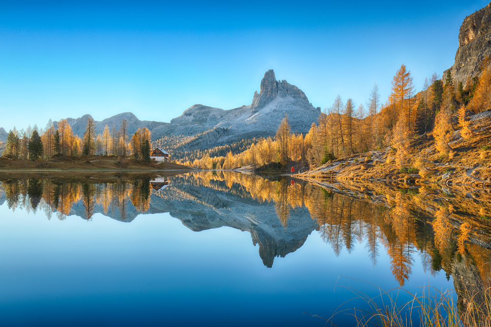
Lago Federa and Croda da Lago Circuit
- Mileage: 8 miles (12.7 kilometers)
- Elevation Gain: 2,969 feet (905 meters)
- Time: 4.5 to 6 hours
- Difficulty: Hard
- Type of Trail: Loop
- Trail Guide: Link
This is a great option if you’re looking for an all-day hike in the Dolomites. But it is not for beginners as it is one of the more challenging hikes. That said, there is a way to make it a bit easier.
It is slightly less complex if you hike the trail to Lago Federa as an out-and-back route. To do this, you’ll start the hike at Ponte de Ru Curto, where there is a car park. From here, you head up path 437 along the pine forest to Casòn de Formin.
This is the first trail junction of the hike and happens about 1 mile into the walk. You’ll keep left to head up to Lago Federa on path 434. Almost 1.7 miles into the hike, there is an optional detour to Val Negra — a stunning viewpoint over the nearby Cortina d’Ampezzo.
Now the hiking trail starts to head downhill, and after 2.5 miles, you are at Lago Federa. It has absolutely pristine emerald water, perhaps one of the most beautiful lakes in northern Italy. In the summer months, it’s perfect for a swim to cool yourself down.
It’s also home to another of the Italian Dolomites’ picturesque mountain refuges, Rifugio Palmieri, where you can get a snack. If you want to continue the circuit, you’ll walk up Forcella Ambrizzola, so make sure to enjoy the view. At Forcella Ambrizzolla you’re standing at 7,500 feet, but you’re not done yet.
The hiking trail briefly descends into luscious alpine meadows, and you’ll keep right onto the Croda da Lago range. You’ll start the very steep ascent up the Forcella Rossa saddle. Here’s where it’s useful to have good hiking shoes, as it’s a bit rockier. But it won’t be long before you reach the top!
After this, it continues along trail 435, flattens out, and begins to descend into Val de Formin. You’ll have to do quite a bit of rock climbing and scrambling here, so take your time. Once you’re down this, pat yourself on the back, take in the views, and head back into the forest.
Lago di Braies
- Mileage: 2.2 miles (3.5 kilometers)
- Elevation Gain: 594 feet (181 meters)
- Time: 1 hour
- Difficulty: Easy
- Type of Trail: Loop
- Trail Guide: Link
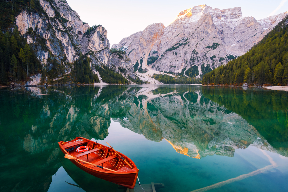
One of the most fantastic parts about hiking in the Dolomites is the spectacular scenery. This hiking trail around the tranquil Lago di Braies is certainly one of the most beautiful hiking trails in the Dolomites.
This Lago di Braies hike is easy in the South Tyrol region and shouldn’t take much longer than an hour to complete. It’s quite a leisurely stroll, which you can do as a day hike, taking breaks along the way for a midday beer.
Start on the western shore and follow the Giro del Lago signposts as you walk on a wide gravel path, providing you with unique views of the lake. It’s a fantastic hike, no matter your fitness, as there’s not much elevation gain besides a few stairs.
Along the way, you’ll spot various peaks, such as Apostoli and Seekofel. These are truly majestic sights that will take your breath away. Once you’ve reached the base of Seekofel, you’ll see a pebble beach. This is the perfect opportunity to dip in the lake’s turquoise waters.
Then, the trail rises a bit on the lake’s eastern side, which gives some of the best views on this walk. Here, you’ll be able to appreciate the view of Monte Nero, another brilliant hiking opportunity. The hiking path descends as you return to the start near Hotel Lago di Braies.
Lago di Sorapis
- Mileage: Roughly 7 to 8 miles (13.8 kilometers)
- Elevation Gain: 1,520 to 2,550 feet (919 meters)
- Time: 3 to 7 hours
- Difficulty: Moderate to challenging
- Type of Trail: Loop
- Trail Guide: Link
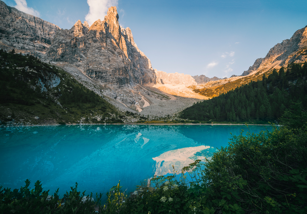
Another brilliant alpine lake hike in the Dolomites is the hike to Lago di Sorapis. Lake Sorapis is one of the most beautiful places in the Dolomites, if not the whole of Europe. Its milky aquamarine colors are mesmerizing as it reflects nearby peaks.
Now to get here requires a trek. Okay, more than just a bit, as you can only get here on foot. You’ll start at a car park (Parcheggio per Sorapis on Google Maps) and hike up a short dirt trail to reach the trailhead.
The shortest Lago di Sorapis hike will be around 7.2 miles and starts by heading down into a forest. The trail is easy to walk on, and it’s gradual up until 1.2 miles in. This is where you’ll have your first steep incline.
Just keep going as you get closer to the halfway point. You’ll have a few more steep inclines and some rock scrambling and climbing up some metal steps.
Just 0.3 miles from Lake Sorapis is a trail split. Keep left to trek onto the lake, but turn right if you want to turn the hike into a loop. Keep pushing on, as then you’ll get to the incredible Lago di Sorapis.
Then, you can take a break, have lunch, and grab some shots of the alpine lake. If you didn’t bring lunch, visit Rifugio Vandelli for delicious food. Once you’re happy, you can return the way you came or walk up to Forcella Marcuoira to make it a challenging but incredible loop trail.
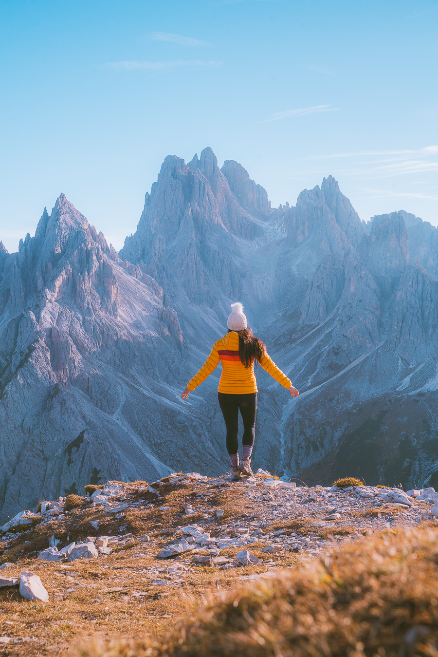
Adolf Munkel Weg To Geisler Alm
- Mileage: 5.7 miles (9.2 kilometers)
- Elevation Gain: 1,445 feet (440 meters)
- Time: 4 to 6 hours
- Difficulty: Moderate
- Type of Trail: Loop
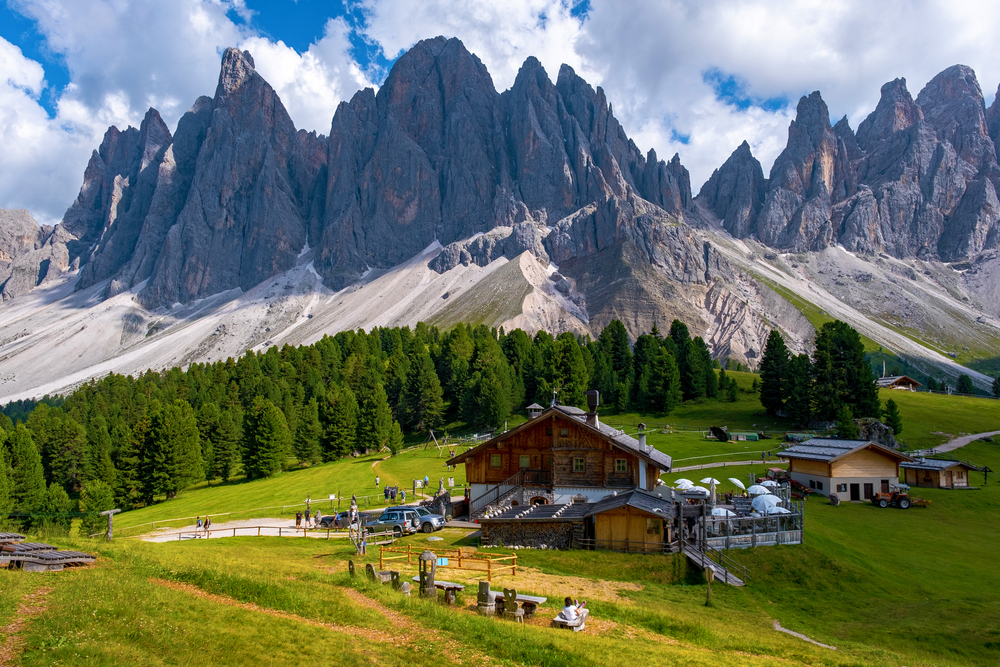
The Adolf Munkel Trail has majestic scenery but is not a steep hike, which is why this may be the best hike in the Dolomites. It starts in Val di Funes, as you both start and finish at the same car park.
The Adolf Munkel Trail hike starts on trail 6, heading to Tschantschenon. The trail is a wide gravel road and is well-indicated, so you can relax about not getting lost. For this part of the hike, you’ll be walking through the woods, which might feel a bit boring.

Tip: Arrive early in peak hiking season, as it fills up quickly.
However, don’t worry, as this won’t last long. At 1.1 miles into the hike, you’ll head up trail 35 on the left, the official start of the Adolf Munkel Trail. Now, you’ll continue to Geisler Alm after crossing a stone bridge.
Now it starts to get gorgeous, and it’s why this is such a highlight of the Puez-Odle National Park. You can spot views of the Odle-Geisler mountain range between the verdant forest branches. Now, you’ll just need to climb up some stairs, which can be steep, but keep pushing as you’re almost there.
After 2.6 miles, you’ll reach another trail junction. Here you need to take trail 36 for the most idyllic scenery, such as Malga Casnago. It has a mountain hut where you can get something to eat.
Otherwise, there is also a mountain hut at Geisler Alm called Rifugio delle Odle. It’s just 5 minutes from Malga Casnago, so keep going.
Once you get there, you can get why it’s a terrific day hike in the Dolomites. It’s got unobstructed views of the rocky peaks, which contrast beautifully with the sky, especially in the summer.
To complete the Adolf Munkel Trail hike, take trail 36 back to Zans. It’s mostly downhill and shouldn’t take longer than an hour to finish.
Read More: 25 Things to Do When Visiting Switzerland in the Winter
Cinque Torri
- Mileage: 1.2 miles (1.9 kilometers)
- Elevation Gain: 430 feet (130 meters)
- Time: 1 hour
- Difficulty: Easy
- Type of Trail: Loop
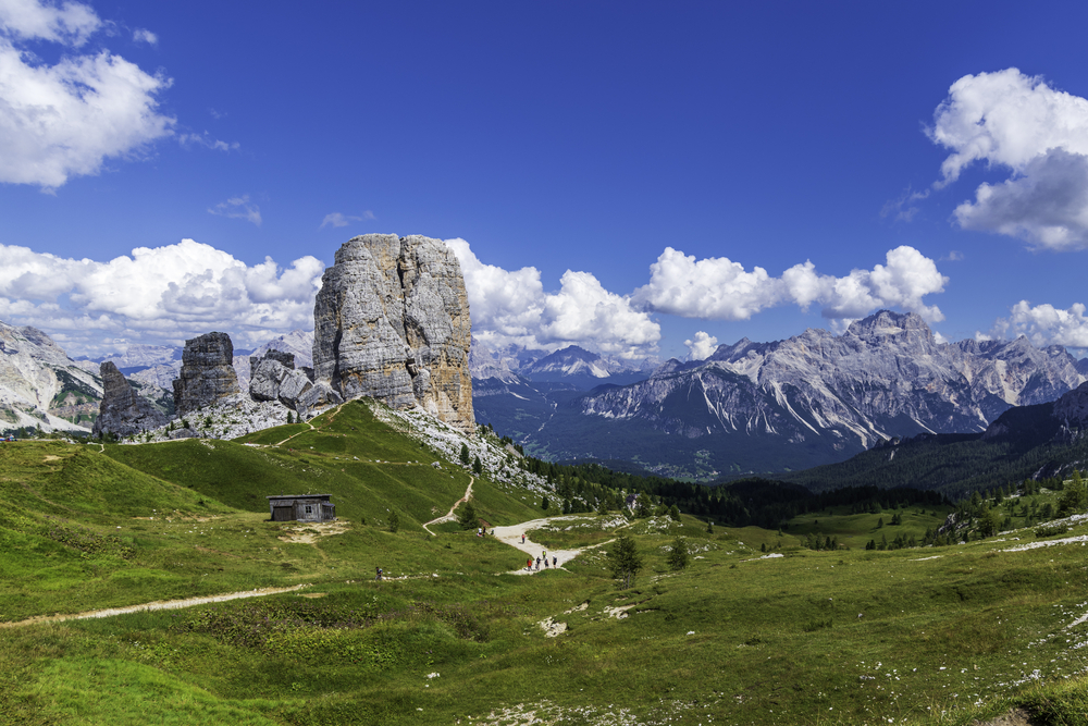
The Cinque Torri is a collection of towering rock formations used by Italian forces in World War I. So it serves as a monument and open-air museum, making it one of the best hikes in the Dolomites for history buffs.
Italian troops built trenches and bunkers amongst the Cinque Torri as an alpine shelter in the Italian Dolomites from the Austro-Hungarians. Getting here requires some of the least hiking in the Dolomites, as you catch a cable car to Rifugio Scoiattoli.
Then, you just need to hike around the various formations on a gravel trail. This hike has many informational signs along the way, so it’s easy to learn about each rock formation.
It’s mostly a gradual hike, besides from a few steep downhills. You’ll just need to follow route 2, which ends at a viewpoint, before heading back to Rifugio Scoiattoli.
Puez-Odle Altopiano
- Mileage: 10.6 miles (17 kilometers)
- Elevation Gain: 2,800 feet (853 meters)
- Time: 6 to 9 hours
- Difficulty: Moderate to strenuous
- Type of Trail: Out-and-back
This is perhaps the most challenging hike on the list and starts in Selva di Val Gardena. You’ll take a cable car up to Rifugio Jimmy, where you’ll start your hike, taking trail 2 up into the mountains. You’ll soon summit Forcella Cier before descending into a rocky landscape. This can get quite challenging as it’s a sheer climb.
This downhill is quite slippery, so take it slow while observing views of Lago di Crespeina and the Vallunga valley. Keep going if you’re still feeling good. Your next trail downwards is at the Puez Mountain Hut, around 1.5 hours from here.
Take this portion of the hike slowly, as there are a lot of rough terrains. It will take you another four hours to get to Rifugio Puez, where you can take a well-deserved lunch break. After this, you‘ll want to hike down trail 16 back to Selva, as it’s beautiful. It will probably take you another hour or two to get down.
Piz Boè
- Mileage: 3.3 miles (5.3 kilometers)
- Elevation Gain: 1,410 feet (430 meters)
- Time: 2-4 hours
- Difficulty: Moderate
- Type of Trail: Out-and-back
If you’re feeling like climbing to the top of a mountain without that much effort, Piz Boè is one of the best hiking trails to take. It starts at Passo Pordoi, where you ride a cable car to Sass Pordoi and do a short hike to the top.
It’s the highest peak of the Sella Group in the Dolomites, and you can hike from the bottom. This, however, is very tough and best left for the pros. Once you reach Sass Pordoi, follow trail 627A to get to Piz Boè.
Along the way, you’ll pass Rifugio Forcella Pordoi, walking downhill. It’s quite rocky here, so hiking poles may help. Otherwise, enjoy the descent, as it won’t last much longer. Keep following the trail signs turning left towards Piz Boè.
It’s uphill now, but there are metal rungs and chains to make the ascent a bit safer. Once you reach the top, you’ll see why this is such a popular route. To get back, backtrack the way you came slowly, and soon you’ll be back at Sass Pordoi.
Tofana di Mezzo
- Mileage: 0.2 miles (0.3 kilometers)
- Elevation Gain: 180 feet (54 meters)
- Time: 30 minutes
- Difficulty: Easy
- Type of Trail: Out-and-back
You’ll need to go on a cable car and gondolas from Cortina d’Ampezzo to get to Cima Tofana. Once at the top, you’ll follow a hiking trail to the third-highest peak in the Dolomites.
Climb up the staircases from Cima Tofana. Once at the top, you’ll see Tofana’s peak. Go along the gravel path for 15 minutes, rock scrambling as you go. In the end, you’ll witness some of the most breathtaking views (literally) in Italy.
To get back, you’ll need to do a bit of rock climbing, so take it slow. Also, if you’re really afraid of heights, I’d advise against doing this hike.
Lagazuoi To The Falzarego Pass
- Mileage: 2.5 miles (4 kilometers)
- Elevation Gain: 2,100 feet (640 meters)
- Time: 3 hours
- Difficulty: Easy
- Type of Trail: Point-to-point
After going up a cable car, you’ll reach Lagazuoi from the Falzarego Pass. Now, you’ll hike back down to the pass on a great downhill hike. This area is another famous part of World War I history, as it was a conflict site between Italians and Austrians.
You’ll start by following trail 401 towards Rifugio Lagazuoi downhill. Continue on trail 401 at the next trail junction, where it flattens a bit on your way to Passo Falzarego. After a bit, you’ll arrive at Forcella Travenanzes and take trail 402 to the pass.
It will get a bit steep before descending further. Along the way, you’ll see sights like Croda da Lago and Cinque Torri, which means you’re on your way. Keep going, as you’re almost there.
How Many Days Do You Need in The Dolomites?
If you want to get the most out of the experience of being here, it’s best to stay at least 3-5 days. This is so you can do as many Dolomites hiking trails as you want without worrying about flight departures.
There is so much to do here, even if you don’t love hiking.
Best Time for Hiking in The Dolomites
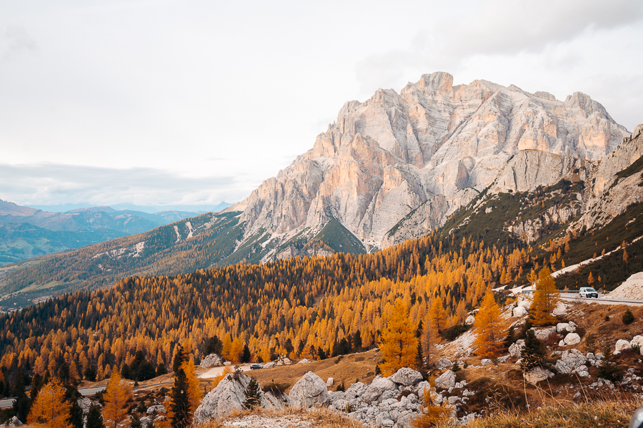
The best time to go to the Dolomites depends on what you want to get out of the experience. Fall in Italy is perfect for hiking in the Dolomites, as there aren’t as many people, and the weather is still lovely.
Summer is brilliant for mountain bikers and hikers. But, with the balmy weather, it becomes more crowded, and prices go up. Winter is perfect for skiers. That’s because it’s full of incredible snowy slopes.
Tips for Visiting the Dolomites
Here are a few tips to help you plan your adventure and enjoy Dolomites’ best hikes:
- If you’re a beginner, check out this hiking 101 post for some helpful tips and tricks.
- Be sure to bring along weather-appropriate hiking clothes and gear. If you need some inspiration, have a look at this guide on what to wear hiking.
- Bring comfortable hiking shoes. Check out this post on the best hiking boots for women to get an idea of what to look for.
Wrapping Up the Best Dolomites Hikes
Hiking in the Dolomites, Italy, is such an amazing thing to do. Whether it’s along an alpine lake or up mountain peaks, it will be an enjoyable memory.
Now that you know more about the best hiking in the Dolomites, what are you waiting for? Book a trip to Italy and enjoy this region’s incredible natural beauty.