
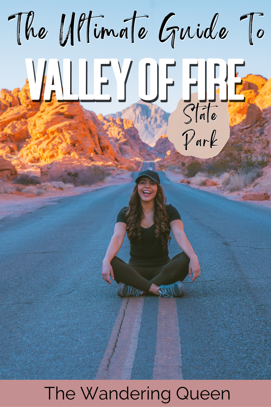
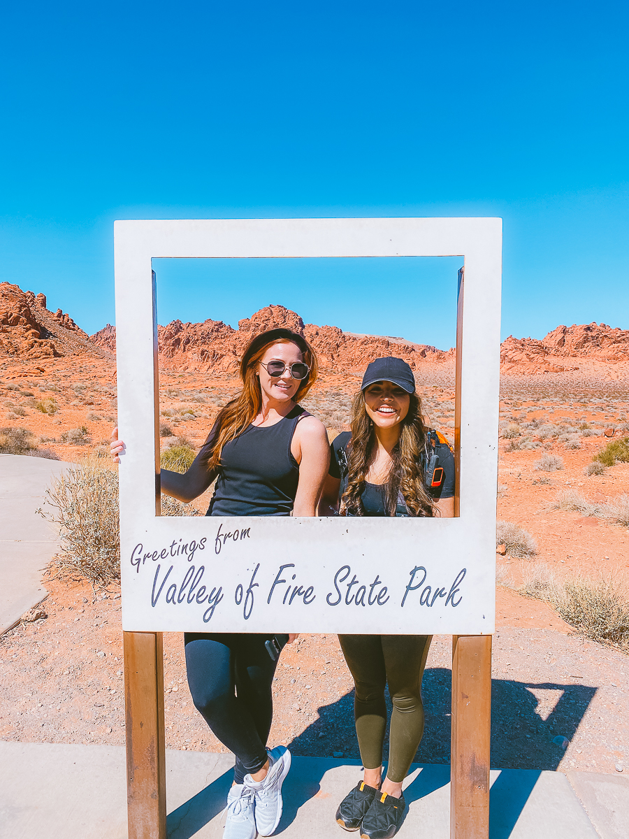
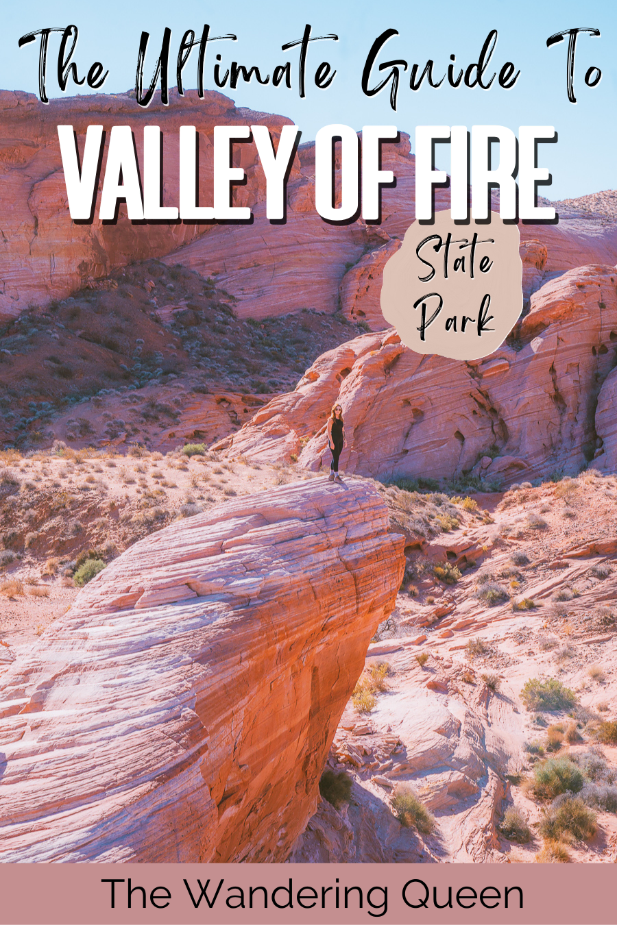
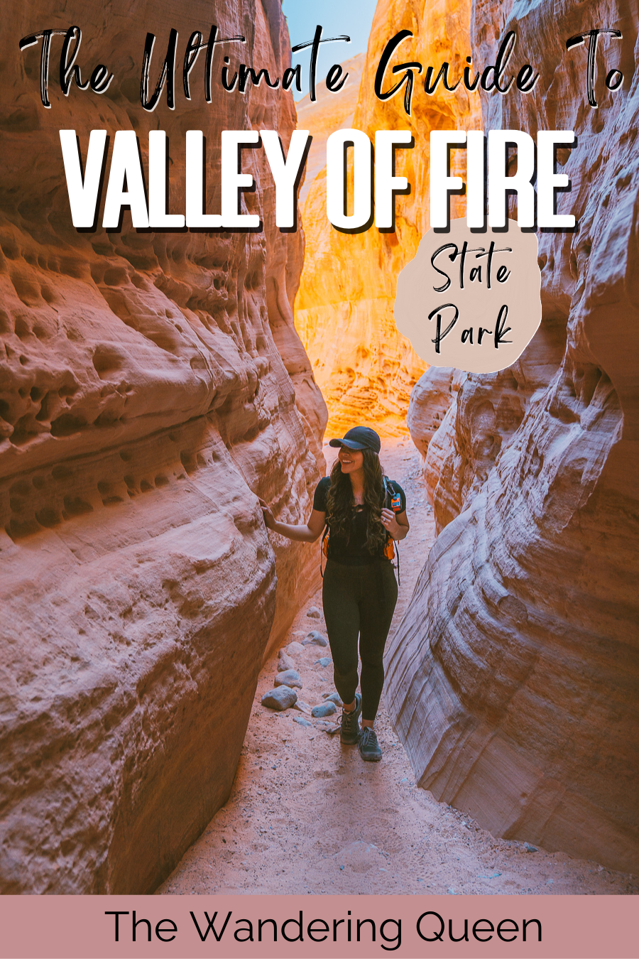
The Ultimate Las Vegas To Valley Of Fire Day Trip Itinerary
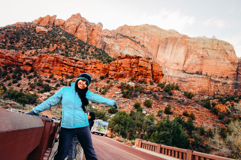
Valley Of Fire State Park was on my bucket list for years! This place is an absolute dream, and I was excited to finally see it.
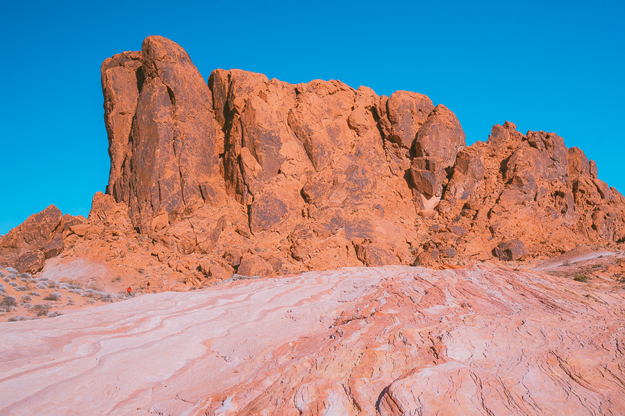
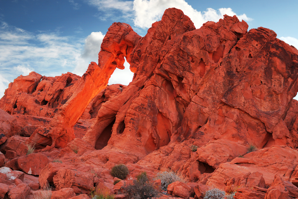
The park is filled with bright red, orange, and pink rock formations. It doesn’t seem real, and it is an adventure-lovers paradise. What is even more amazing about this park is that you only need one day to see most of it.
The hikes are extremely easy, and it is located so close to Las Vegas, Nevada! When at the park, I noticed many families hiking together, and it seemed like an easy outdoor getaway for the whole family.
So below, I talk about how to get from Las Vegas to Valley of Fire State Park, I list things to do, I talk about the weather, and I also have the perfect itinerary for you. Have fun planning!
Disclosure: This post contains affiliate links. If you click one of them, I may receive a small commission (for which I am very grateful for) at no extra cost to you.
How Much Time Do You Need To Visit Valley Of Fire
I was able to see 90% of the park in one day. Valley Of Fire State Park is pretty small, and many hikes are short (less than a mile).
There are also many viewpoints where all you need to do is get out of the car and take a photo. If you want to see most of the park within a day, it is best to get up for sunrise (or pretty early), so you don’t have to wait in line during traffic. We left the park around 1 pm, and the line to get into Valley Of Fire State Park was extremely long.
Also, even though we were there in February, it was pretty hot by midday. We were starting to get heat exhaustion, so we decided to leave at that time. For comfort and fewer crowds, it is best to get there early.
Download my free Outdoor Photography Guide
How To Get To Valley Of Fire
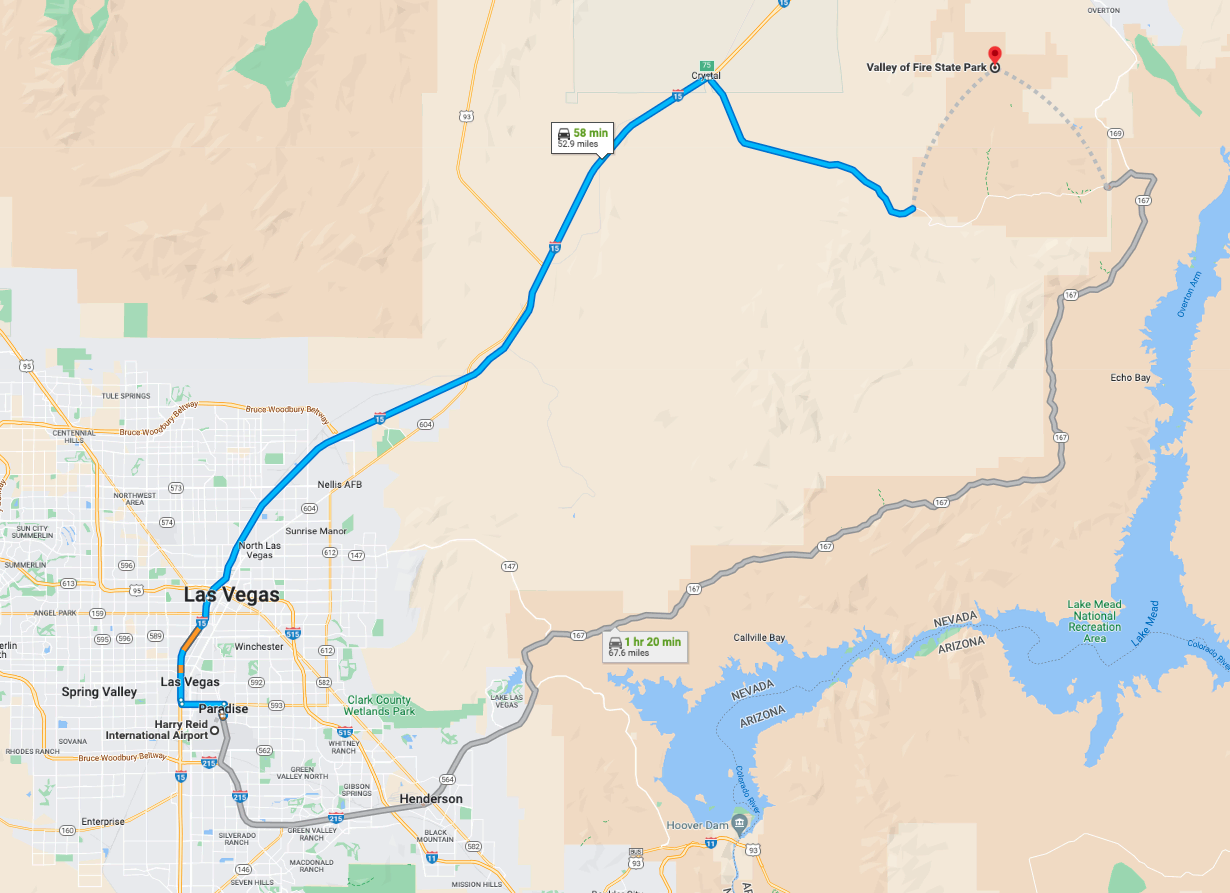
The best way to get to the Valley Of Fire is to fly into Harry Reid International Airport, rent a car and drive to the park. The drive is 53 miles away, about an hour drive. We ended up getting a hotel in Las Vegas.
Hotels In Las Vegas
The best place to stay near the park is Las Vegas, Nevada. Below is a map of the best hotels in Las Vegas.
Booking.comMap Of Valley Of Fire State Park
I have all the viewpoints and trailheads flagged on the map below. There is also an official Valley Of Fire State Park Map Here.
What To Pack
Sunscreen: Nevada gets HOT! Even in the winter, we were hiking in bright sunny weather at times. >Buy Sunscreen
Hiking Boots/Shoes: If you use tennis shoes, you can easily hurt your toes by hitting a rock by accident (Trust me, I have done it so many times before). >Check Out My Hiking Shoes
Hiking socks: Having the correct socks helps you prevent getting blisters. Smart Wool is probably my favorite brand out there. >Buy Hiking Socks
Water Reservoir: Water reservoirs help prevent me from getting dehydrated while hiking. The great thing about this reservoir is that it doesn’t have a plastic taste. >Here Is My Water Reservoir
Water: Stay nice and hydrated.
Sunglasses: It can get sunny, so make sure to pack some sunglasses. >Check Out These Sunglasses
Snacks: The best snacks are jerky, nuts, and energy bars. Clif Bars are great for hiking.
Camera: The Sony A6000 was one of the first cameras I started traveling with. The Sony A6000 is an excellent camera for people that want to start improving at travel photography. >Buy Sony Camera Here
First Aid Kit: This is one of the first things I bought when I first started going on adventures. It is super portable. >Buy This Awesome First Aid Kit Here
Day Pack to carry all your things: The REI bag I have linked, we have had for seven years now, and it is still going strong! >Buy This Great Quality Backpack
Headlamp: A headlamp is an absolute must in case you get stranded in the dark! It is a lot more portable and easier to use than a flashlight. >Buy A Headlamp Now
Leggings or Hiking Pants: I always wear leggings while hiking because it is what I feel most comfortable with! >Click For My Favorite Hiking Leggings
Breathable sweat-wicking shirts: Cotton shirts soak up your sweat when hiking, so make sure to wear something breathable. >Check out this awesome breathable shirt here.
Sports Bra: For women. >Buy One Here
Jacket: In case you get chilly during sunrise. >Buy My Favorite Jacket
Tripod: This is an optional item, but it is excellent for getting the ideal sunset pictures. >Check out this tripod
Knife: I always carry a knife in my backpack just in case. >Check Out My Knife Here

Claim your FREE Hiking Checklist
Ready to start hiking? Grab my free hiking checklist and never forget anything at home!
FAQ
- Entrance is $10 per vehicle ($8/vehicle Nevada resident) at the fee station (yes, they accept cards),
- Pets are welcome, but they must be on the leash,
- There is a visitors center where you can buy drinks, snacks, and souvenirs,
- All plants, animals, and rocks are protected by state law. Please do not remove or disturb them,
- The park is open from sunrise to sunset unless camping in campgrounds,
- You can rock climb but only in specific areas. Go to the visitors center to find out more,
- You can get married inside the park. In fact, we witnessed a wedding at the Seven Sisters. Contact the park for more information.
Valley Of Fire Tours From Las Vegas
Below are many options for a guided hiking tour. All the tours pick you up from Las Vegas.
Best Time To Go
The best time to go to The Valley Of Fire is November through March. Temperatures are pretty mild for hiking (60 degrees F to 75 degrees F), during the day. Nights are pretty chilly, but no one is allowed to explore the park at night.
I went in February, and it was pretty chilly for sunrise, but it felt pretty hot in the afternoon. I no longer needed a jacket after 10 am, and the sun was pretty powerful. I can’t even imagine how it would feel in the summer. The Valley Of Fire weather was amazing when we were there. A sunny day with no clouds.
Things To Do In Valley OF Fire
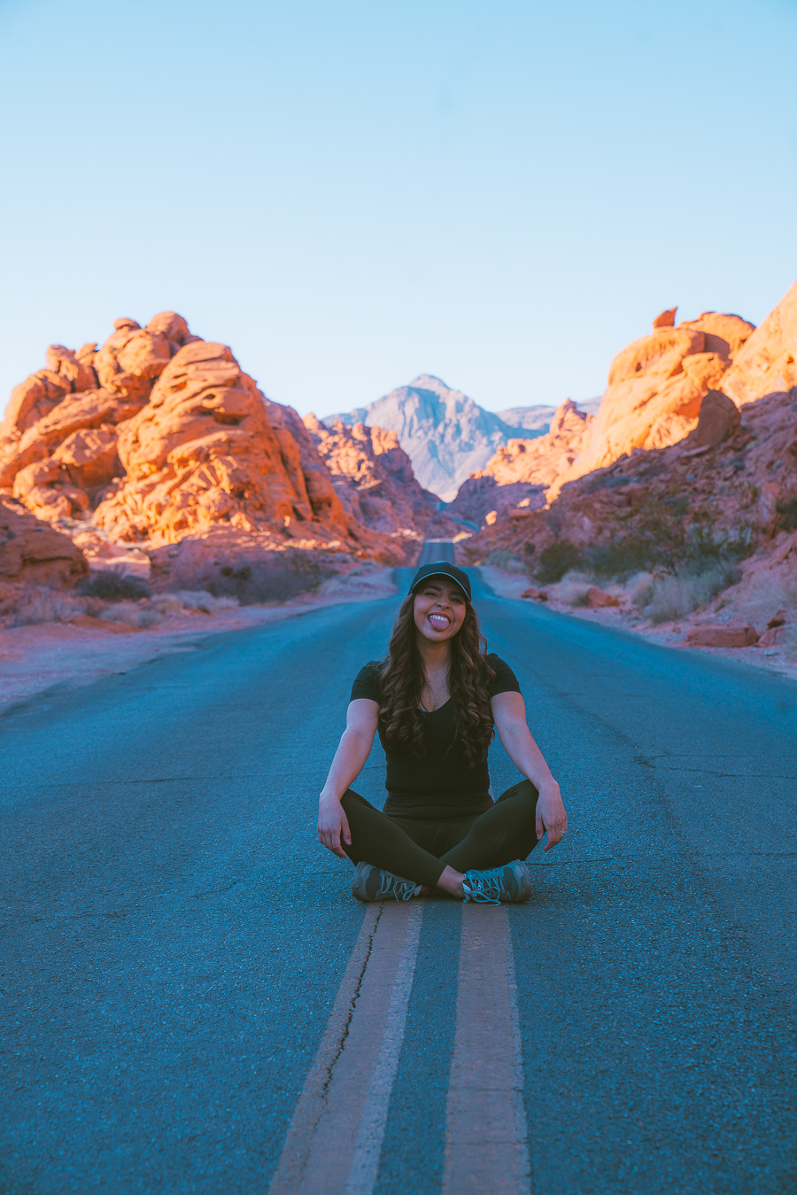
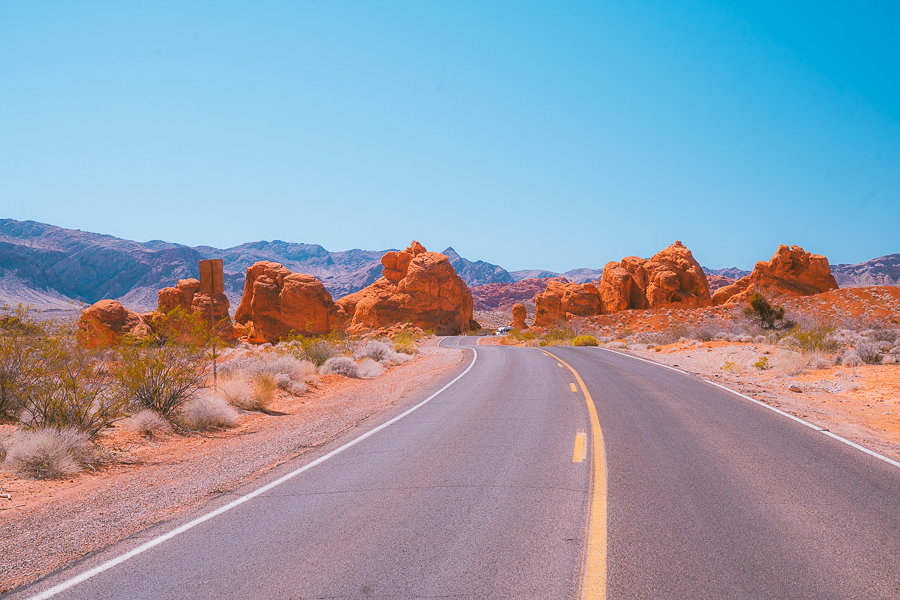
Take The Instagram Famous Photo
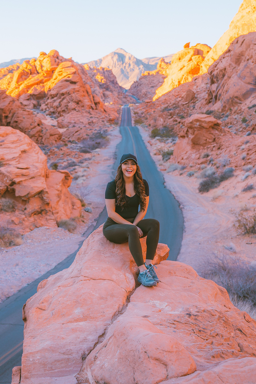
The number one spot I wanted to see in Valley of Fire State Park was this Instagram-famous viewpoint of the long winding road. After talking to my friend, she told me it was best to plug in the exact location before heading out to the park.
The coordinates are: 36.448747, -114.515689, and is located on Mouse’s Tank Road. It is also shown on the Google Map above.
The best time to do this activity is at sunrise. There are next to no cars driving the road, not many people are there, and the lighting looks spectacular.
I had always wondered how people could take photos on the road, but after experiencing it for myself, I realized that not many people get up early enough. So we had this pretty much to ourselves on a Saturday morning.
The parking for this area is pretty small, and it is easy to miss, so it is best to put in the coordinates on your way to the park. If you got to Rainbow trailhead, you have gone too far. The rock is in between Mouse Tank Trailhead and Rainbow Trailhead.
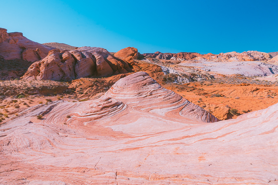
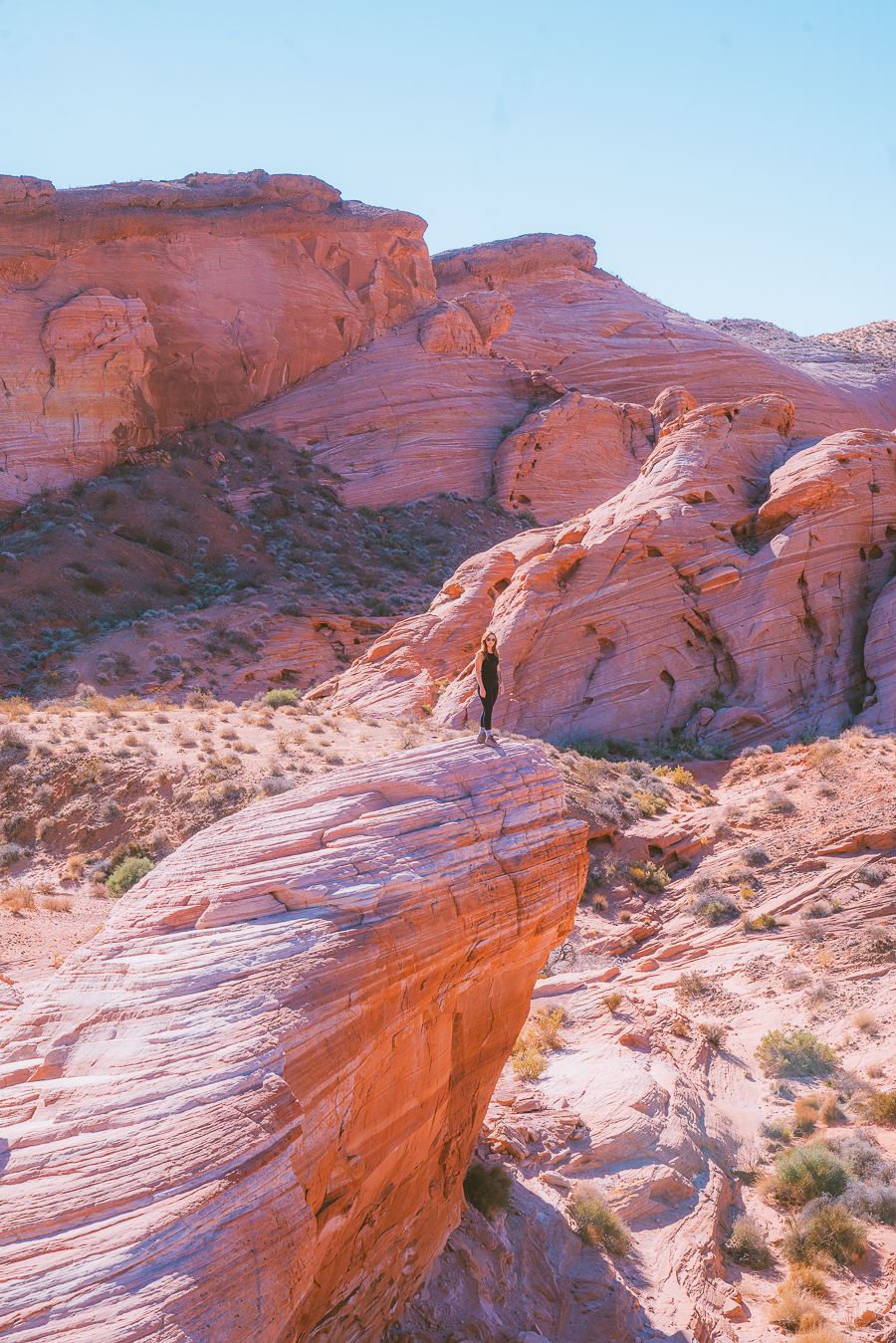
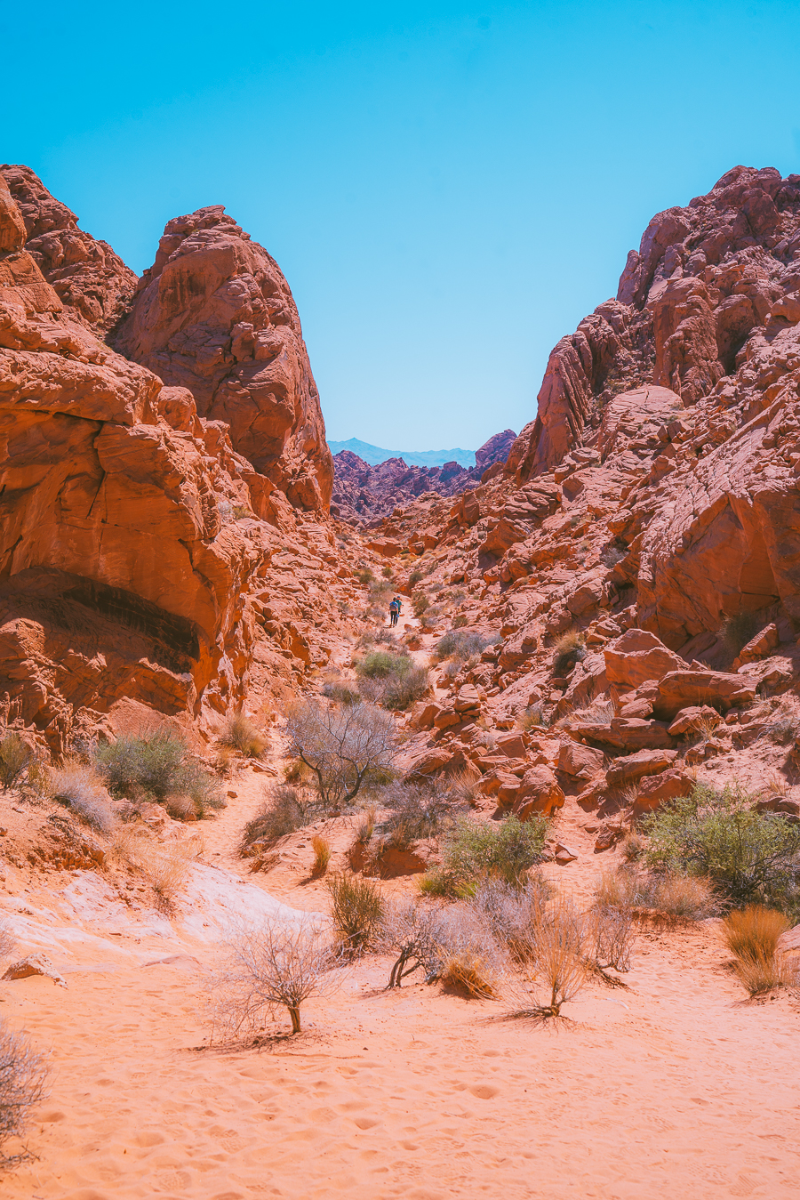
Fire Wave Trail
- Distance: 1.3 miles, roundtrip
- Elevation Gain: 236 ft.
- Route Type: Out and Back
- Difficulty: Easy
- Trail Guide: Link
The Fire Wave Trail is not mentioned in the official Valley Of Fire map, but we still wanted to do it. I have seen countless photos of this spot and was excited to finally witness it. It did not disappoint!
The trail is relatively easy, but there are no shady spots, so bring plenty of water. It can get hot! It was early morning, and we were starting to feel the heat.
Eventually, the trail leads you on a colorful red, orange, and pink slab. It is so colorful and breathtaking! The best photo spot is on top of the wave and is shown below.
Pink Canyon
If you want to keep on hiking the Wave Trail, you will eventually run into the Pink (Pastel) Canyon. Unfortunately, since we didn’t have enough water and we were hot, so we turned around. But I have heard that is a fantastic spot to take photos of pinky-colored rock formations.
Grab Your Free Car Camping Checklist! 🚗🌲
Ready to elevate your car camping game? Snag our essential checklist to ensure you’ve got everything you need for a stress-free, fun-filled adventure! Perfect for beginners and seasoned campers alike. Download now and hit the road prepared! 🌟🎒
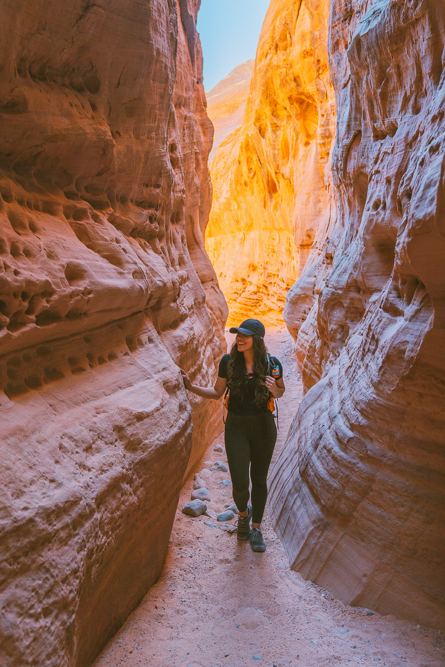
White Domes Trail
- Distance: 1.1 miles, roundtrip
- Elevation Gain: 177 ft.
- Route Type: Loop
- Difficulty: Easy
- Trail Guide: Link
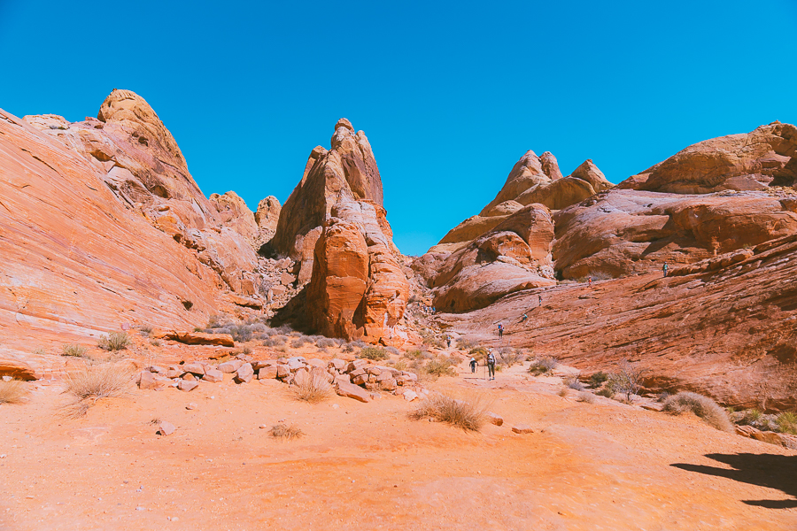
This is such a fantastic beautiful trail. I really enjoyed it. It is easy, beautiful, and colorful. My favorite part was the slot canyon, as shown below. The slot canyon was fairly short but a lot of fun. If you are looking at the map, you will notice it is a loop, and I think going clockwise is the best.
The trail will take you steadily uphill if you go clockwise, making it easier on hot sunny days. This was one of my favorite trails in the park. I highly recommend it.
Rainbow Vista
Distance: 1.0 miles, roundtrip
Elevation Gain: 95 ft.
Route Type: Out and Back
Difficulty: Easy
Trail Guide: Link
Rainbow Vista is a fantastic trail for the whole family. It features bright red boulders and rocks surrounding you throughout the trail. It is a spectacular trail with stunning views throughout. In the end, there is a viewpoint of even more red boulders.
I will warn you that the trail is pretty sandy, so you will probably have sand in your shoes after the hike. We ended up taking off our shoes and walking bare feet. Luckily the sand was not hot.
Mouse Tank
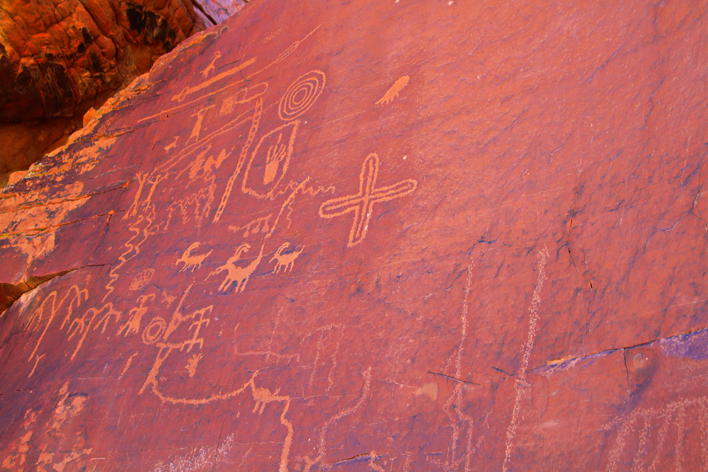
Mouse Tank is probably the least exciting hike on this list, so you can skip this if you are low on time. It is pretty short and easy, though. This hike features petroglyphs and natural tanks that fill with water during certain seasons. Please do not touch or alter the beautiful ancient art.
Seven Sisters
Seven Sisters is a great spot for lunch. There are many picnic tables, and we even saw a couple getting hitched in this area! There is plenty of shade, and the seven big boulders look spectacular.
Elephant Rock
Distance: 0.3 miles, roundtrip
Elevation Gain: 52 ft.
Route Type: Out and Back
Difficulty: Easy
Trail Guide: Link
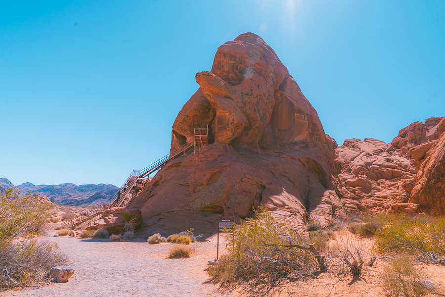
The Elephant Rock is located near the Eastern entrance and is a short walk away from the parking lot. The rock formation resembles an elephant. I loved coming to this side of the park because there is a cool spot to take a photo with friends and family (seen below).
Atlatl Rock
Atlatl Rock is a great place to spot ancient petroglyphs. The stairs take you up for a better vantage point, as shown in the picture. This is a quick stop near the western entrance.
Arch Rock
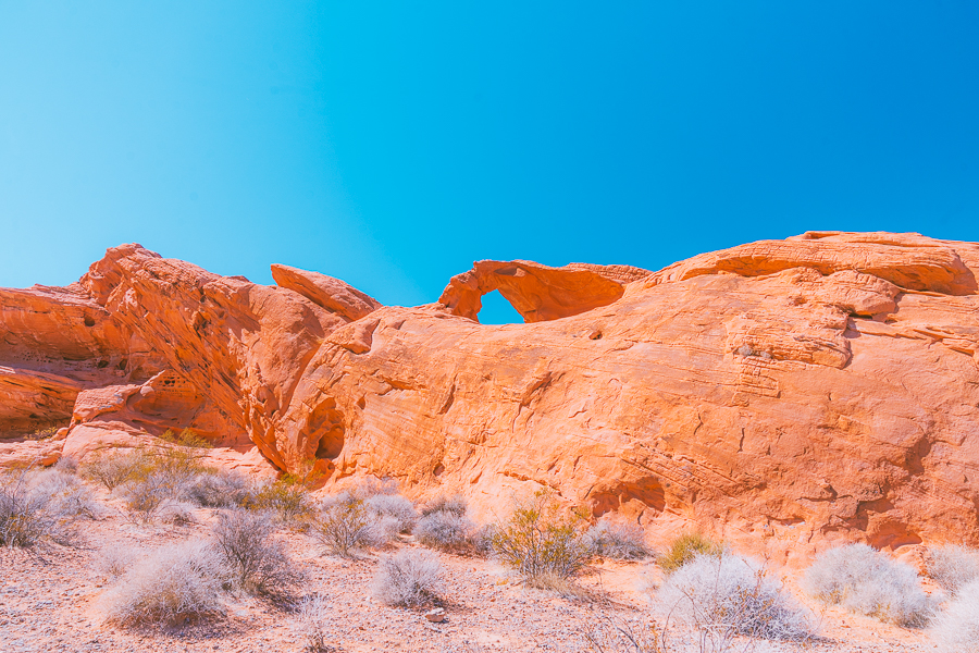
Arch Rock is a quick pit stop right after Atlatl rock. You don’t need much time here as the arch is next to the road. This was probably my least favorite part of the park. The arch was pretty small and hard to photograph.
Beehives
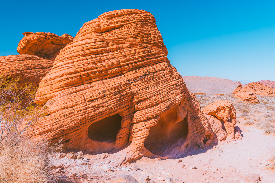
I liked the Beehive area. It is filled with wild formations that look similar to beehives. Many people were climbing around the numerous shapes. This seemed like a fun place for the whole family. There are no hikes, but I still enjoyed this area. It seemed like a fun playground.
Las Vegas To Valley Of Fire Itinerary
Like I said above, you only need a day to see most of the park, but if you want to avoid driving around everywhere, I have listed the perfect itinerary for the day below:
Things You Must Not Miss In The Las Vegas To Valley Of Fire
Not everyone has the time or energy to complete the above itinerary, so I list some of my favorite spots that you cannot miss.
- The Instagram Famous Spot
- The Fire Wave Trail
- The White Domes Trail
- The Rainbow Vista
- Beehives
Final Thoughts On Las Vegas To Valley Of Fire State Park
Planning for this Las Vegas To Valley Of Fire trip was extremely easy. It was probably one of the easiest outdoor trips I have ever planned. This park is so close to Las Vegas, the views are extraordinary, and the hikes are easy. If you are looking for a park for the whole family or a solo hiking trip, this is the perfect park for you.
Make sure to check out some of my other great outdoorsy posts in the Southwest.
- 21 Of The Best Grand Canyon Views
- The Ultimate Arizona Road Trip Itinerary
- The 13 Best Hikes In Sedona Arizona
- The 6 Best Hikes In Red Rock Canyon Las Vegas
- 16 Amazing Weekend Trips From Las Vegas

new on the shop
The Ultimate Camping Trip Planner!
Our camping trip planner helps you stay organized and plan all aspects of your adventure so that you can conquer new territories with ease.

Thanks for this awesome itinerary! We’ll be visiting VoF for the first time – great seeing all your tips and pictures so we know which stops we’d love to make. Cheers!