
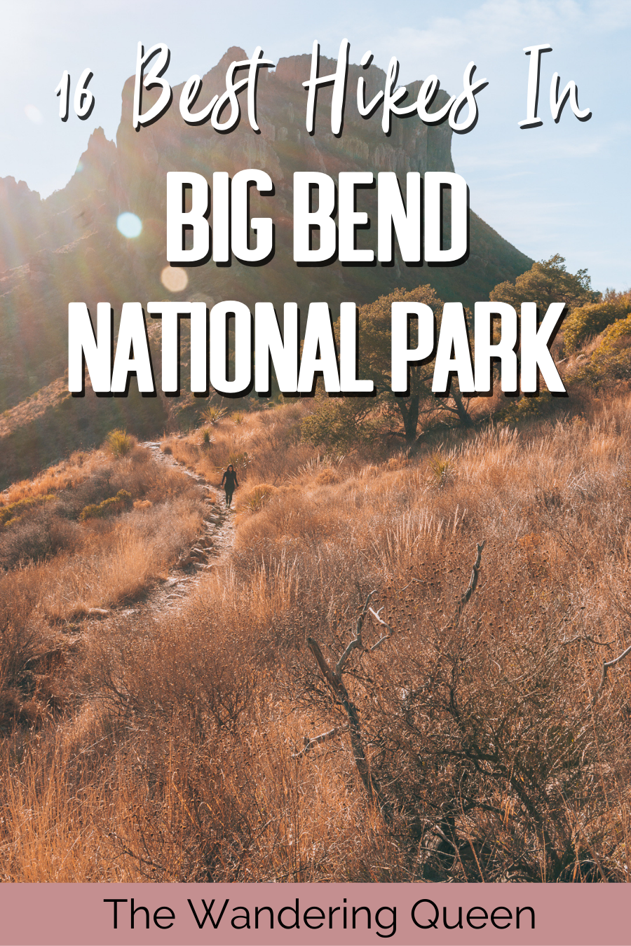
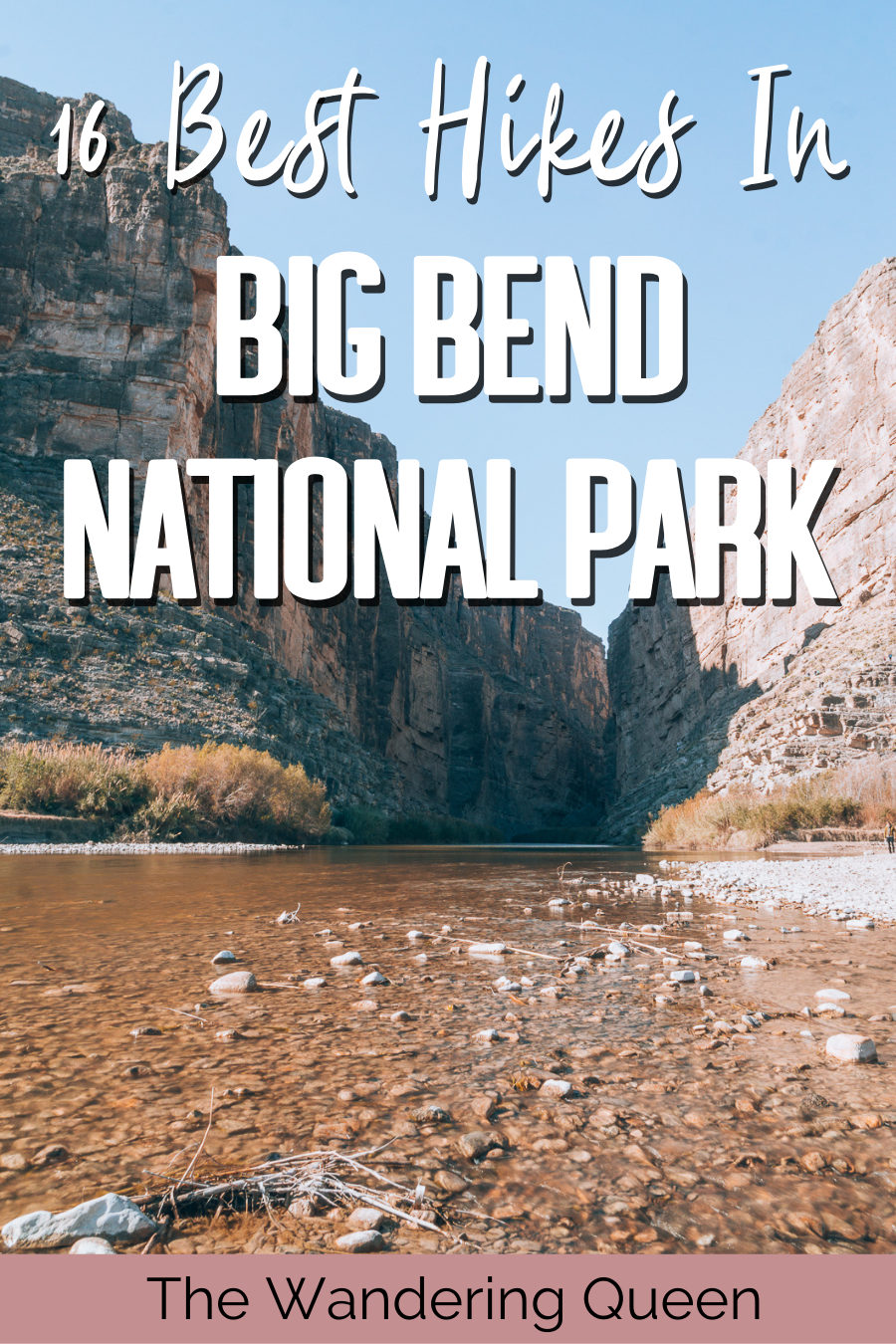
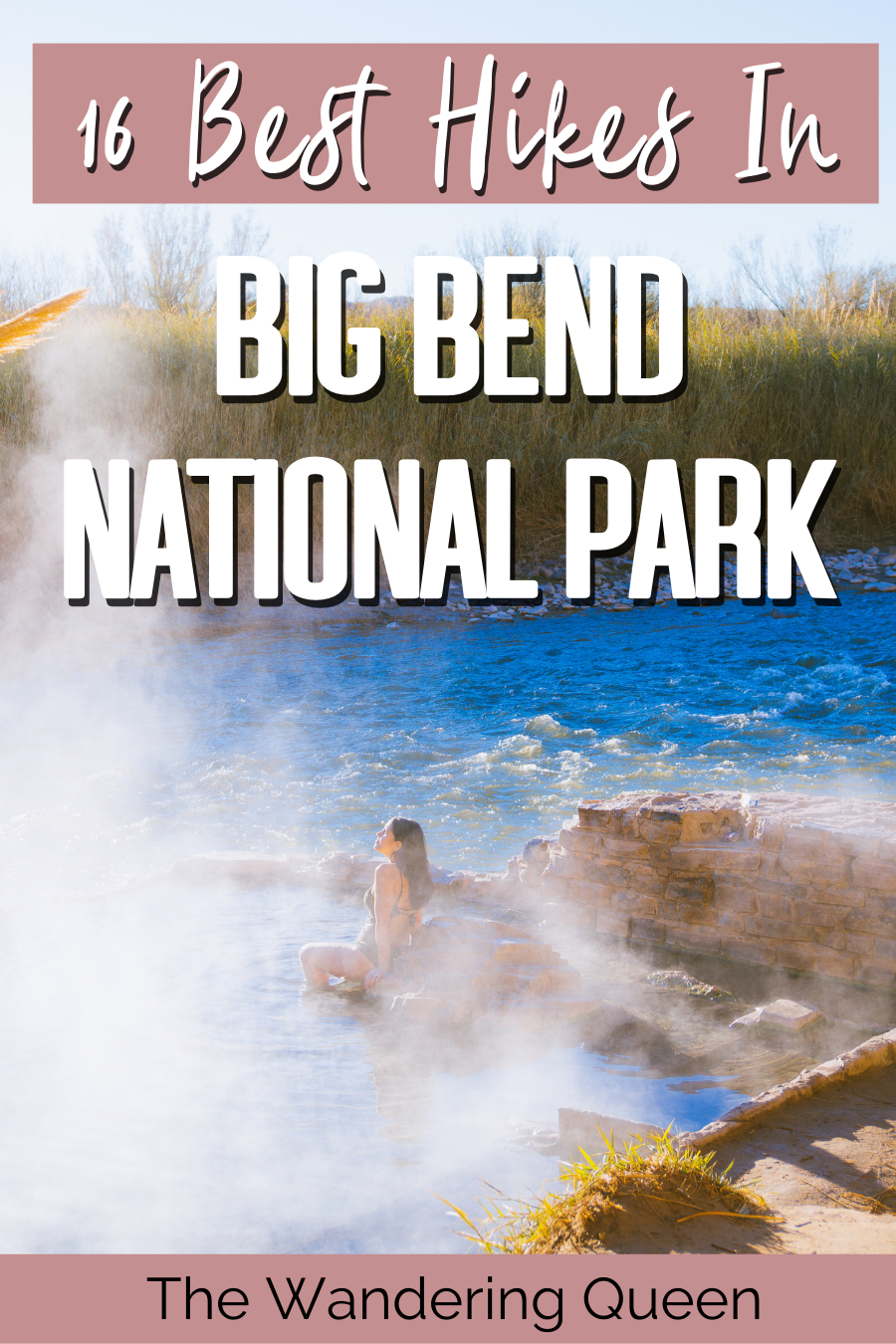
The 16 Best Hikes In Big Bend National Park
For the past three years, I have been making a considerable effort to visit the United States National Parks. My end goal is to see all 63 of them. But a few months back, I realized I hadn’t been to the most popular National Park in my own state of Texas; Big Bend National Park. So, we decided to take a long four-day weekend in January to visit the park. Hiking the best hikes in Big Bend National Park was some of my best experiences in Texas. No joke! There was so much to see and do at this park, and I was surprised at the endless amount of Big Bend hiking trails.
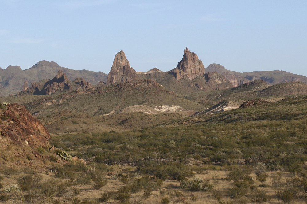
Big Bend National Park is made up of three main areas. The first and most popular area is called The Chisos Basin. It is filled with stunning, grand mountains of all shapes and sizes. Just driving around this area leaves you in wonderment. Another place called The Rio Grande Village is mainly known for its hot springs and the Boquillas Canyon. If you get up early enough, you can spot the steam from the hot springs along the Rio Grande River. The last area called The Castolon includes the famous Santa Elena Canyon, one of the main staples of the park. Jameson and I hiked through all three main areas within a few days. So keep on reading on for the ultimate Big Bend National Park Hiking Guide.
Disclosure: This post contains affiliate links. If you click one of them, I may receive a small commission (for which I am very grateful for) at no extra cost to you.
Download my free Outdoor Photography Guide
Hiking In Big Bend National Park Map
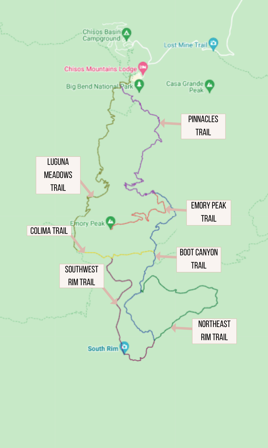
Below is a Big Bend National Park hiking map highlighting all the trailheads, campgrounds, and the Big Bend National Park visitor center discussed in this article. I advise saving the map of the Big Bend area to make sure you can view it offline. To find out how to save google maps on your phone, click here. There is almost next to no service at Big Bend.
For the official Big Bend, trail map click here. You can also pick up a Big Bend Hiking Trail Map at the Visitors Center, or you can buy one on Amazon here.
Where Is Big Bend National Park Located
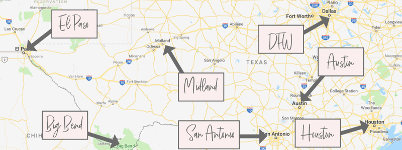
Big Bend National Park is located in Texas next to the Mexico Border. The closest airport to Big Bend National Park is located in Midland, TX. Getting to Big Bend National Park can be accomplished by driving from the following airports:
- El Paso to Big Bend National Park: 4 hours and 15 minutes, 287 miles, El Paso International Airport,
- Midland to Big Bend National Park: 3 hours, 197 miles, Midland International Air and Space Port
- Houston to Big Bend National Park: 8 hours and 40 minutes, 577 miles, George Bush Intercontinental Airport,
- San Antonio to Big Bend National Park: 5 hours and 41 minutes, 408 miles, San Antonio International Airport,
- DFW to Big Bend National Park: 7 hours and 29 minutes, 527 miles, Dallas Fort Worth International Airport,
- Austin to Big Bend National Park: 6 hours and 31 minutes, 441 miles, Austin-Bergstrom International Airport.
Big Bend National Park Weather
The best time to go to Big Bend National Park to enjoy hiking is the winter or fall. Summer months bring in the unbearable Texas heat. We went in the winter, and the weather was perfect for hiking with a light jacket. I have listed the Big Bend National Park weather averages below:
- December-February: This season has dry, mild, cool weather during the day. Average temperature highs are 60°F-66°F. But, be wary that the night temperatures can be freezing.
- March-May: This is the best time of year to experience the migrating birds and fewer crowds. The average temperatures in the spring are about 77°F-88°F.
- June-August: The Big Bend National Park temperature soars during this time of year. I do not advise going on a long hike during the summer. The average temperatures are around 100°F.
- September-November: Visting Big Bend National Park in October and November is an excellent time of year. The average temperatures during these months are 86°F-68°F.
Things to Pack for Big Bend Hikes
- Sunscreen: This is needed all year long! >Buy some sunscreen, so you don’t accidentally burn!
- Hiking Boots/Shoes: Hiking shoes or boots are needed for Big Bend. Don’t hurt your feet hiking in regular tennis shoes. >Buy my Hiking Shoes
- Hiking socks: Having the correct socks helps you prevent getting blisters. Smart Wool is probably my favorite brand out there. 🙂 >Buy Hiking Socks
- Refillable water bottle: I always bring a Hydroflask on all my adventures. They are on the heavier side, but I know for a fact they will not break. I have had a few cheap water bottles break on me before. >Check Prices Now
- Water Reservoir: I love this one! >Check It Out Here
- Water: Hiking for sure requires water.
- Sunglasses: I usually wear the most fashionable sunglasses when I hike. 🙂 >Check Out These Sunglasses
- Snacks: The best snacks are jerky, nuts, energy bars for hiking. >Cliff Bars are great for hiking so click HERE.
- Trekking Poles: This is an optional product, but they help with the knees. The poles I have listed are known to be one of the best in the market. I am not going to lie I didn’t use trekking poles in Big Bend, but I don’t have a lot of problem with my knees. Not everyone’s bodies are the same, so if you feel like you need some extra help, then check out my trekking poles. >Buy My Trekking Poles Here
- Camera: I have linked the camera I used to take pictures of Big Bend. The Sony A6000 is an excellent camera for people that want to start improving at travel photography. >Buy Sony Camera Here
- First Aid Kit: This is one of the first things I bought when I first started backpacking and camping. It is super portable. >Buy This Awesome First Aid Kit Here
- Day Pack: The REI bag I have linked, we have had for seven years now, and it is still going strong! >Buy This Great Quality Backpack
- Good hiking pants or shorts: These are probably the best hiking pants that I have found. If you are hiking in the summer bring some shorts. It will get hot! >Buy my hiking pants here
- Breathable sweat-wicking shirts
- Sports Bra: For women.
- Jacket: Only bring in the winter time. >Buy My Favorite Jacket
- Tripod: This is an optional item, but it is excellent for getting the perfect sunset pictures. >Check out this tripod
- Headlamp: Just in case you get stuck hiking at night! >Buy A Headlamp Now
- Big Bend Map: Love the National Geographic Maps! >Buy Here
- National Park Pass: I highly recommend getting a year-long America The Beautiful Pass. >Get It Here

Claim your FREE Hiking Checklist
Ready to start hiking? Grab my free hiking checklist and never forget anything at home!
Big Bend National Park Lodging
- Chisos Mountain Lodge: If camping is not your style, then the Chisos Mountain Lodge is for you. The lodge has many cottages and rooms. We were near this lodge trying to find the trailhead for “The Window” and the area felt lively and energetic. This is the only hotel in the national park. >Check Prices and Availability Now
- Lajitas Golf Resort: Located in Terlingua, Texas, Lajitas is one of the best places to stay near Big Bend National Park. >Check Prices and Availability Now
Read More: Where To Stay In Big Bend National Park | 9 Best Lodging Options
Big Bend National Park Camping
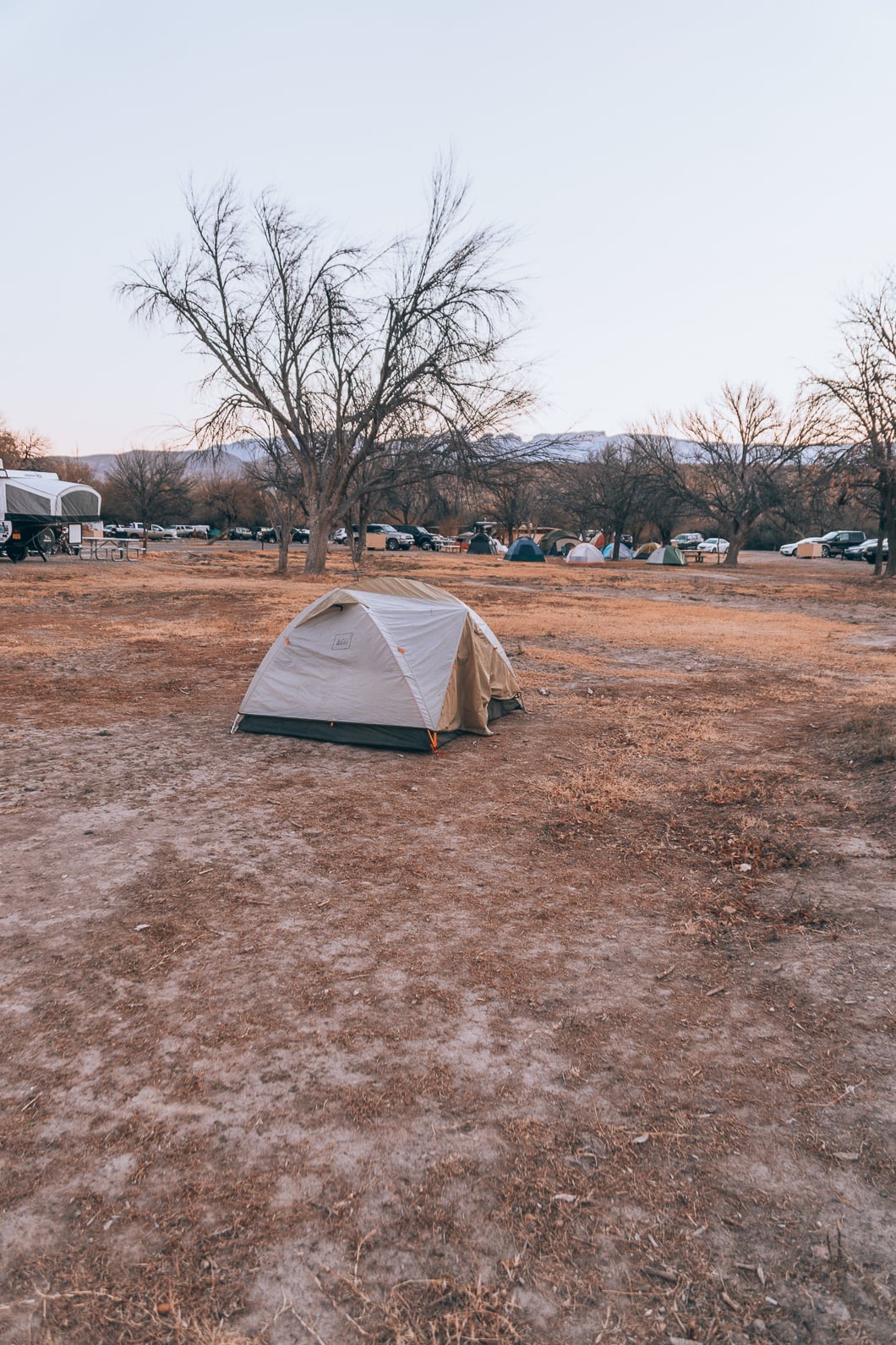
Rio Grande Village Campground
I booked a campsite at Rio Grande Village Campground a few months in advance. As an aside, I highly suggest reserving campsites as early in advance as possible because they ALWAYS fill up more quickly than one anticipates. For example, the Rio Grande Village Campground was the only campsite available at the time of booking, and I booked months in advance.
What I liked most of Rio Grande was how close the campsite was to the Hot Springs. The short drive to the warm hot springs clashed with the cold air, was the perfect start to our mornings.
What I didn’t like about the campsite is that it felt far removed from a large portion of the park. For instance, it was a 30-40 minute drive to the Chisos Basin area where the majority of hikes are located. To get to the other end of the park, it took 60 – 90 minutes to reach notable hiking trails. Be prepared to drive!
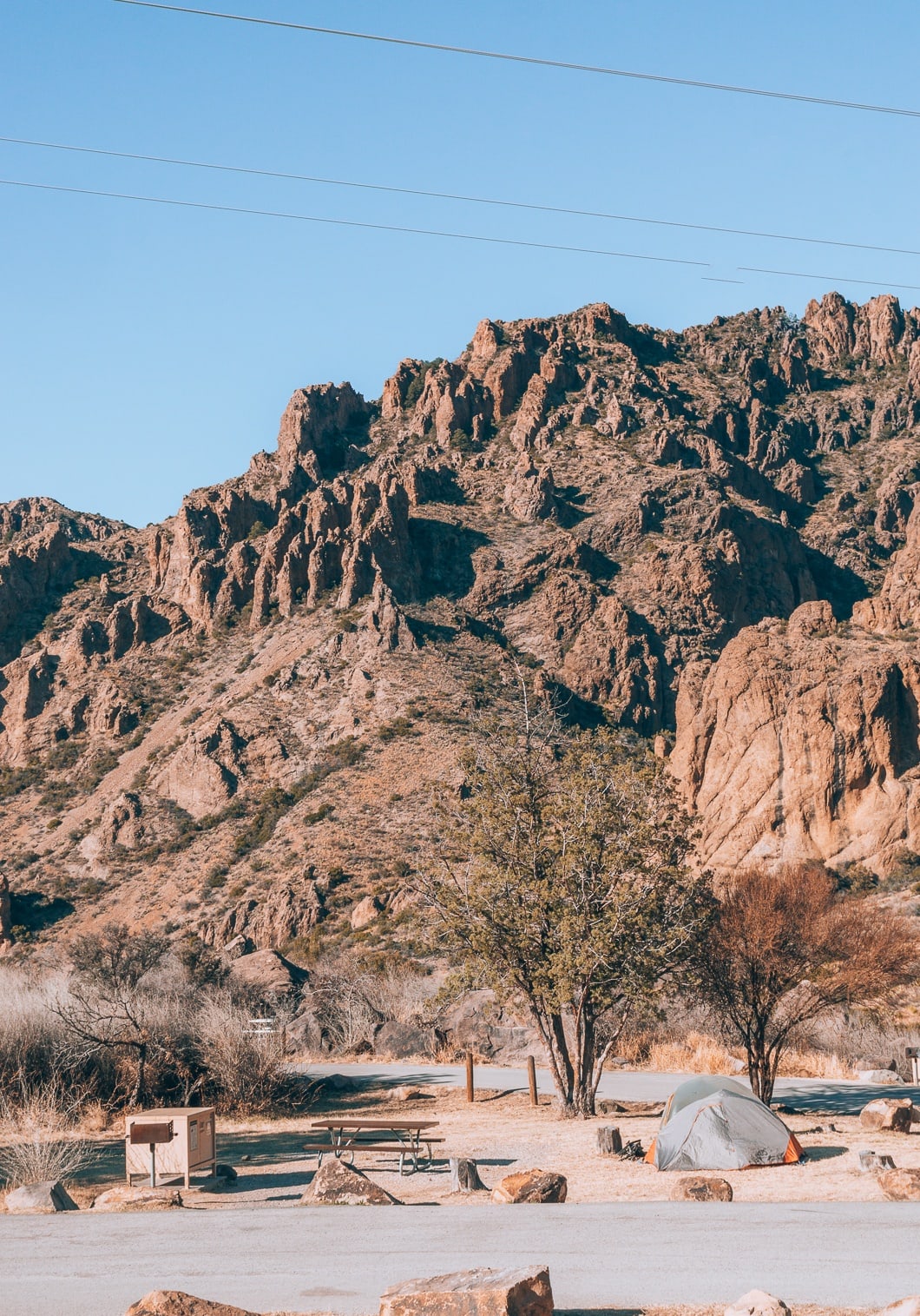
Chisos Basin Campground
Another Big Bend National Park Campground is the Chisos Basin Campground. The campsite has spectacular views, is close to numerous hikes, and is centrally located. If I had to plan the trip again, I would have made earlier reservations to book a spot at the Chisos Basin Campground. The Chisos Basin Visitor Center is located near the campground.
Cottonwood Campground
Cottonwood campground has 24 camping sites and is located near Santa Elena. You can reserve group campsites online, and individual campgrounds are first-come, first-serve year-round. Click here for more information on this campground.
Big Bend National Park RV Camping
RV camping in Big Bend National Park can be done in all three campsites I have listed above. There are some restrictions on two of the campsites:
- Rio Grande Village Campground: No restrictions, 100 sites.
- Cottonwood Campground: No generators allowed, 24 sites.
- Chisos Basin Campground: RVs over 24 feet or trailers over 20 feet are not recommended.
For more information on Big Bend RV camping click here.
Big Bend National Park Facts
- The Rio Grande runs through Big Bend National Park. In the Rio Grande Village area, you can see Mexico on the other side of the river.
- There are more species of birds found in Big Bend National Park than in any other national park in the U.S.A.
- Big Bend National Park animals include javelinas, Mexican black bears, gray foxes, cougars, coyotes, and roadrunners.
- Because of the remoteness, Big Bend is considered one of the best places to stargaze.
- There are over 60 different species of cacti.
- Big Bend is one of the least visited national parks. Around 300,000 people visit a year.
- The Big Bend National Park hours are located here.
- Big Bend National Park entrance fee: $30 for a vehicle, $25 for a motorcycle, $15 for individuals. Or you can use a national park pass here.
- The Big Bend National Park elevation ranges from 1,800 feet to 7,832 feet.
Best Hikes In Big Bend National Park
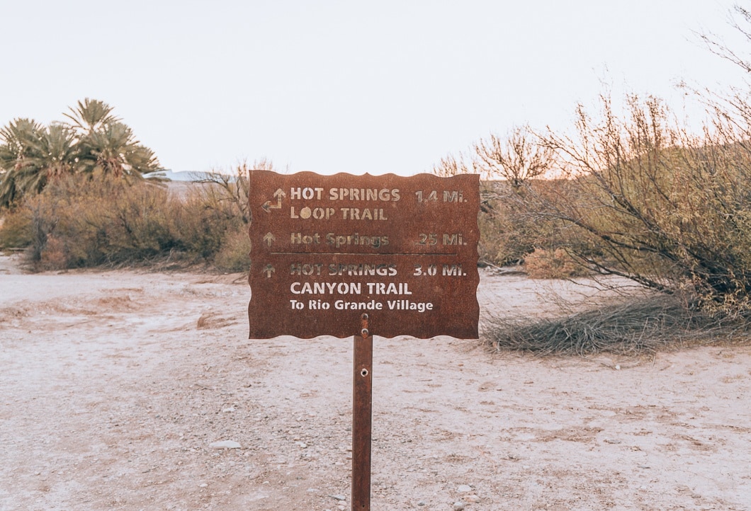
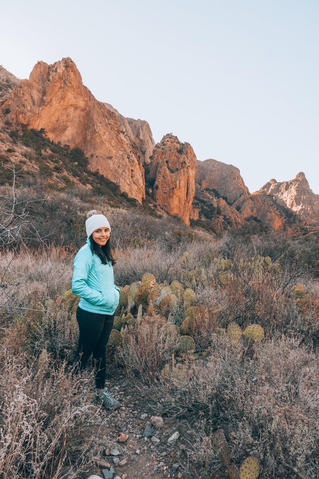
Hot Springs Trail
- Distance: 1.2 Miles Roundtrip
- Difficulty: Easy
- Elevation Gain: 144 ft
- Trail Guide: Link
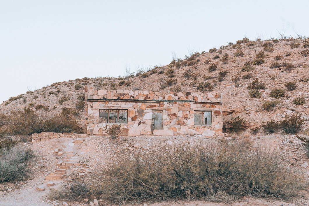
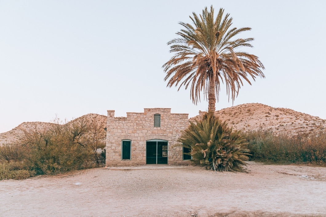
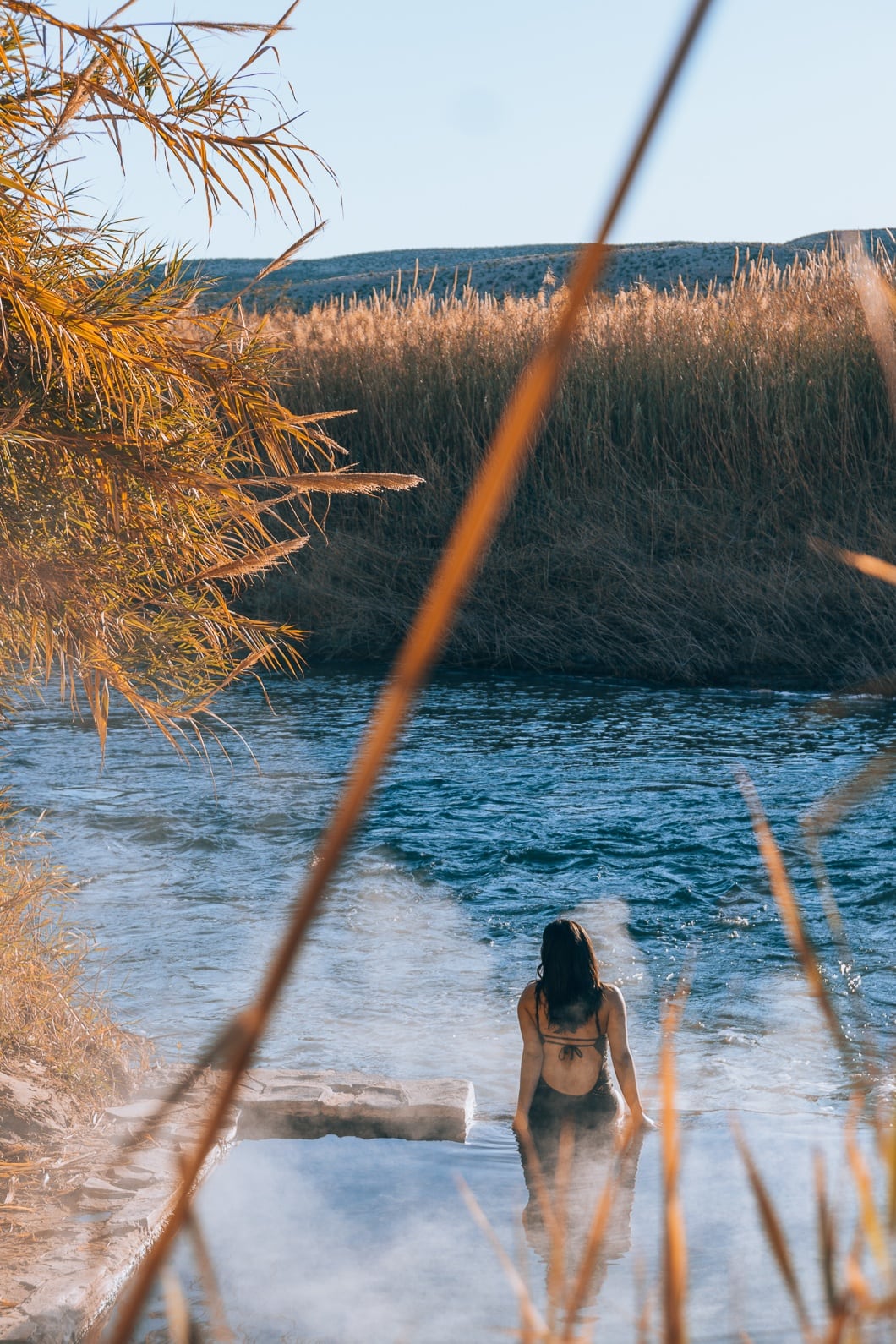
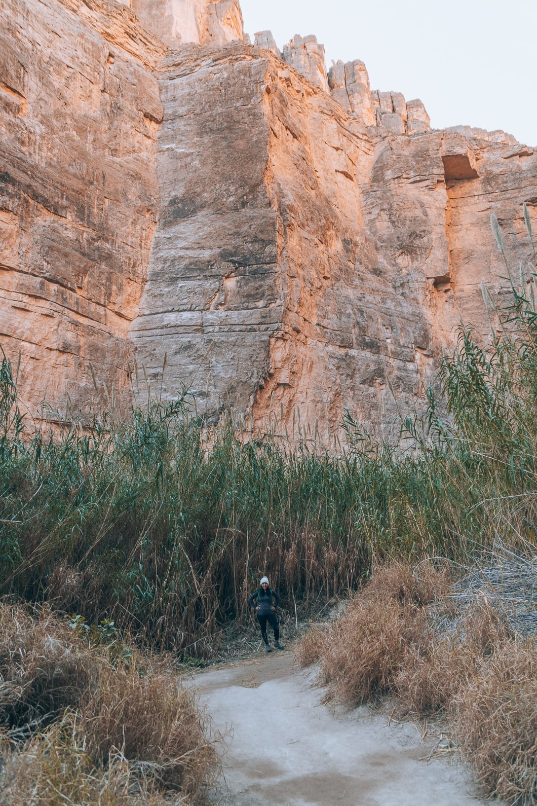
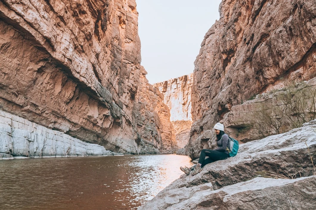
Hot Springs Trail is one of the best trails in Big Bend National Park. I had heard so much about the hot springs before we made our way to Big Bend. People say they are soothing and even have healing powers. The hot springs intrigued me because I had never been to a natural hot spring before. When we researched, we determined it would be best to visit early morning as the sun rises. The cold air mixed with the hot water was the best way to spend the first hour of the morning.
When the day came, the cold, brisk early morning conditions made it extremely difficult to get up; but, we were determined to experience the hot springs at the best time possible. We got up, packed our bathing suits, and drove to the start of the hot springs trail. We saw the charming stone buildings and palm trees at the beginning of the path. The palm trees are not native to the area, but they give a calming, soothing vibe.
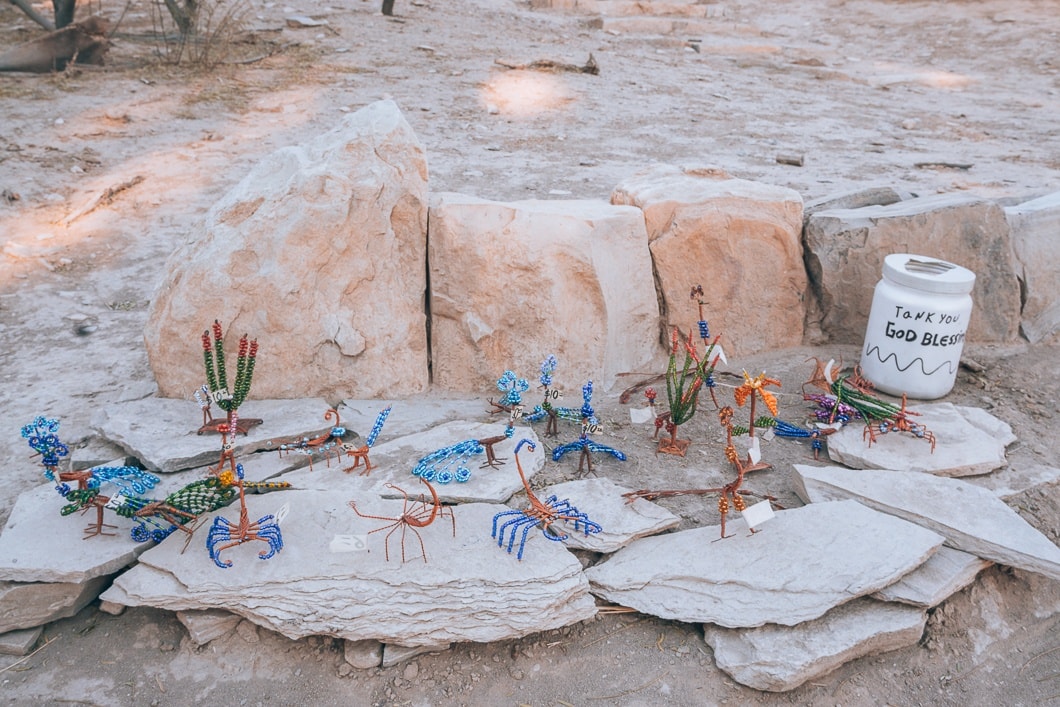
Next to the stone buildings were some cute copper miniature statues made by locals. We also saw the figurines on the Boquillas Canyon hike, and they are very colorful and beautifully made.
To get to the Hot Springs, the hike is only a short 0.5-mile hike round trip. There is a tall, jagged, rough canyon on one side of the hike and tall, wispy plants on the other side, hiding the infamous Rio Grande. Throughout the hike, you can hear the soothing sound of the rushing river flow. The running water sound was a nice prelude for the relaxing hot springs.
When we arrived, we quickly changed into our bathing suits. The moment we stepped into the hot springs, the warmness enveloped our whole body and took all our worries away—the hot water contrasting the 30-degree air made for a very relaxing morning.
Eventually, my body became too hot, and I would dip my feet in the chilly Rio Grande to help.
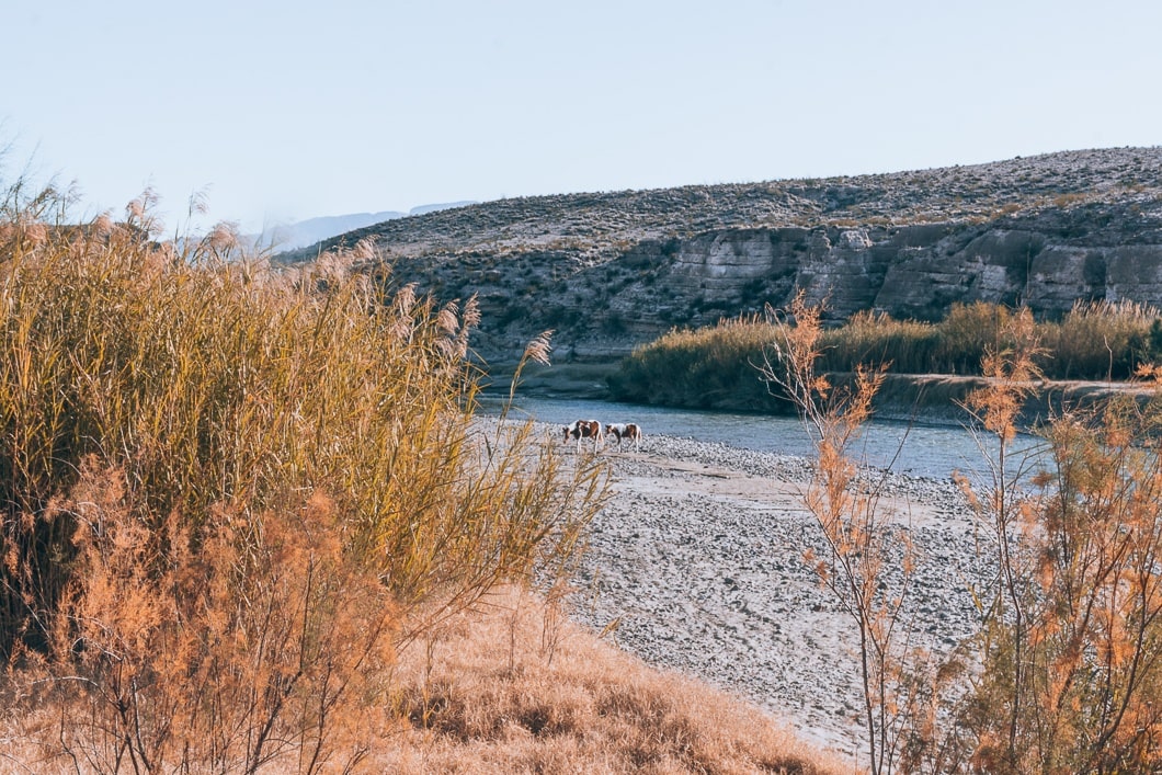
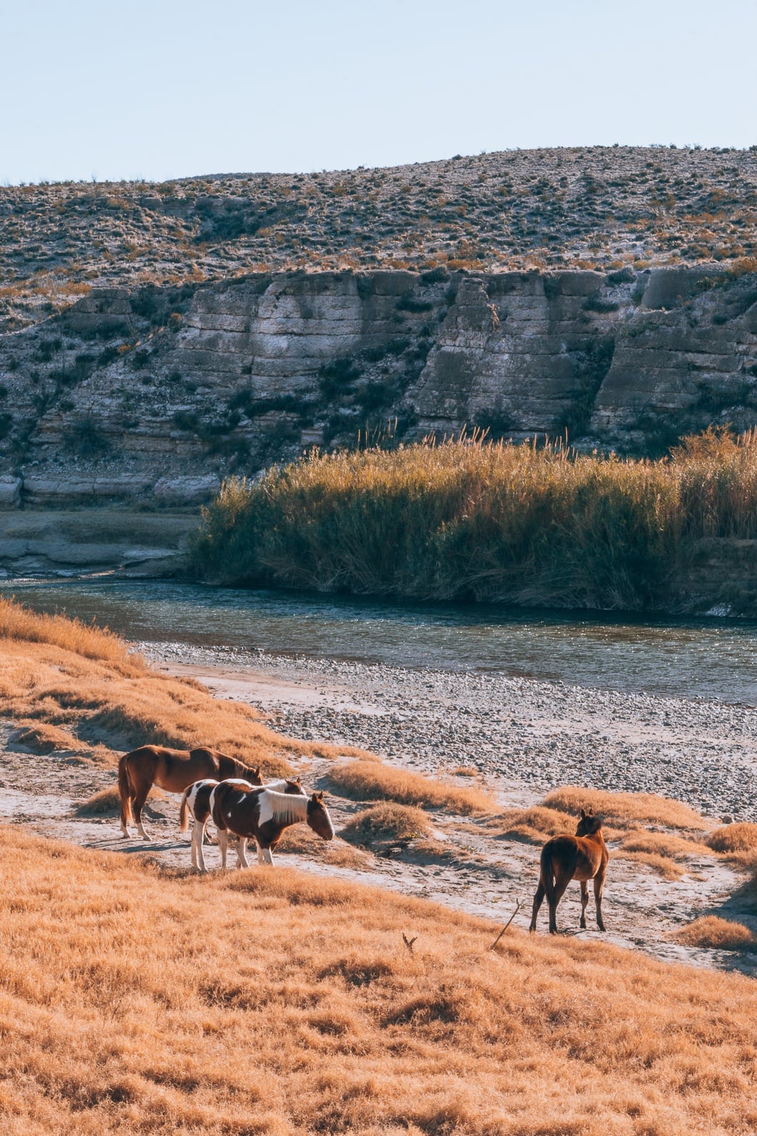
The following day, we decided to come back to the hot springs because we loved soaking in the early morning so much. While soaking in the natural tub, we saw wild horses drinking on the bank of Rio Grande, and Jameson slowly snuck up close enough to get some great pictures.
Due to Jameson thinking he lost his wedding ring in the Springs (don’t worry, we found it later in the tent bag), we had to go back a third time in the afternoon around 12 pm. I would not recommend going at this time. Even in January, the spring was sweltering hot due to the sun’s radiance, and it was extremely crowded. I am pretty sure we wouldn’t have enjoyed the great hot springs nearly as much as in the early morning.
Read More: 11 Best Things To Do in Big Bend National Park, Texas
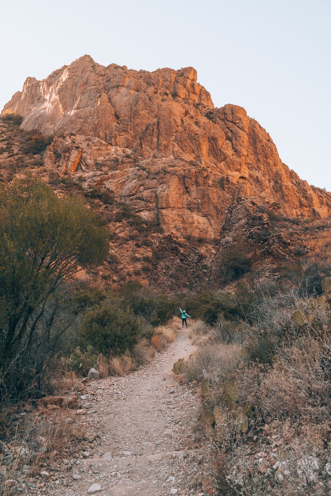
Boot Canyon Trail
- Distance: 3.5 miles from the Chisos Basin Trailhead, then continues 2.8 miles to the South Rim
- Difficulty: Hard
- Trail Guide: Click Here
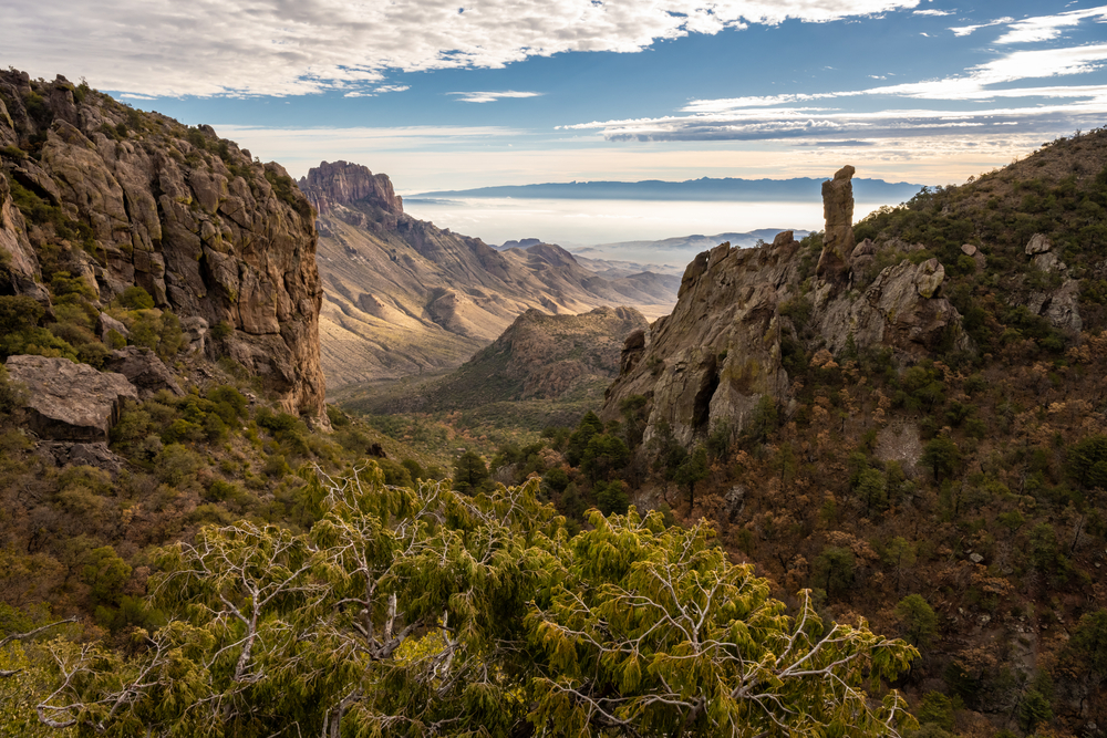
Boot Canyon is a trail in the Chisos Basin area with spectacular views. It is challenging, especially if you add in Emory Peak. To get to Boot Canyon hike on the Pinnacles Trail, you can continue to Southwest Rim Point if you want to make it even more difficult. I talk about SW Rim Trail below. I also have a map of the whole area above that is color-coded.
Grab Your Free Car Camping Checklist! 🚗🌲
Ready to elevate your car camping game? Snag our essential checklist to ensure you’ve got everything you need for a stress-free, fun-filled adventure! Perfect for beginners and seasoned campers alike. Download now and hit the road prepared! 🌟🎒
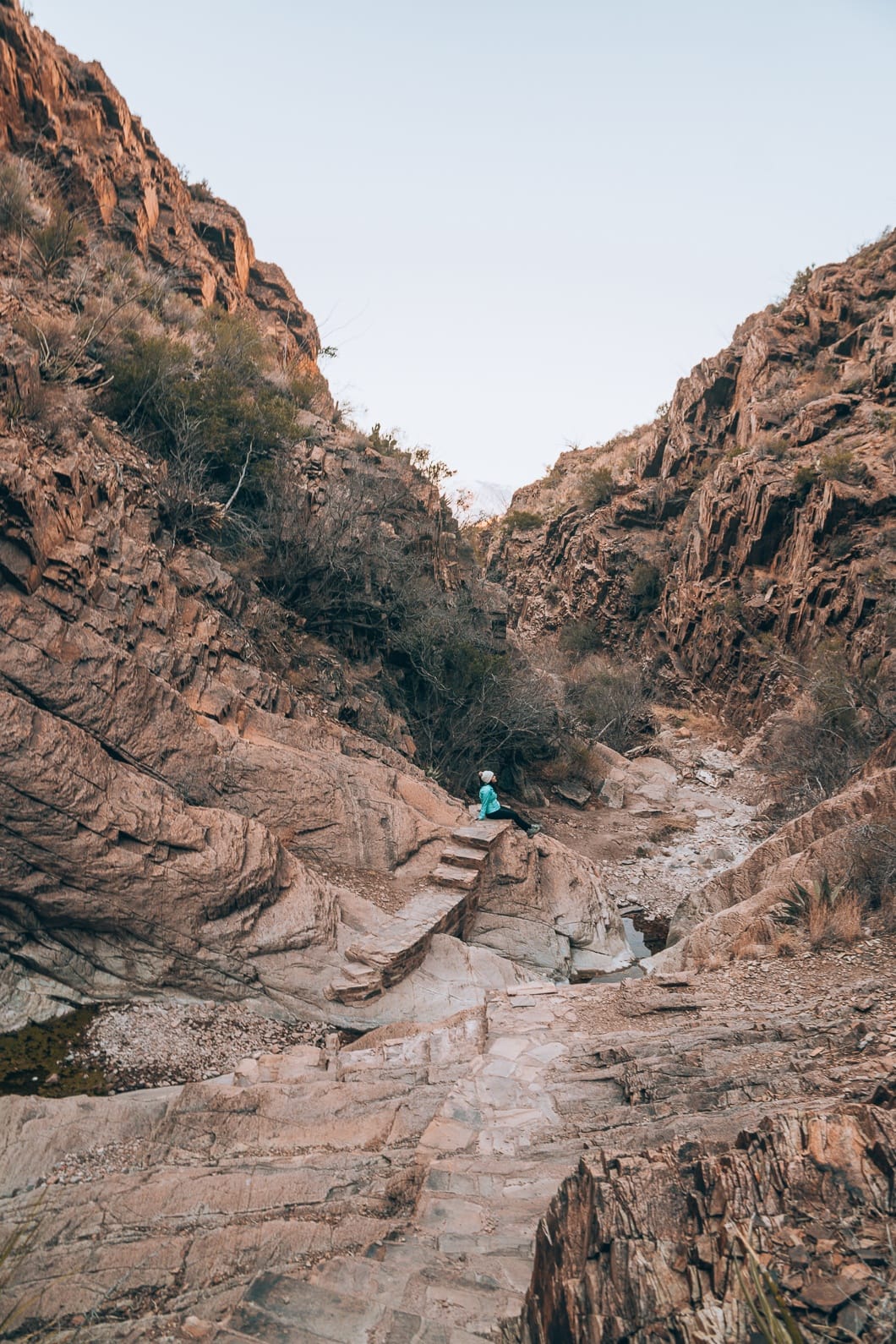
Ernst Tinaja
- Distance: 1.9 Miles Roundtrip
- Difficulty: Easy
- Elevation Gain: 131 ft
- Trail Guide: Link
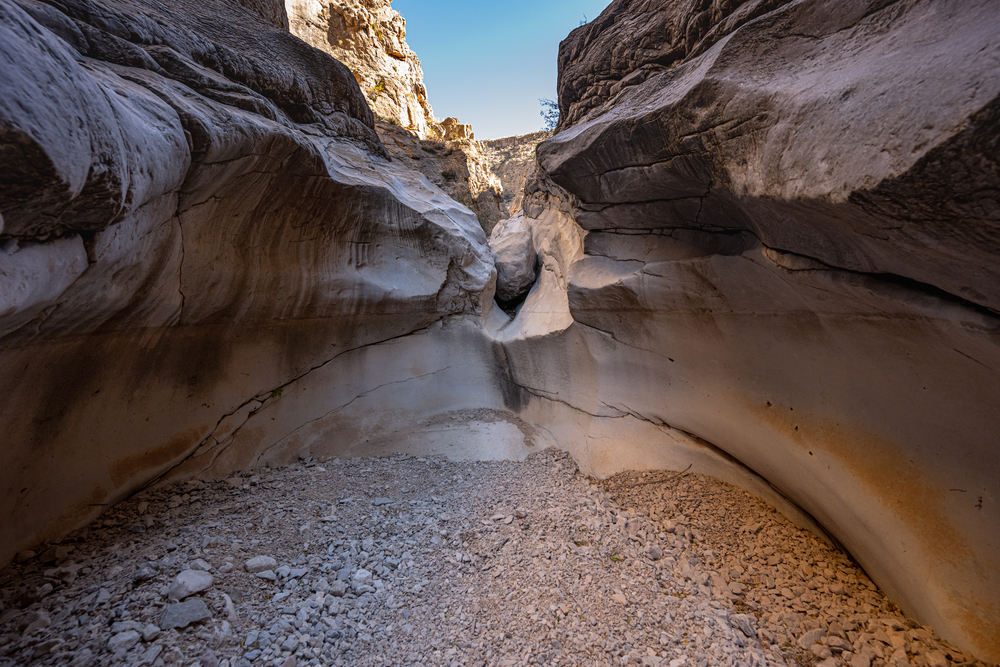
The Ernst Tinaja is located near the Rio Grande Village, and it is a pretty adventurous trail. First, the road to get there is pretty treacherous. You have to have a high clearance car to get to the trailhead because it is super bumpy, and there can be water on the road. Some people love the road; some people hate it. It all depends if you have a good 4WD and high clearance car and if you are into roughing it.
The trail is pretty short and easy, but you can make it a bit more challenging by going even further and scrambling over the rocks. Ernst Tinaja is made of beautiful limestone and has a watering hole in the middle, and it is breathtaking. Be careful when walking around as it can get pretty slippery.
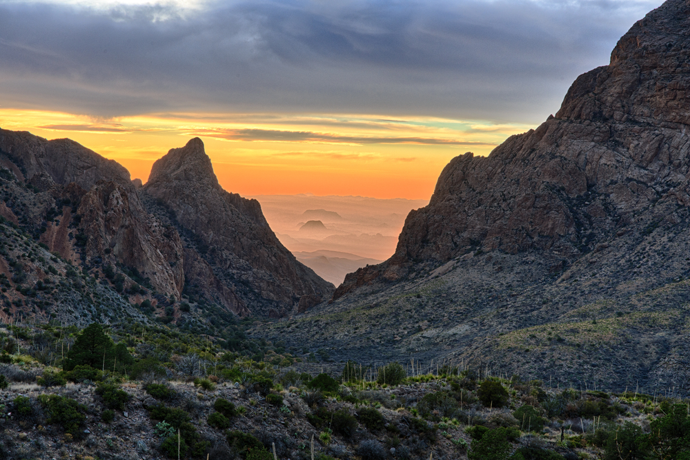
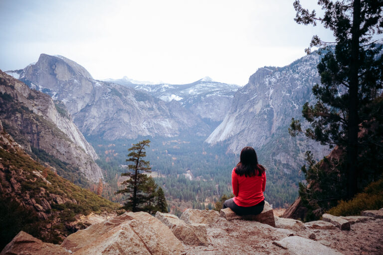
The Lost Mine Trail
- Distance: 4.8 Miles Roundtrip
- Difficulty: Moderate
- Elevation Gain: 1,131 ft
- Trail Guide: Link
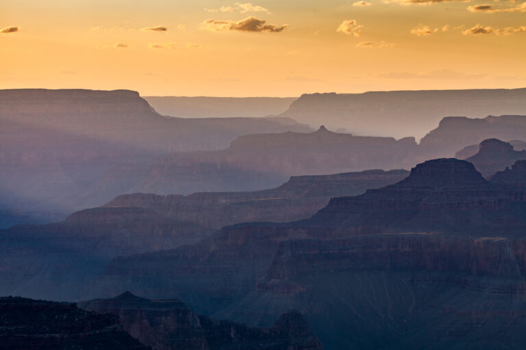
The Lost Mine Trail is a challenging trail. We started hiking in the late afternoon to experience the golden sunset. This was one of my favorite Big Bend National Park trails.
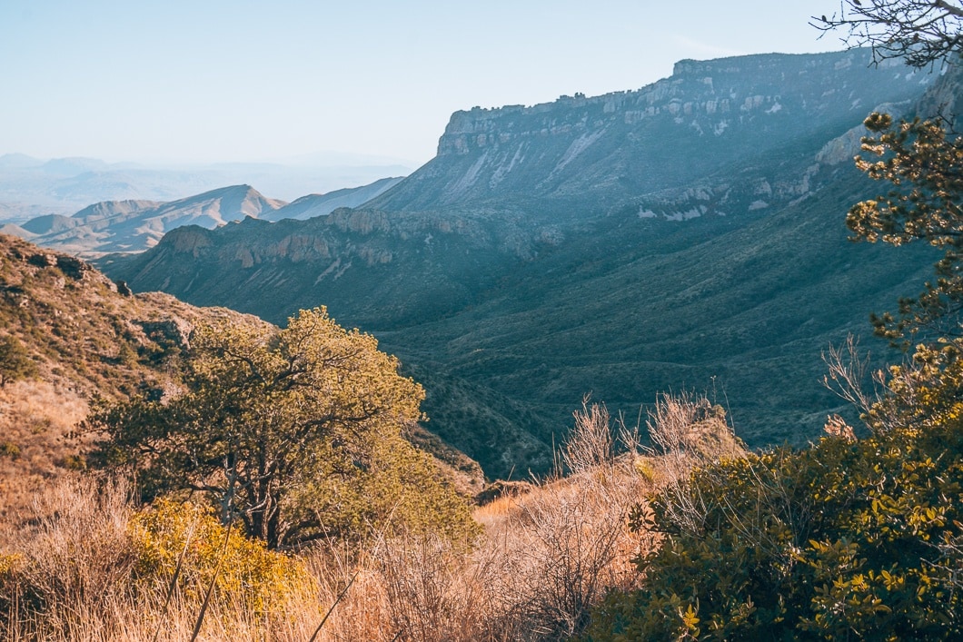
I loved how most of our pictures turned out—a beautiful golden hue against the grand mountains. Below we got one of my favorite photos of the weekend.
The last quarter of the trail became difficult due to ascending switchbacks. But, once at the top, there were many remarkable views of all the surrounding mountains. The views are stunning, but I feel the mountain’s beauties are hidden in the shade. Even with all the beautiful pictures, I believe the hike would be best in the morning to illuminate the entire valley area.
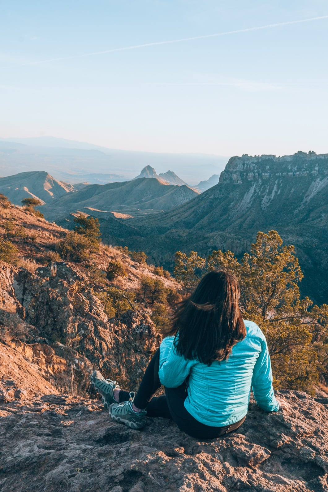
In the end, I loved this trail, and I feel like it is one of the best Big Bend hikes. The hike is a bit difficult towards the end but still doable. If I had a chance to do the trail again, I would do it in the early morning to see if the mountains capture the warm, amber light of the sunrise, bringing out its full beauty.
Lower Burro Mesa
- Distance: 1.0 Mile Round trip
- Difficulty: Easy
- Elevation Gain: 144 ft
- Trail Guide: Link
The Lower Burro Mesa is a great easy family hike that features outstanding rock formations. Towards the end of the trail, a pour-off rock formation looks magnificent, but it is usually dried up.
Chisos Basin Loop Trail
- Distance: 2.4 Miles Roundtrip
- Difficulty: Easy
- Elevation Gain: 465 ft
The Chisos Basin Loop Trail is great for people that want to experience a part of the Pinnacles trail but don’t think they can make it to Emory Peak, which is 10 miles round trip. This is a great easy hike for the whole family with fantastic views of the Chisos Basin.
Window Trail
- Distance: 5.5 Miles Roundtrip
- Difficulty: Moderate
- Elevation Gain: 961 ft
- Trail Guide: Link
The Window View Trail is one of the longer trails, but it is straightforward due to its relatively flat surface. Since the hike takes you through the middle of the Chisos Basin Mountains, you get to see many fascinating rock formations.
Throughout the hike, I was astounded to see such unique rock formations. Every few minutes I wanted to stop to take pictures because everything was just so impressive!
In the end, I was surprised to see the highlight of this trail was indeed a window! The window tunnels into a vast canyon jutting out, and at the time, it was illuminated by the sun. After taking pictures with Jameson, we ate some snacks and enjoyed the views. I will note that I was a bit frightened getting close to the edge of this picture, but it was worth it.
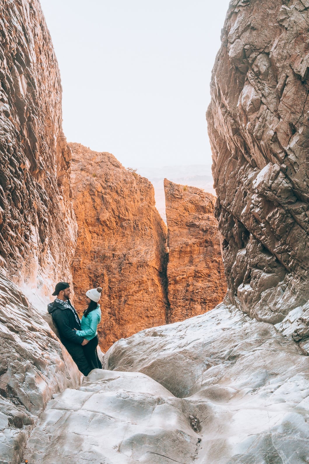
I enjoyed this hike, and seeing all the different shapes, sizes, and colors of rocks was enjoyable. I also loved looking out The Window and watching the vibrant colors on the rock change as the sun went down.
Window View Trail
- Distance: 0.4 Miles Roundtrip
- Difficulty: Easy
- Elevation Gain: 16 ft
- Trail Guide: Link
The Window View Trail is the easiest hike on this list, and the trail is perfect for sunset after completing the more difficult and long Window Trail.
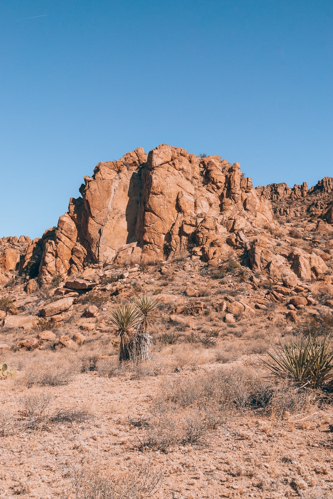
Balanced Rock Via Grapevine Hills Trail
- Distance: 2.0 Miles Roundtrip
- Difficulty: Easy
- Elevation Gain: 246 ft
- Trail Guide: Link
Getting to the start of the trail was a little tricky due to the long bumpy dirt road. But once we got there, we parked and prepared our daypacks with water and lunch.
I admired the first part of the hike because of the distinctive rock formations. This part of the park has a different feel compared to the rest of Big Bend. It was strange how drastically different the colors, formations, and size of rocks were compared to the Chisos Basin area just a few miles away. The stones in this area reminded me of Wichita Mountains located in Oklahoma and Joshua Tree located in California.
The first part of the hike was flat and smooth, but the trail began to ascend towards the end. We were able to catch a view of the majority of the path, shown below.
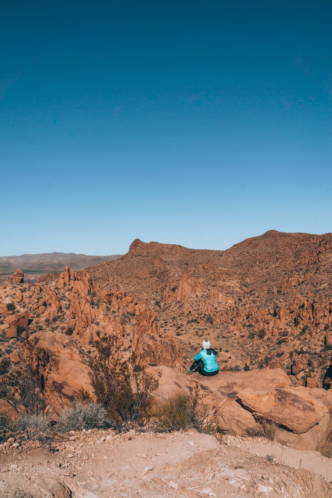
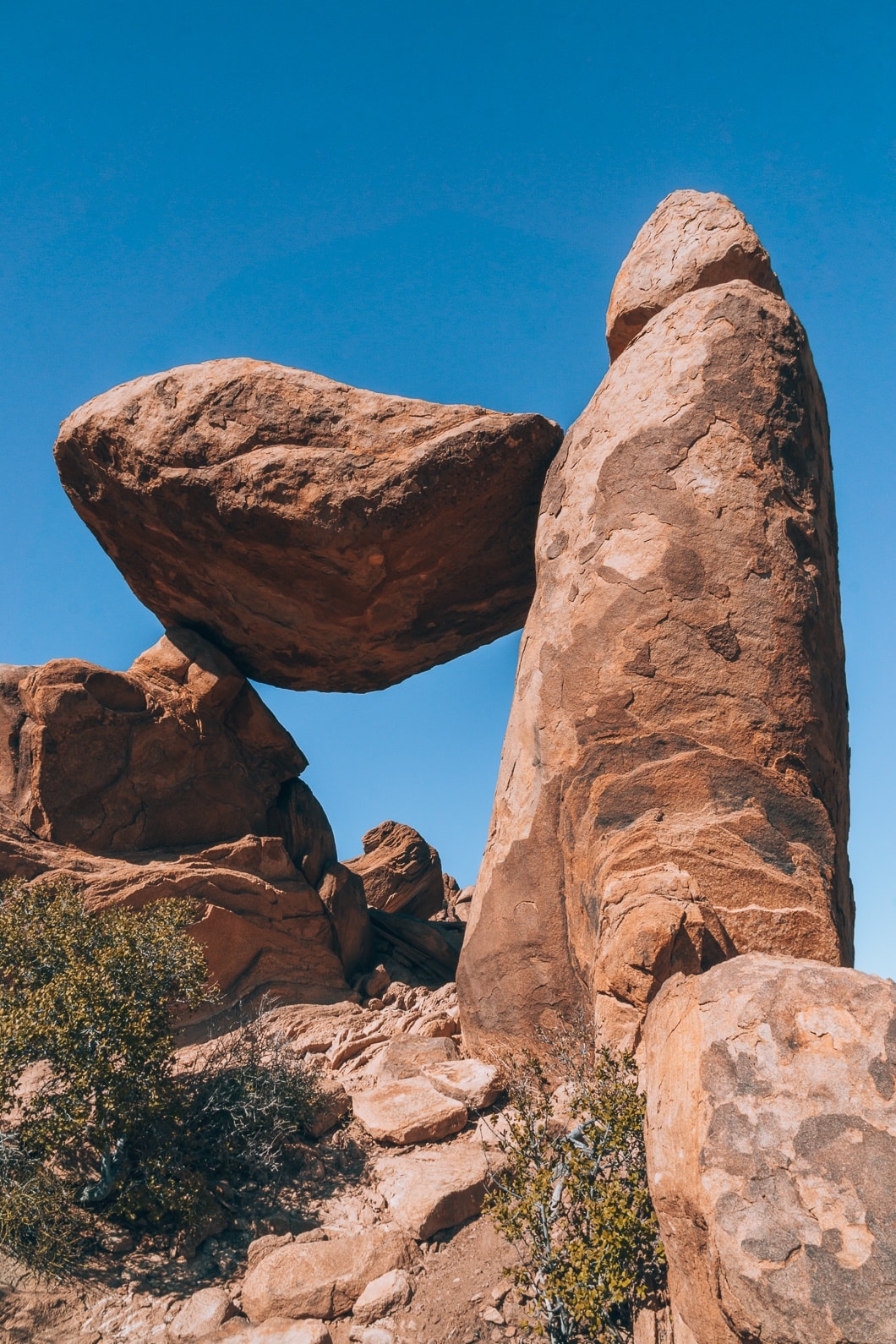
Overall I liked experiencing the different rock formations compared to the rest of the park, but the Balanced Rock was underwhelming. If you are looking for a trail with a different feel to it, then this hike is probably for you.
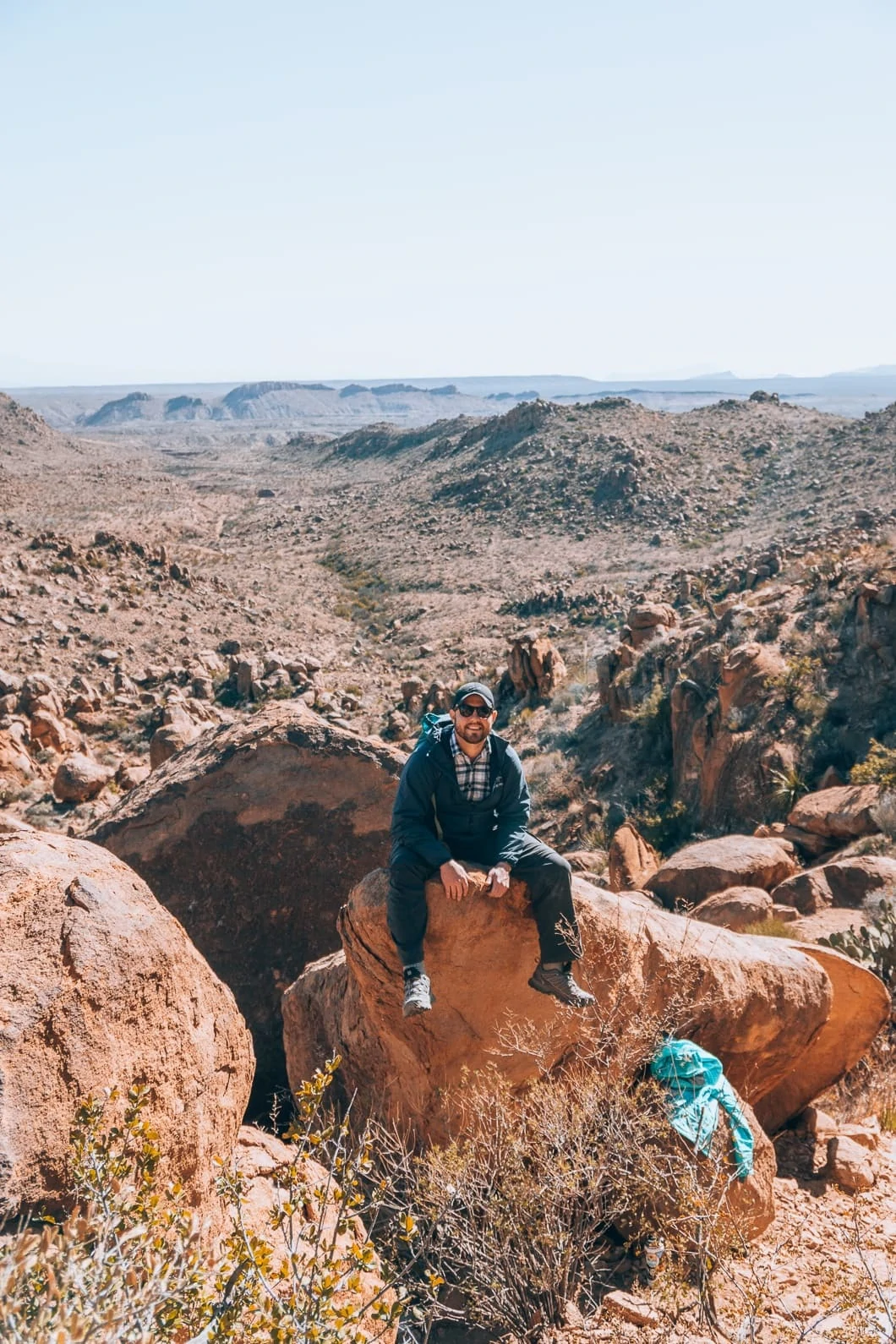
Emory Peak
- Distance: 10.4 Miles Roundtrip
- Difficulty: Hard
- Elevation Gain: 2,522 ft
- Trail Guide: Link
Another popular Big Bend hike is the Emory Peak trail. The 7,625-foot mountain is the highest Peak at Big Bend National Park. The trail starts at the Chisos Basin Parking lot. Follow the Pinnacle Trail for 3.5 miles until you hit the Emory Peak Trail. Follow the trail up to the peak for about one mile until you reach the top.
I have lived in Texas for 30 years and this is probably one of the most talked-about hikes in the state.
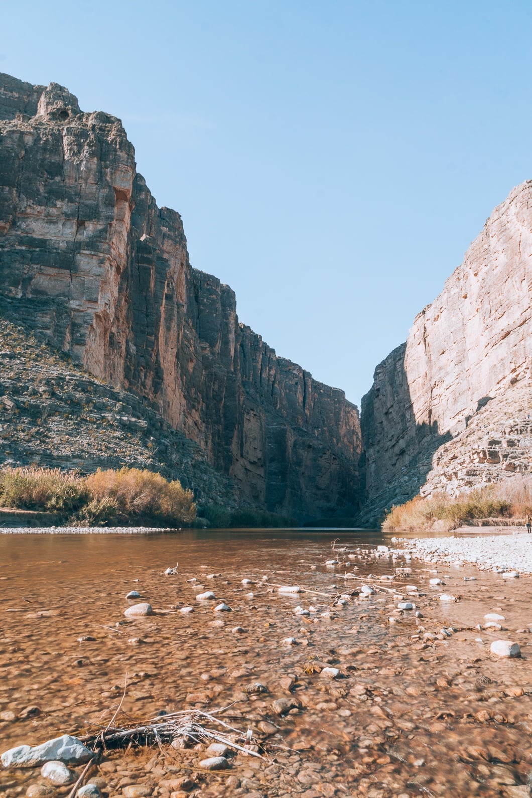
Boquillas Canyon Trail
- Distance: 1.2 Miles Roundtrip
- Difficulty: Easy
- Elevation Gain: 229 ft
- Trail Guide: Link
The Boquillas Canyon Trail runs into and along the Rio Grande river. The trail was close to our campsite, so it was a quick, easy drive to the trailhead. The sunrise that morning was spectacular. You could easily see at least half a dozen hot springs along the Rio Grande due to the rising steam of the cold morning.
On the trail, the only people we encountered were a group of people who camped on the Rio Grande River. They were on an 8-day canoeing trip and decided to camp in the canyon. A picture of their canoes on the river bed is below.

I fell in love with Boquillas Canyon. Boquillas is a lesser-known canyon when compared to Santa Elena, but I enjoyed Boquillas more. Boquillas has a soft, graceful, quiet feel, while Santa Elena feels powerful and busy.
I am so glad we stopped by to see this canyon. The canyon wasn’t in our initial itinerary, but we decided to add it since it was close to our campsite. If we had stayed near the Chisos Basin campground, I would have still made an effort to see this canyon. Perhaps lump the Hot Springs and Boquillas together on the same day.
Rio Grande Village Nature Trail
- Distance: 1.0 Miles Roundtrip
- Difficulty: Easy
- Elevation Gain: 121 ft
- Trail Guide: Link
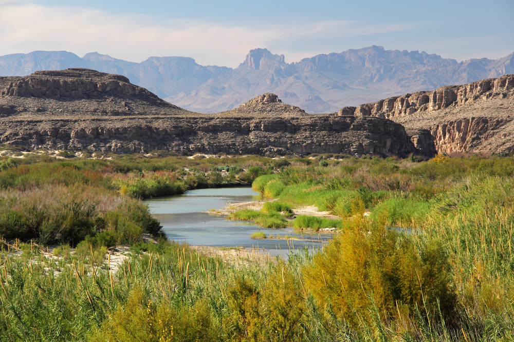
The Rio Grande Nature Trail is a pretty easy leisure hike with fantastic views of the park’s wetlands. The Rio Grande looks breathtaking from the trail. It is located next to the campground so parking can be a bit tricky. It is best to park at the entrance of the campground. This is a great spot for sunrise or sunset.
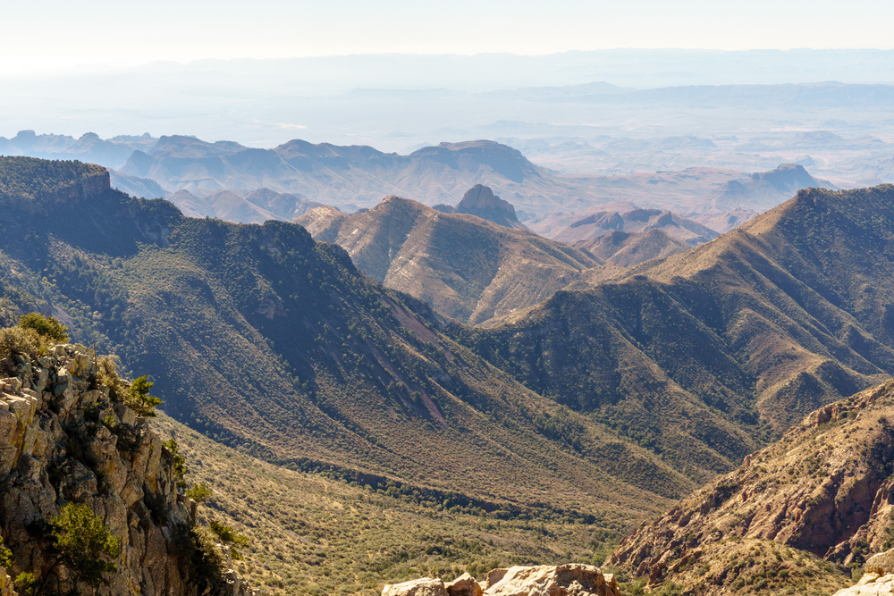
South Rim Trail
- Distance: 12-14.5 miles round trip
- Difficulty: Strenuous
- Trail Guide: Link
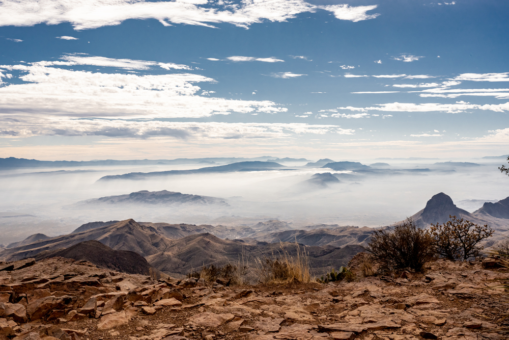
The trailhead for South Rim is located at the Big Bend Chisos Basin Parking Lot. Since this trail can be considered either a backpacking trail or a hiking trail, there are many backpacking campsites along the way. If you would like to attempt a full-day hike, I suggest getting up exceptionally early to finish this trail.
To get to the South Rim trail, hike on Laguna Meadows Trail to Colima Trail to the South Rim Trail. On the way back to the trailhead, you can go a different route and make it a loop. You can even add in Emory Peak! Just go from Boot Canyon to Emory Peak to Pinnacles Trail.
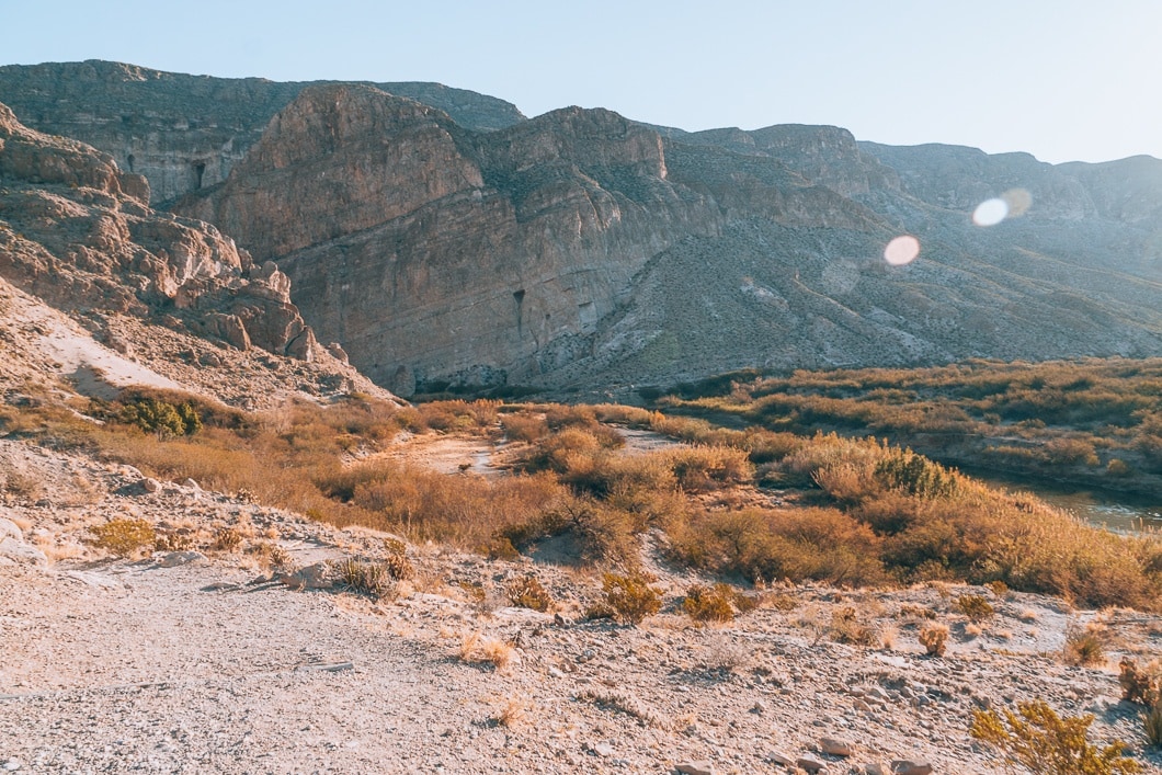
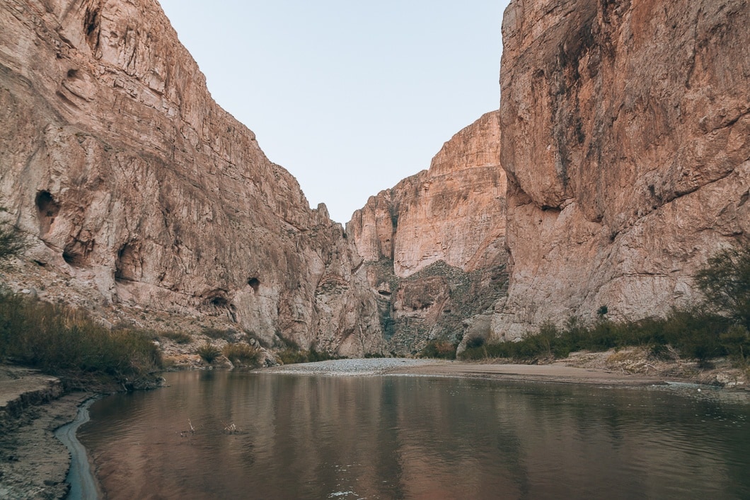
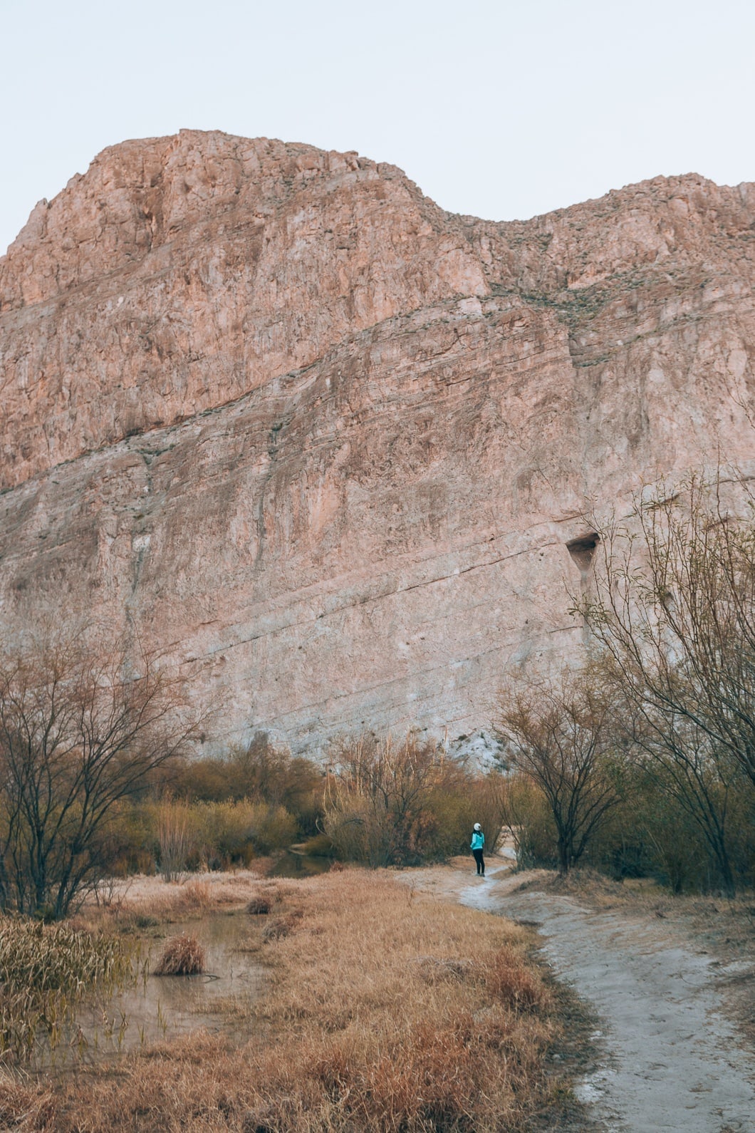
Santa Elena Canyon Trail
- Distance: 1.4 Miles Roundtrip
- Difficulty: Easy
- Elevation Gain: 157 ft
- Trail Guide: Link
Santa Elena was our last trek in Big Bend. While researching what to do at Big Bend, Santa Elena was the trail I was most excited about. Initially, we planned to canoe down the Rio Grande through Santa Elena Canyon; but unfortunately, the shuttle services did not have employees to shuttle travelers around. I was disappointed, to say the least, but I know when one travels, not everything goes as planned. Getting to hike around the canyon was a great alternative.
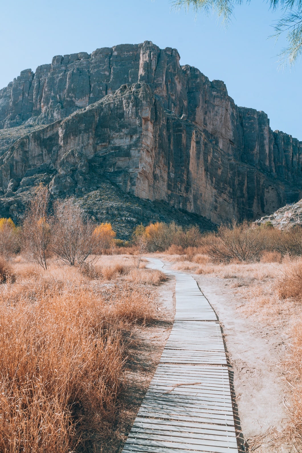
The trail to Santa Elena starts off flat and with a gorgeous view, as shown above. We stopped next to the river bank to take some lovely pictures of the river.
Eventually, the trail ascends a couple of switchbacks and then descends again to flat level ground.
As seen in my pictures above and below, the trail takes us into the canyon. We noticed some kayakers and canoers enjoying the beautiful day on the water. Eventually, the trail dead-ends, so we had to turn back around but not before we got some great shots!
I loved Santa Elena! I can see why the canyon is one of the most popular attractions in the park. I was heartbroken that I couldn’t canoe down the river and enjoy the canyon even more. But, I was pleased to have been able to at least experience Santa Elena on foot.
Tuff Canyon
- Distance: 1.0 Miles Roundtrip
- Difficulty: Easy
- Elevation Gain: 104 ft
- Trail Guide: Link
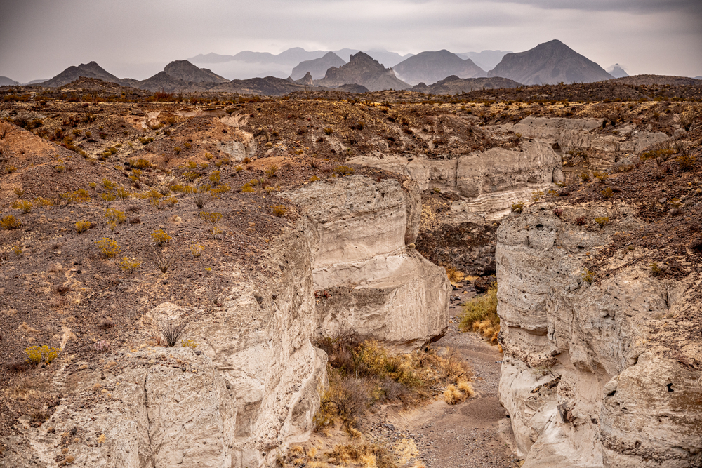
Tuff Canyon is a great trail to hike on the way to Santa Elena Canyon. The canyon is made of volcanic ash, and during the rainy season, the canyon fills with pools of water. The trail leads around the edge of the canyon to see into it and eventually leads into the canyon. Bring water because the shade is minimal depending on what time of day you go.
Mule Ear Spring Trail
- Distance: 3.9 Miles Roundtrip
- Difficulty: Moderate
- Elevation Gain: 410 ft
- Trail Guide: Link
Mule Ear Spring trail is a long but relatively flat desert hike with crazy rock formations in the distance. There is little to no shade, so bring plenty of water and go early! The spring on this trail is usually dried up, but this is still a good trail if you want to see the Mule Ears rock formation.
Final Thoughts On Big Bend National Park Hiking
In the end, Big Bend is a fantastic park. It has hot springs, canyons, mountains and a lot of wildlife. As far away from a major city, this place is, Big Bend was bustling, lively, and spirited. I thoroughly enjoyed my time here, and I can’t believe it took me this long to make it here.
Thanks for reading my Big Bend National Park hikes guide! Make sure to read some of my other National Parks posts:
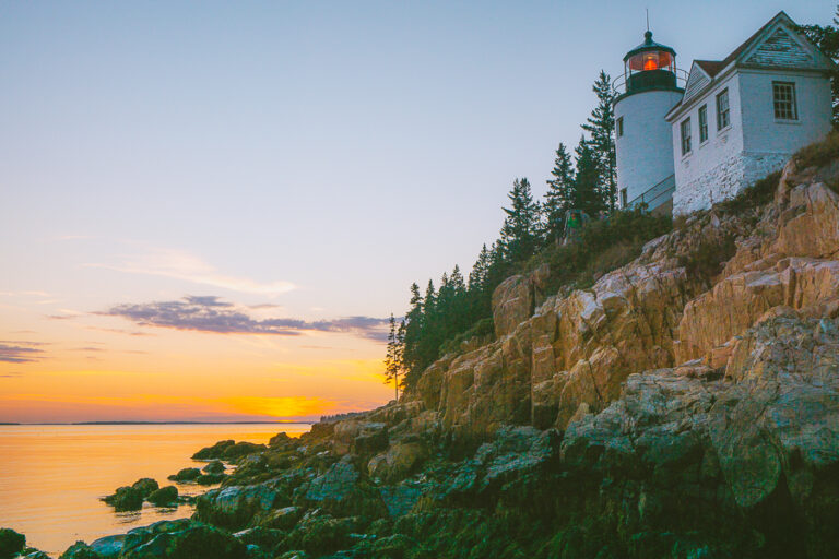
- 13 Fun Things To Do In Acadia National Park
- 10 Awesome Things To Do In Glacier National Park
- The Ultimate Guide To Death Valley National Park
- Awesome Hikes In Shenandoah National Park
- The Best Smoky Mountain National Park Hikes
- Best National Parks To Visit In The Spring
- 11 Best Things To Do in Big Bend National Park, Texas
Also, follow me on Instagram, where I discuss all things hiking, camping, and backpacking. You can get ready for your next outdoor adventure! Follow Me Here.


Wowowow! So much awesome information. thank you thank you. You are making trip planning a whole lot easier for me. 😛 And your pictures – stunning!
Thank you so much Jen! I am so happy you enjoyed it 🙂
Wow this trip sounds like a blast. I love hiking and I really really REALLY want to be able to travel more. The photos you took are all so stunning! Now I definitely want to go!!
Thank you so much for the comment. I am really happy you liked the pictures! Yes the trip was so much fun and really recommend this National Park.
This looks like such an epic trip! Your pictures are gorgeous!
Thanks! I am so happy you like them 🙂
These photos are gorgeous!! I love hiking through national parks, but it has been a few years since my husband and I have been able to visit one. Big Bend definitely looks like one I need to add to our bucket list!
Thanks for commenting Brittany. But yes I believe you do need to visit a national park soon! Big Bend is gorgeous, I am sure you will love it.
Amazing photos!! We were just in Big Bend last August and I love how different our experiences were, just because of the weather. For such a lesser known park there is just SO much to do!! We couldn’t do anything in the desert really, due to the heat, and rains had flooded any trails on the river. So I need to go back again. The Mule Ears hike, and the hot springs and Santa Elena hikes are at the top of my list!!
Awwww man that is so sad you didn’t get to do all of it. It is such an amazing park even though like you said it is lesser know than the other National Parks. Make sure to go in the winter next time. The weather was perfect during the day but chilly at night but, it was manageable. Thank you for commenting!
Saving for when we go back to Big Bend! We went in December and only had a day in the park (we had our dog with us so couldn’t do a lot of hiking). Your photos are beautiful!
Thank you so much! Yes go again! There is so much to do there. I was actually in shock with the amount of hikes there. No one ever talks about Big Bend so I was really surprised at how amazing this park actually is.
Like you, I’d like to get to all 59 national parks one day. Big Bend looks incredible. thank you for highlighting some great trails to tackle for when I get there!
Your welcome 🙂 Hope we can both get through all 59. I know we can do it!
The light in your photographs is magical! I remember while hiking in Smith Rock State Park, OR last spring the massive rock formations made me feel so humbled.
I was at Smith Rock last year so I know exactly what you mean. I felt sooooo tiny, loved that area! Thank you for commenting 🙂
Wow! What an extensive and informative post. This will really help in planning the trip!
As always love the pictures! The one with the sun-rays are are gorgeous love!
Thank you so much! 🙂
Wow, your photos are straight up dream like! The hot springs look and sound amazing as well. This is now on my Bucket List!
Thank you! So happy you like it 🙂
Oh my gosh this looks like SUCH a beautiful park!!! The landscape is incredible and your photography is so amazing 😍
Thank you so much! I am so happy that you enjoyed 🙂
I also want to visit all the National Parks in the country, and I’ve never been to Texas so really looking forward to visiting this one some day! Your pictures are beautiful…I feel like they took me away from home for a bit to the peacefulness of the outdoors, so nice!
Thank you so much! I am glad that you like them! Texas is not known for Mountains or hikes so I was so happy to share this beautiful place in this massive state 🙂
Wow, your blog is really beautiful and these pictures are stunning. I think visiting all of the National Park is a great goal! I also love hiking and spending time in the nature, so when I am back in the US, I will come back to your blog for more guides. Cheers!
Thank you so much I really appreciate this comment 🙂 I really hope you can see a lot of the National Parks here. They are stunning! Have a good day:-)
This post has made my trip planning to Big Bend so much easier. Thanks for all the detailed information! Now, do you recommend any hiking shoes in specific or will tennis shoes do the job? Thanks!
If you are doing The Lost Mine Trail, I would recommend hiking shoes. The other trails are a lot easier to get away with tennis shoes. These are the hiking shoes I use : https://www.rei.com/product/856296/oboz-sawtooth-low-bdry-hiking-shoes-womens?cm_mmc=aff_AL-_-182133-_-231737-_-NA&avad=231737_c11d9204d
I really like them a lot. They protect my feet real well. I recently went on a hike in Death Valley with tennis shoes on and I remembered why I always wear my hiking shoes. Hiking shoes just protect your feet real well and they are made to grip so much better so you wont slip as much. Hope this helps! Next week I am posting a camping guide so make sure to come back and check it out for your trip 🙂
I disagree about not needing hiking boots. I think they’re mandatory for any hiking trail in Big Bend. Trails can be uneven; boots can help prevent or limit injury if you twist an ankle. More importantly, you’re hiking in the Chihuahuan Desert, where practically everything wants to prick you. Boots will give you far more protection than tennis shoes.
Otherwise, good report and you have some nice photos.
Thank you 🙂
I’m originally from Texas, but have never made it to Big Bend…your guide makes me really want to make the effort to get there. Thanks for putting so much information in one place.
You should totally go and see it! I was surprised how much I loved it!
I have never heard of this National Park before but it looks so pretty! I think that’s another reason for me to visit Texas!
Yeah it took me 30 years of living in Texas to finally visit. Not a lot of people know of it lol.
I’m still so in love with the visuals of your blog – and what better to go with that than such a beautiful place? Absolutely gorgeous, and so much information! Thanks for sharing!
Thank you 🙂
Very thorough and helpful guide. I have this park on my list and will reference this article when it’s time to plan. Thank you!
Yay so happy you like it Jamie 🙂
So much information and so thorough. We’re headed to Big Bend in a few days and after reading this I feel prepared and more excited!
Yeah it will surprise you how much you will enjoy it! It is such a pretty place.
Thanks a lot, very useful information, preparing a (winter) trip to Big Bend. How would you rate Big Bend compared to other National Parks?
I actually really fell in love with Big Bend. It is a very underrated national park. I came into the park indifferent and left falling in love with it. I would give it an 8/10.