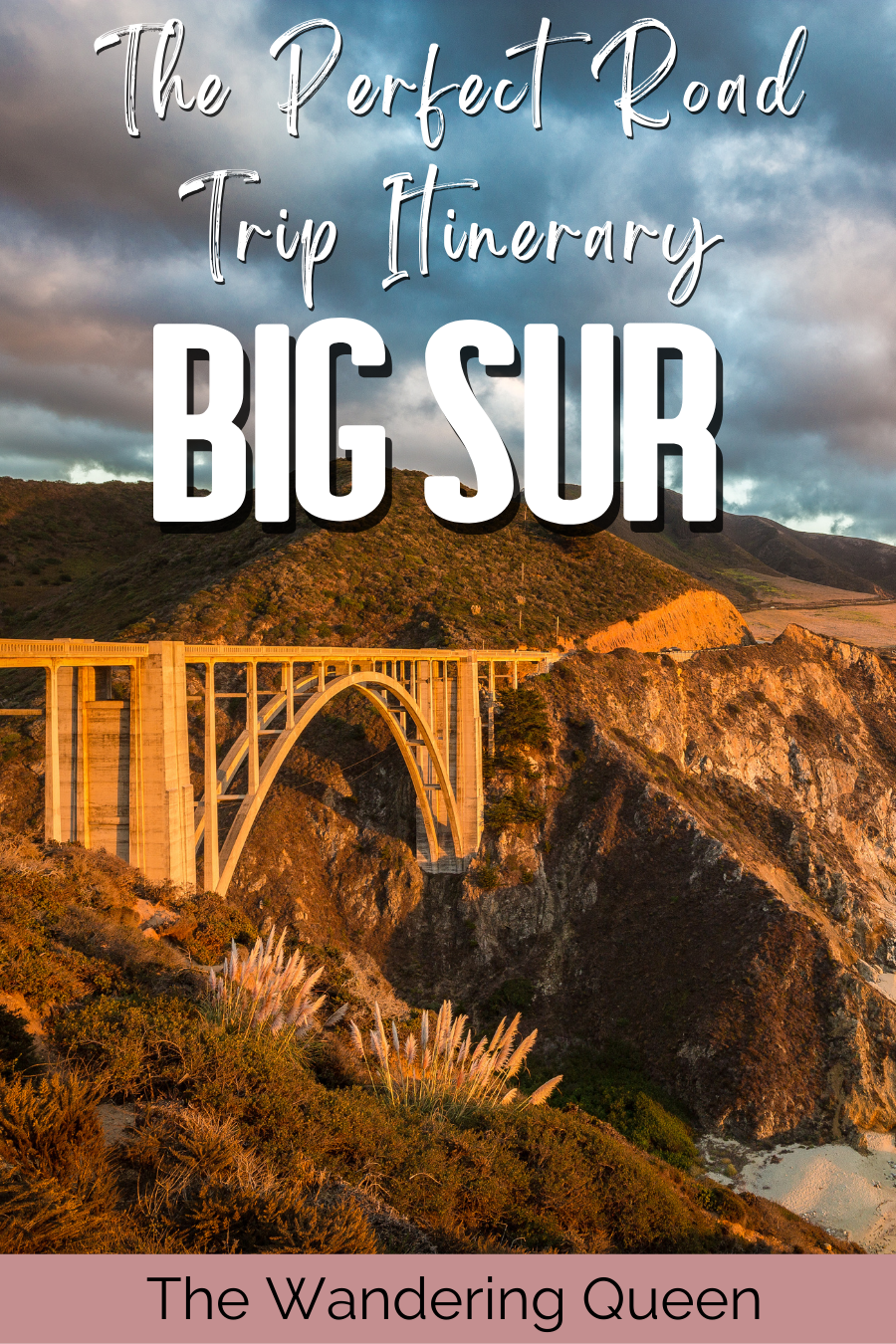
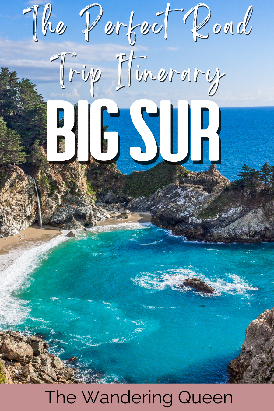
The Perfect Big Sur Road Trip Itinerary
When I moved from Texas to Washington State, I decided to make a trip out of it and do an ultimate Big Sur Road Trip. It was one of the most magical areas I have ever visited in California. The green cliffs, beautiful waterfalls, giant trees, and exquisite beaches were extraordinary. I haven’t stopped thinking about this beautiful area since, so I decided to make a fun itinerary for you.
I have highlighted my favorite spots on Highway 1, including parks, viewpoints, how to get there, what to pack, fantastic tips, and much more! Get ready for an outstanding Big Sur itinerary!
Disclosure: This post contains affiliate links. If you click one of them, I may receive a small commission (for which I am very grateful for) at no extra cost to you.
Download my free Outdoor Photography Guide
What To Pack
- Car Charger: The drive is long, so make sure to pack this. >Buy Charger
- Water Bottle: Stay hydrated! >Buy Water Bottle Here
- Water Cube: Bring a lot of water since there are few gas stations. >Buy Water Cube Here
- Beach Blanket: You definitely should relax at one of the beaches I talk about below. >Buy Beach Blacket Here
- Camera: There are so many great photography spots on this trip. >Check Out This Camera
- Comfy Shoes: I love these Teva shoes when traveling. They are so comfortable. >Check Out These Comfy Shoes
- Sun Screen: It might be sunny, so be safe and put on some sunscreen. >Buy Sunscreen Here
- Hand Sanitizer: In case you need to use the park bathrooms.>Buy Hand Sanitizers
- Sunglasses: >Buy Sunglasses
- Map: There is no service, so bring a map or download a Google map. >Buy Map Here
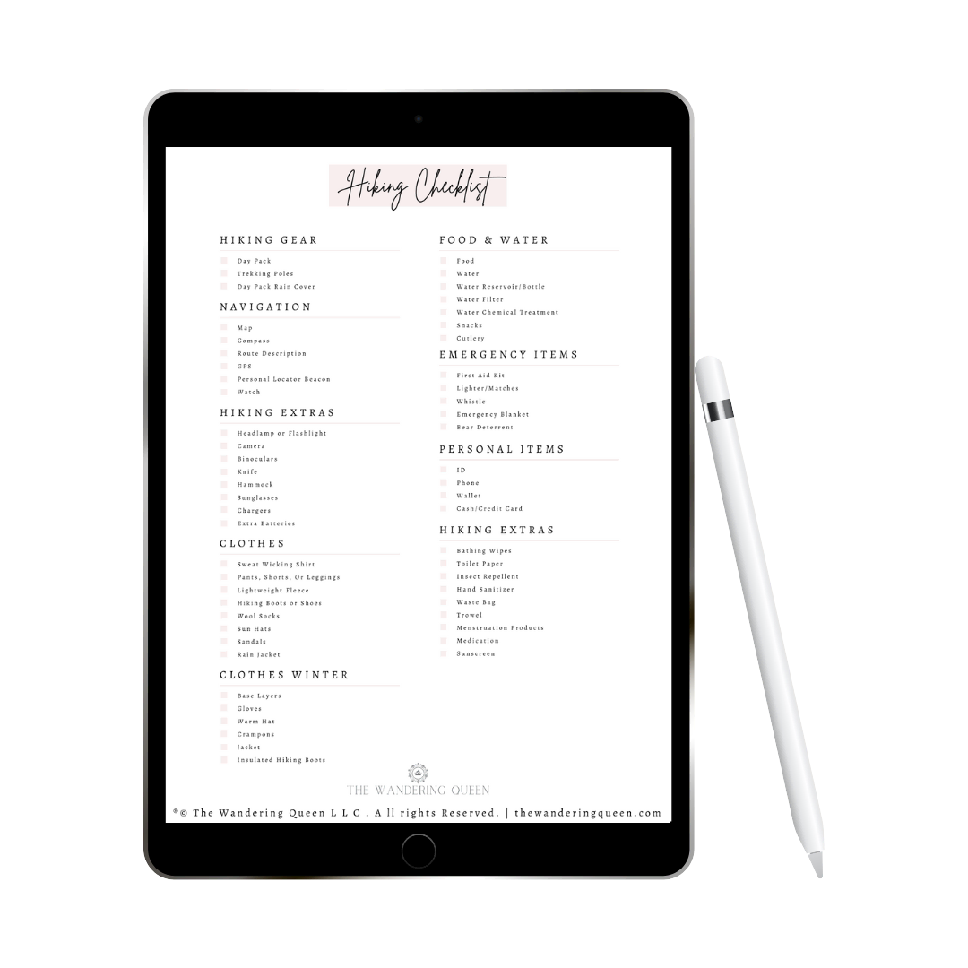
Claim your FREE Hiking Checklist
Ready to start hiking? Grab my free hiking checklist and never forget anything at home!
Read More: The Ultimate Checklist For Road Trip Essentials
Best Time To Visit
Honestly, you can go all year long to visit Big Sur. I went in February, and it was chilly, but at least the weather was outstanding! Sunny days the whole time we were there.
Spring is the best time to visit when the wildflowers bloom, adding gorgeous colors to the scenery.
How To Get To Big Sur
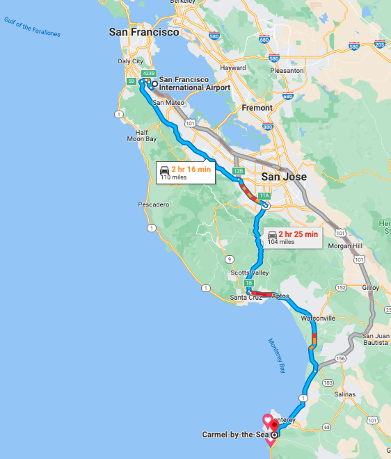
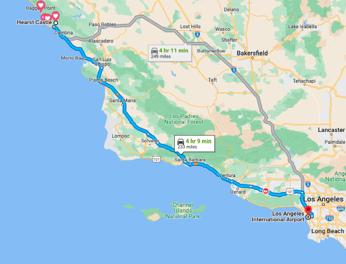
The best way to get to Big Sur is to fly into San Francisco International Airport, rent a car and drive to Carmel. It takes around 2 1/2 hours (depending on traffic) and is about 110 miles away.
You can also drive from Los Angeles International Airport and make your way up North instead, although it is a longer drive to get to the first section of Big Sur (Hearst Castle). I drove from Los Angeles because I was moving from Texas to Seattle, so I made my way up north.
Where To Stay
Finding a place to stay on Big Sur can be difficult because there isn’t much accommodation, so prices can be high. You don’t need to stay at a hotel to enjoy your time on Big Sur because you can complete most activities within a day. But if you want to go at a slower pace, you can stay at a hotel. Below are some excellent options.
- Alila Ventana Big Sur: This is a cozy and luxurious hotel nestled in the California Mountains and has a splendid restaurant, and a wonderful pool. This romantic destination is adults only. >>>Click Here For Prices
- Hyatt Carmel Highlands: Hyatt Carmel Highlands is located only 10 minutes from the beach and has many rooms with outstanding ocean views. It also has a pool, 3 outdoor garden spas, and a restaurant with views overlooking the Pacific Ocean. >>>Click Here For Prices
- Big Sur River Inn: Want to soak your feet on the Big Sur River after hiking and exploring all day? The Big Sur River Inn is a budget friendly, cozy Inn that is located right next to the river and has a fantastic restaurant. >>>Click Here For Prices
Map Of Big Sur
You can download the Google map below on your computer or phone to help you plan your trip. I will warn you that the starred areas can not be seen without service, so I usually print the itinerary.
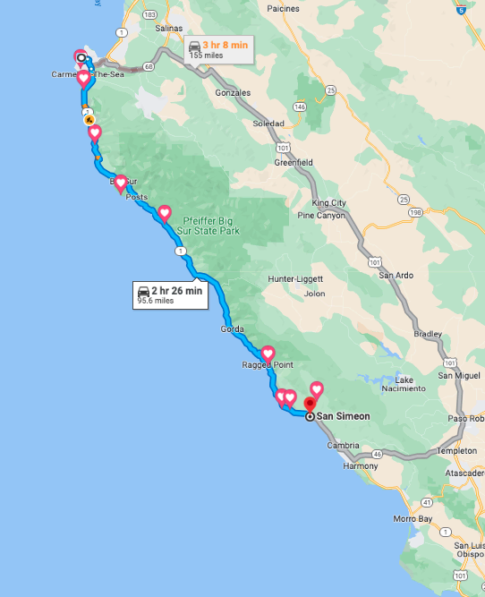
Above is the approximate driving time and mileage to see most of Big Sur (around 96 miles and 2 1/2 hours). The Big Sur area is located between Carmel and San Simeon, and you need to drive on Highway 1 to experience this mesmerizing coastline.
You do not need to see all of Big Sur to enjoy the region. In my opinion, the northern side is the best part.
Tips On Big Sur Road Trip
- The roads can be pretty sketchy when driving. Be careful!
- You might not have service, so learn how to download a Google Map on your phone.
- Dogs are not permitted on the state park trails, but they are permitted in the state park paved roads.
- Make sure to leave no trace! Do not leave any trash at any of the parks.
- Sunset is the best time to take photos.
- Bring a sweater or a jacket! It can get chilly, especially if you are doing sunset hikes.
- Mudslides happen a lot in this area. When exploring Big Sur, you will notice the past mudslides.
- My favorite parts of Big Sur are McWay Falls and Bixby Creek Bridge. Those two should be on your to-do list!
- Bring a car charger because you will be in the car a lot.
- Make sure you have a full tank of gas before you leave. I almost fainted when I saw the gas price when I filled up on Big Sur. It is so expensive.
Read More: The Ultimate San Francisco to Los Angeles Road Trip Itinerary
How Long To Make Your Road Trip
If you wake up early, you can see almost everything on this list in a day. However, you will be rushed and feel like you did not see enough. If you want to relax and go at your own pace, then I recommend making this into a two-day adventure and staying at one of the hotels I suggested above.
Big Sur Tours
Are you getting overwhelmed with planning? Check out some of the tours offered below.
San Francisco To Big Sur Road Trip Itinerary
Carmel By The Sea
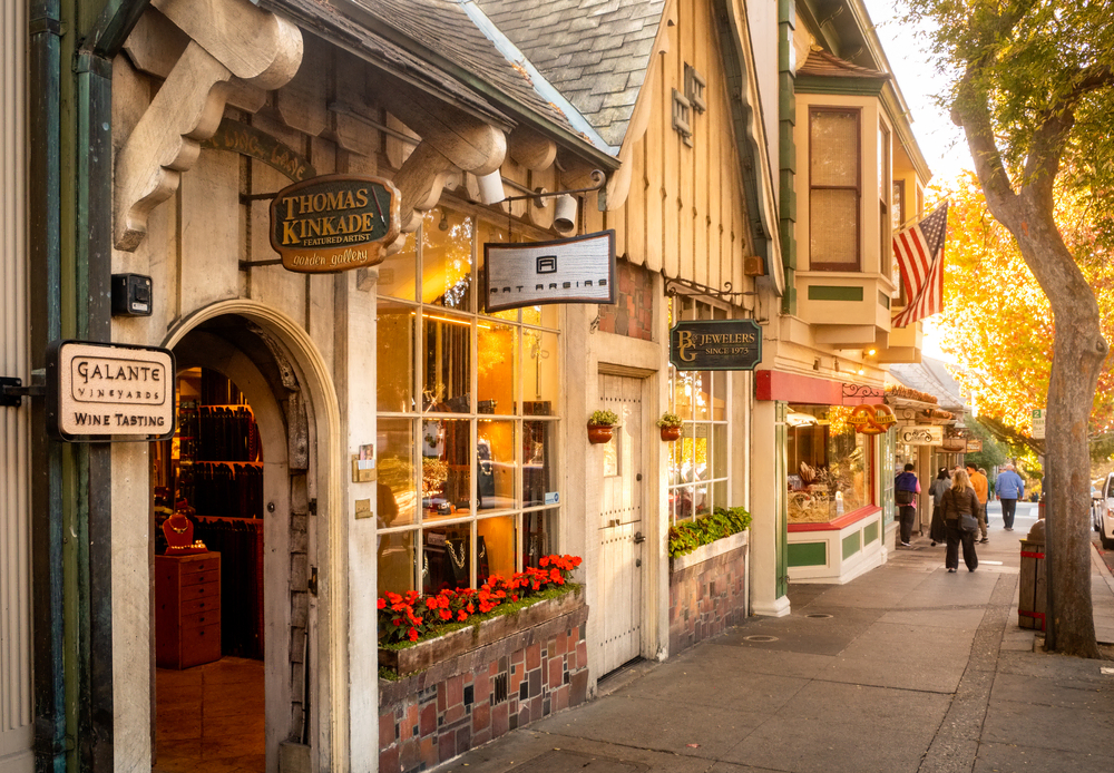
Carmel By The Sea is a quaint little seaside town that was established in the 1880s. The town still has some characteristic stone chimneys and gable roofs that remind me of the English countryside. One of the most popular features is the Mission San Carlos Borromeo de Carmelo, and it is one of the most beautifully restored Roman Catholic churches in California. This is a significant historic building to view. You can also walk around the town and explore art galleries and restaurants. Some of the most popular restaurants include Cultura Bebida Y Comida and Corkscrew Cafe.
Point Lobos State Natural Reserve
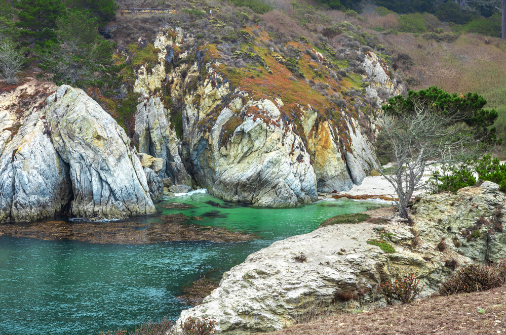
Point Lobos State Natural Reserve is just south of Carmel-by-the-Sea on Highway 1 and is a fantastic spot to enjoy sightseeing, beaches, tidepools, and more. I highly recommend hiking the Point Lobos Loop trail to see the best views in the reserve. It is around 6.7 miles round trip with 741 ft elevation gain. It is long but covers the best parts of the reserve.
If you don’t have much time then check out the Bird Island Trail which features the famous Point Lobos China Cove. This trail is only 0.8 miles round trip. A beach that is magnificent in the reserve is Gibson Beach.
Garrapata State Park
Garrapata State Park is easy to miss when driving down highway 1. There are no signs of the park and it has no staff on site. Still, if you are a big hiker, you might want to try the well-known loop trail containing Rocky Ridge and Soberanes Canyon Trail, which is around 4 miles and has spectacular views of the Atlantic ocean.
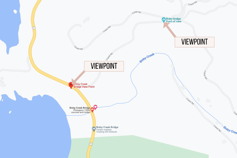
Bixby Creek Bridge
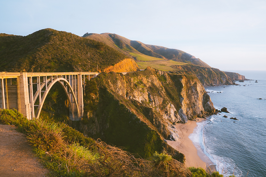
One of the most Instagramable spots on Highway 1 is the Bixby Bridge. This is one of my favorite spots on our road trip. And the best part is that it is one of the easiest activities on this list. Just pull over and take a photo of the stunning cliffside bridge. This bridge is the most photographed bridge in California.
The bridge was built in 1932 and is one of the tallest bridges of its kind in the world. Honestly, I am surprised at how this bridge was built. If you look at the photo above, you can see that the structure is on the cliff and not the ground which is pretty crazy to think about.
There are two main viewpoints of the bridge which I have highlighted below on a map. I would not explore beyond these areas because you can easily go into private property. Getting down to the beach is also pretty difficult and dangerous.
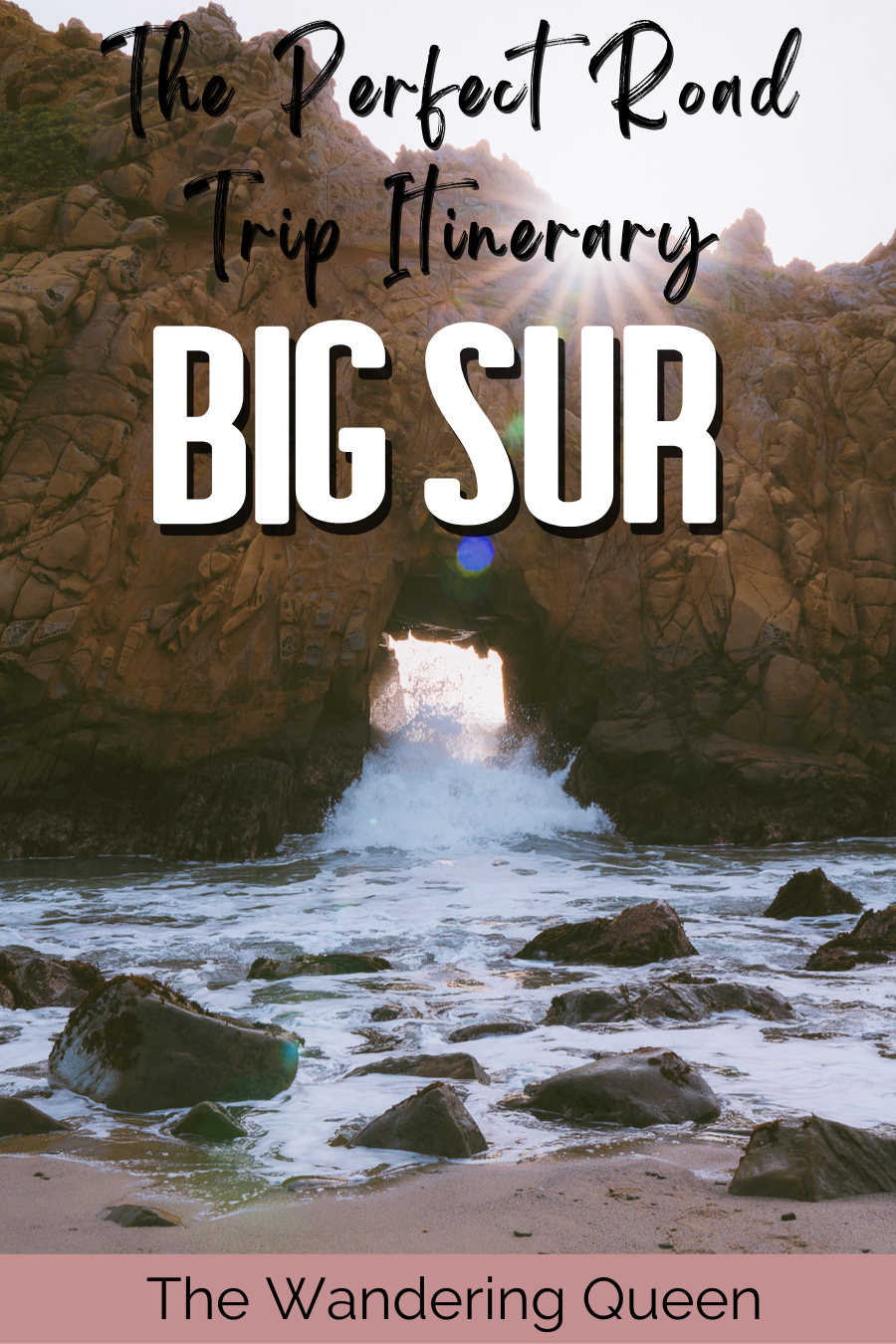
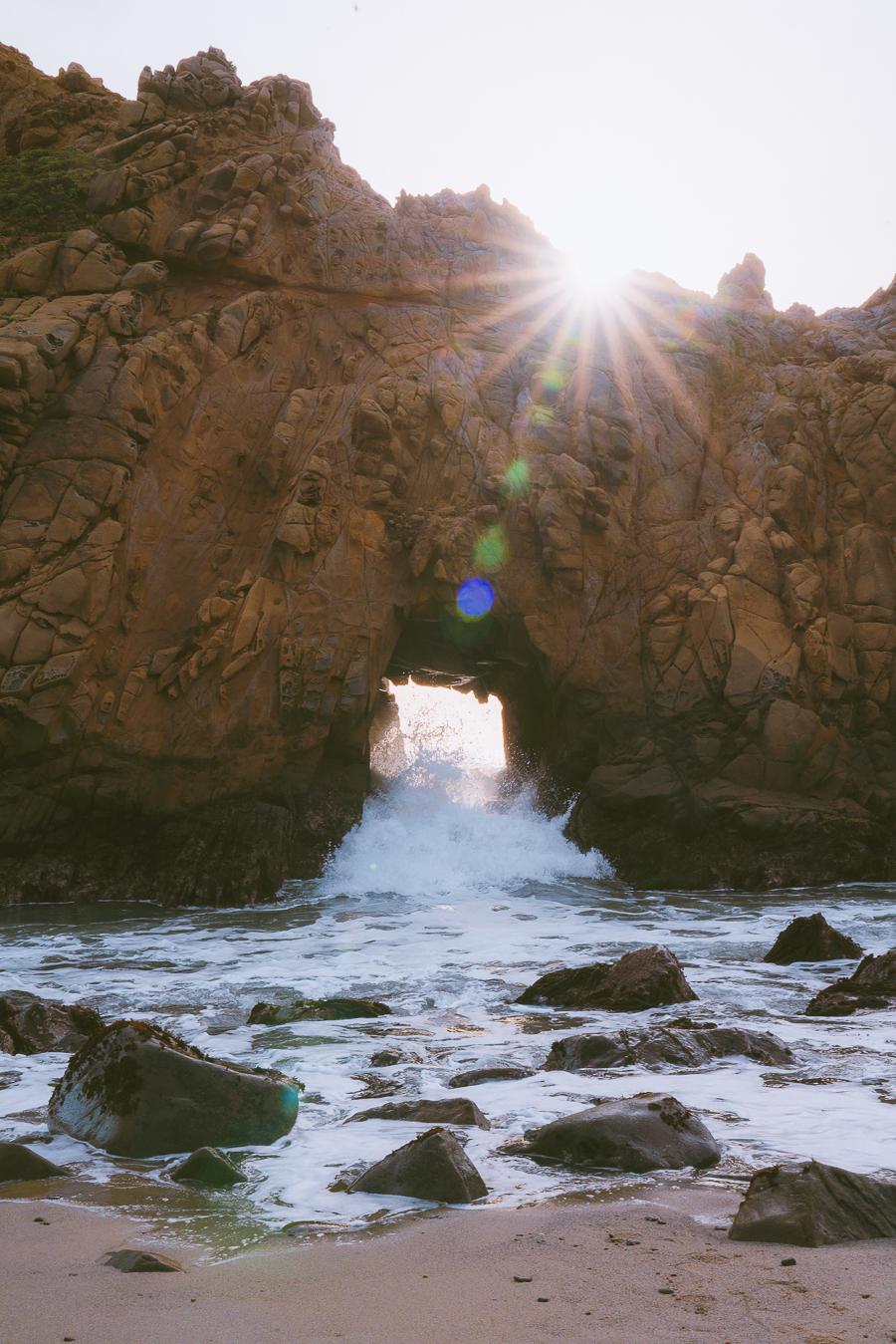
Pfeiffer Beach
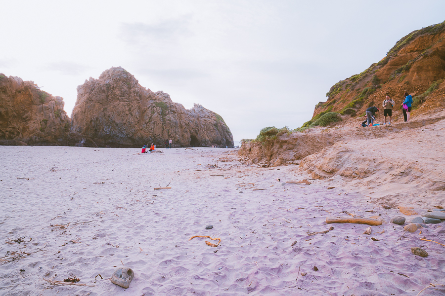
Pfeiffer Beach is another popular area for photographers due to its “purple” sand and Keyhole Arch. Many photographers were crowded around the Keyhole formation and taking sunset photos. I loved this beach, and I feel like it is an excellent place for a picnic or lunch. Even though it felt crowded, there was still plenty of space to set up and relax.
I visited this beach because I had heard it had purple sand, but in my opinion, the beach only had some purple sand. Not enough to really call this a purple sand beach. Still, I really enjoyed seeing the keyhole arch and the waves crashing down on it.
McWay Falls – Julia Pfeiffer Burns State Park
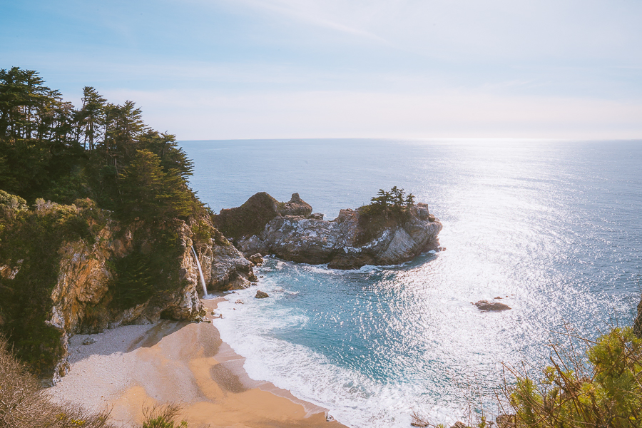
McWay Falls is my favorite waterfall I have seen in California. There is something so dreamy about seeing a waterfall cascading onto a beach. Lucky for you, this is another easy stop/hike to experience this waterfall.
The trail is only 0.6 miles round trip, and it is effortless to hike. When we were walking, we saw some of the devastations that the mudslide created years ago.
Once you get to the viewpoint (the picture shown above), take in the beauty of this wonderful waterfall. It is the closest you can get to the cove. Yes, I know… All of us would love to hike right next to the cove, but it is not allowed and will result in a considerable fine. I really wouldn’t know how to get down to the beach, and it looked sketchy and dangerous to even try.
I will warn you that this trail is very crowded, contrary to what you see in the photo. You can also hike around Julia Pfeiffer Burns State Park like Tan Bark Trail and Tin House Road. I would check here beforehand to see if the trails are open. Too many fires and mudslides can close down a trail at any given time.
Grab Your Free Car Camping Checklist! 🚗🌲
Ready to elevate your car camping game? Snag our essential checklist to ensure you’ve got everything you need for a stress-free, fun-filled adventure! Perfect for beginners and seasoned campers alike. Download now and hit the road prepared! 🌟🎒
Elephant Seal Beach Scenic Overlook
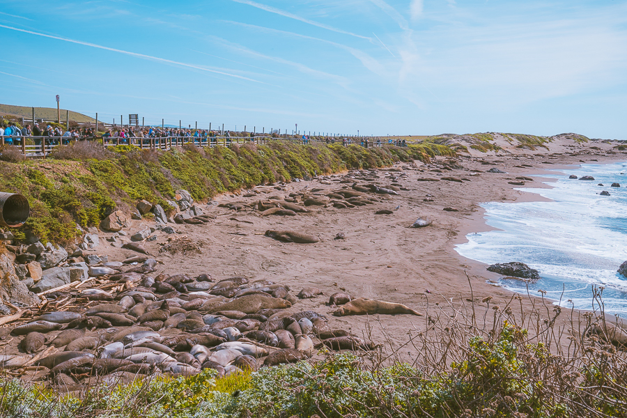
Elephant Seal Beach Overlook is a quick stop to see many cute elephant seals, and it is located near San Simeon. These animals are unique and brutal! We saw many of them fighting while we were here, and it was crazy to witness. Since it only takes a few minutes to witness all the seals, I recommend stopping here.
There is another seal overlook called “Seal Beach Overlook,” and that one is located near McWay Falls.
Hearst Castle
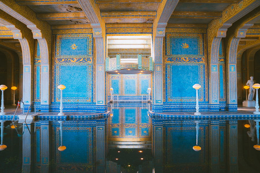
Want to see an American castle? There aren’t too many here in the USA so take advantage, and visit the world-famous Hearst Castle. William Randolph Hearst started to build this estate on his ranchland overlooking the village of San Simeon in 1919. Hearst is mainly known as an American businessman, newspaper publisher, and politician back in the day. He brought over historical art from Europe and created this fantastic castle.
I enjoyed my time touring the castle and my favorite part was the stunning pool as shown in the photo above.
You can book advanced reservations for Hearst Castle Here
Final Thoughts On Big Sur Trip
Thanks for reading all about the ultimate road trip to Big Sur. Check out some of my other California posts:
- 21 Fun Things To Do In Death Valley National Park
- Best Things To Do In Mammoth Lakes, California
- The Ultimate Channel Islands Camping Guide
- The Perfect 2-Day Joshua Tree Itinerary
- 8 Fun Things To Do In Visalia, California

new on the shop
The Ultimate Camping Trip Planner!
Our camping trip planner helps you stay organized and plan all aspects of your adventure so that you can conquer new territories with ease.