The Ultimate 3 Days in Death Valley Itinerary | A Complete Guide
From its eclectic Mars-like landscapes to the ethereal tapestry of color that paints the sky each afternoon, you can’t go wrong with a Death Valley vacation. Considering there are 5,270 square miles to discover, making the perfect Death Valley itinerary is easier said than done.
So why not tick everything off in one go, from knowing how to get there, where to stay, and even when to go? This itinerary is packed with all the best things to do in Death Valley. You’ll be able to enjoy the myriad of colors at Artist’s Palette and wander through some of the best hikes in the country.
So what are you waiting for? It’s time to get packing and prepare for what is going to be the best trip to Death Valley anyone could ever imagine.
Disclosure: This post contains affiliate links. If you click one of them, I may receive a small commission (for which I am very grateful for) at no extra cost to you.
Death Valley National Park
Related Posts
What Is the Best Time to Visit Death Valley National Park?
The quick and simple answer to this question is spring. The season brings about the best weather for hiking through the landscape, but it also offers a few more surprises.
To get the full picture of the weather in Death Valley and what to expect while there, here’s a quick breakdown of each season.

Note: At the time of writing this post, Death Valley National Park is partially closed due to severe flooding caused by Hurricane Hillary in August of 2023. Currently, CA HWY 190 is the only fully opened road through the park, with Death Valley only expected to be fully opened to the public in the fall of 2025. Visit the NPS website for further information and updates.
Spring | Death Valley in March
Although spring encapsulates March, April, and May, the former is the best month to visit during this season. The daily highs in March hit a lovely 82,4°F, which is ideal for hiking.
Spring also offers the opportunity to admire the spring wildflowers if it rains during the winter months. Although this is a rare occurrence, this, paired with the lovely weather, makes spring the best time to visit.
Summer | Death Valley in June
It’s worth remembering Death Valley has recorded the hottest temperature on Earth, so its summer months are intense. Averaging highs at a whopping 116°F, hiking and almost all outdoor activities are very much off the cards.
In short, visiting in summer really isn’t worth the effort.
Autumn/Fall | Death Valley in September
Although things are starting to cool down in the fall, it’s still much too hot to hike in September and October. November is the only time in fall that offers bearable weather, with highs of 77°F.
That said, November is also a very busy time of year for the park, as people flock to Death Valley for the 49ers’ Encampment and Thanksgiving.
Winter | Death Valley in December
The park does get fairly busy around Christmas and New Year’s. However, if you visit any time beyond these festive times, you’ll enjoy the park at its quietest. Although the expected rains during these months are a bit higher, you’ll enjoy lovely average highs of 66°F.
Death Valley Itinerary Map
How to Get to Death Valley National Park
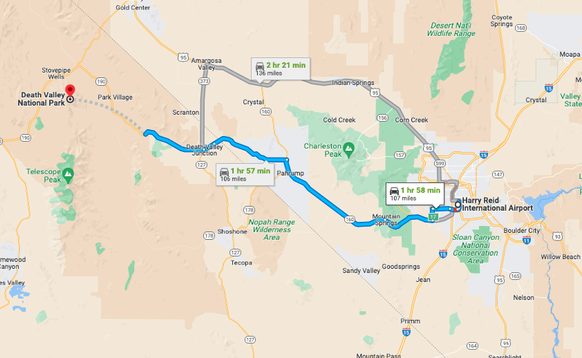
As Death Valley National Park has no public transportation or shuttle, the only way to get to the park is by car.
The nearest international airport is Las Vegas’ Harry Reid International Airport (LAS), which is a two-hour drive away. You can then rent a car and take a Las Vegas to Death Valley road trip along the US-95.
Alternatively, you can also travel from Los Angeles for roughly four-and-a-half hours. The majority of this route will take you along the I-15 northbound.
A trip from Phoenix, Arizona, will take approximately six hours along the US-93 northbound. Lastly, if you’re further north traveling from San Francisco, you can expect a seven-and-a-half-hour trip along the State Hwy 120 eastbound.
Death Valley National Park Tours
What To Pack For Death Valley National Park
- Sunscreen: This is a no brainer. There are areas on the trail where there is no shade. Slather some on right before the trek. >Buy Sunscreen
- Hiking Boots/Shoes: If you use tennis shoes you can easily hurt your toes hitting a rock by accident (Trust me I have done it so many times before). >Check Out My Hiking Shoes
- Hiking socks: Having the correct socks helps you prevent getting blisters. Smart Wool is probably my favorite brand out there. >Buy Hiking Socks
- Refillable water bottle: I always bring a Hydroflask on all my adventures. They are on the heavier side, but I know for a fact they will not break. I have had a few cheap water bottles break on me before. There is no room for error at Death Valley. >Check Prices Now
- Lots of water: Death Valley is HOT. Bring a ton of water!
- Sunglasses: Like I said, it can get pretty sunny.>Check Out These Sunglasses
- Snacks: The best snacks are jerky, nuts, energy bars. Cliff Bars are great for hiking.
- Trekking Poles: This is an optional product, but they really help with the knees. The poles I have listed are known to be one of the best in the market. >Buy The Trekking Poles Here
- Camera: I have linked the camera I used to take pictures of the Grand Canyon. The Sony A6000 is a great camera for people that want to start improving at travel photography. >Buy Sony Camera Here
- First Aid Kit: This is one of the first things I bought when I first started backpacking and camping. It is super portable. >Buy This Awesome First Aid Kit Here
- Day Pack: The REI bag I have linked, we have had for seven years now, and it is still going strong! >Buy This Great Quality Backpack
- Good hiking pants: These are probably the best hiking pants that I have found. They keep you dry in the crazy weather, and they are durable. >Buy my hiking pants here
- Breathable sweat-wicking shirts: >Check This One Out
- Sports Bra: For women. >Buy One Here
- Jacket: Only in the winter >Buy My Favorite Jacket
- National Park Pass: I highly recommend getting a year-long America The Beautiful Pass. >Get It Here
- Map: I love the National Geographic Maps! They are the best! >Buy One Here

Claim your FREE Hiking Checklist
Ready to start hiking? Grab my free hiking checklist and never forget anything at home!
Where to Stay in Death Valley National Park
As for where to stay in Death Valley, you’re really spoiled for choice. Many national parks don’t offer accommodation in the park, but Death Valley does. From luxury stays to affordable camping options, here are a couple of the top options.
Budget | Panamint Springs Motel & Tents
If you’re searching for something simple with all the comforts necessary when staying in Death Valley, look no further than Panamint Springs Motel. The wood-cabin-style rooms offer rustic lodging, which pairs perfectly with some modern amenities like air conditioners (which are a necessity).
They provide a minimarket on-site so you can stock up before your day of exploring. You can also tuck into some classic American delicacies at the Panamint Grill. It’s a real all-American stay for those on a budget. >>>Check Availability
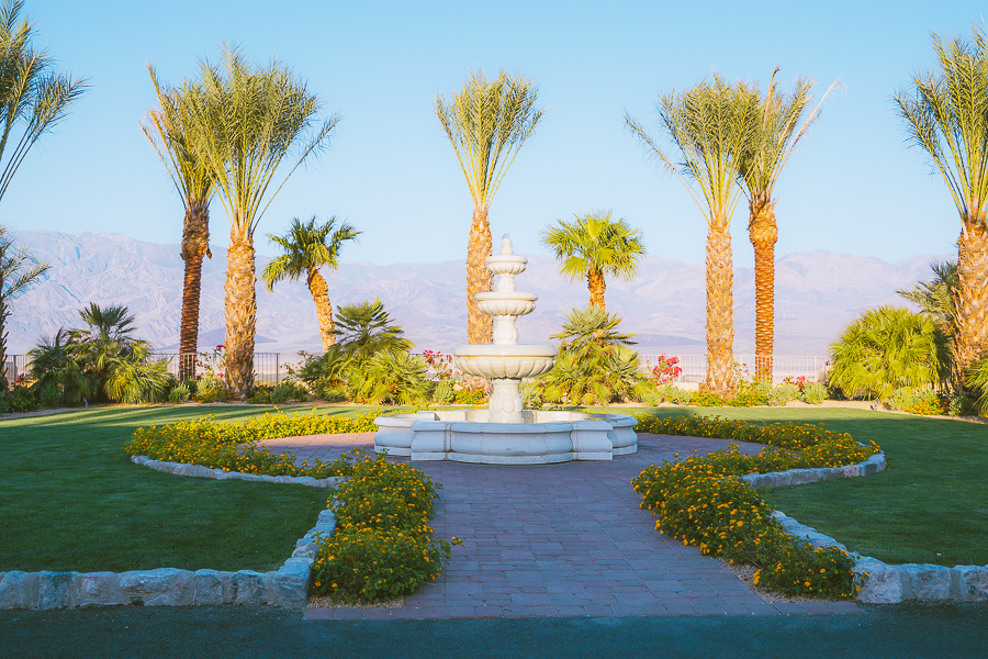
Mid-Range | The Ranch at Death Valley
For a stay in a more central location of the park, The Ranch at Furnace Creek is a fantastic mid-range option. While the rooms offer an air of elegance and simplicity to them, the resort as a whole is as luxurious as you might expect.
You can enjoy free walking tours, tuck into the complimentary breakfast, or splash around in the refreshing pool. It’s a very kid-friendly stay, with playgrounds and buffets offered. >>>Check Availability
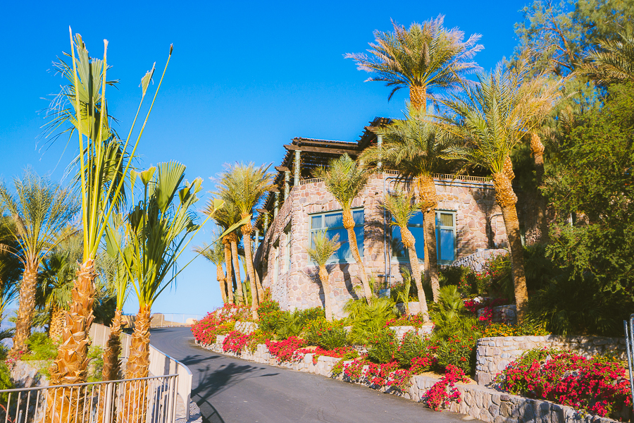
Luxury | The Inn at Death Valley
If you’re only planning on spending one day in Death Valley, splurging on a stay at The Inn is definitely worth considering. The wellness and spa center allows you to melt the stresses of travel away while the two on-site restaurants dish up some simply divine cuisine.
The resort also offers guided tours of the area, and its central location in Furnace Creek makes it a great base for touring the park. Plus, the lowest-elevation golf course in the world is only 1.8 miles from this magical resort. >>>Check Availability
Best Death Valley Campgrounds
If you’re looking for a slightly more naturalistic experience, then camping could be up your alley. With 12 campgrounds across the park, it’s not plain sailing when choosing where to set yourself up.
Here are the top three spots to consider, each offering a unique experience:
Budget | Mesquite Springs Campground
Nestling below Grapevine Canyon, this is a lovely first-come-first-served campground. There are no showers or electricity, but there are flush toilets and potable water available. Ubehebe Crater is also just 8.4 miles away. With the average fee being $14 per day, it’s a very affordable camping option. >>>Check Availability
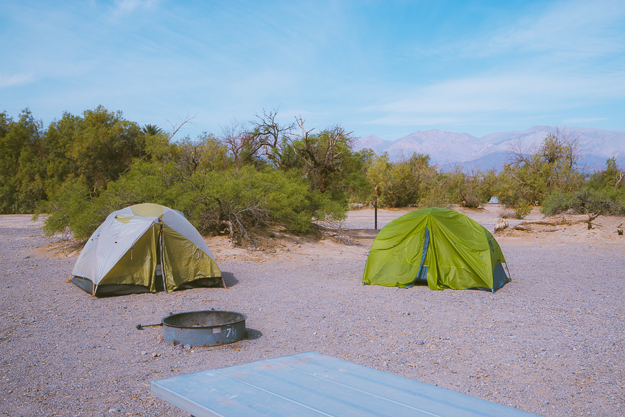
Mid-Range | Furnace Creek Campground
For something slightly more centrally located, consider staying at the Furnace Creek Campground. It has all the necessary amenities like picnic tables, electric hookups, and flush toilets. The prices range depending on the seasons, as this is a very popular campsite. You’ll need to book a spot during the peak season from October to March. >>>Check Availability
Luxury | Tarantula Ranch Vineyard
If you’ve been glamping before, then you’ll know how amazing these lodgings are. And the Tarantula Ranch is where glamping is done right. They follow the leave no trace principles, making it an ecologically aware campsite. From its quaint RV-style glampsites to the stunning BBQ facilities, you’ll be able to enjoy Death Valley in a truly unique way. >>>Check Availability
Read More: Where to Stay in Death Valley | 13 Hotels, Resorts & Camping Spots
A Complete Death Valley National Park Itinerary
Get ready to see how you can make your time in Death Valley an unforgettable one. This itinerary focuses on the top hikes in Death Valley. After all, hiking is the best way to see the park’s magical landscapes.
Day One Death Valley Itinerary
Day one is all about exploring the breathtaking hikes in the park’s central region. The hikes have been arranged in such a way that the time of day perfectly coincides with the best viewing times of each landscape.
Top Tip: It’s a great idea to visit the Furnace Creek Visitor Center before venturing through the park. They provide some helpful tips and information about staying safe when in Death Valley.
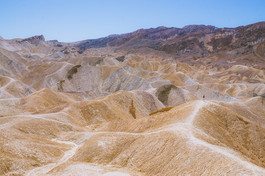
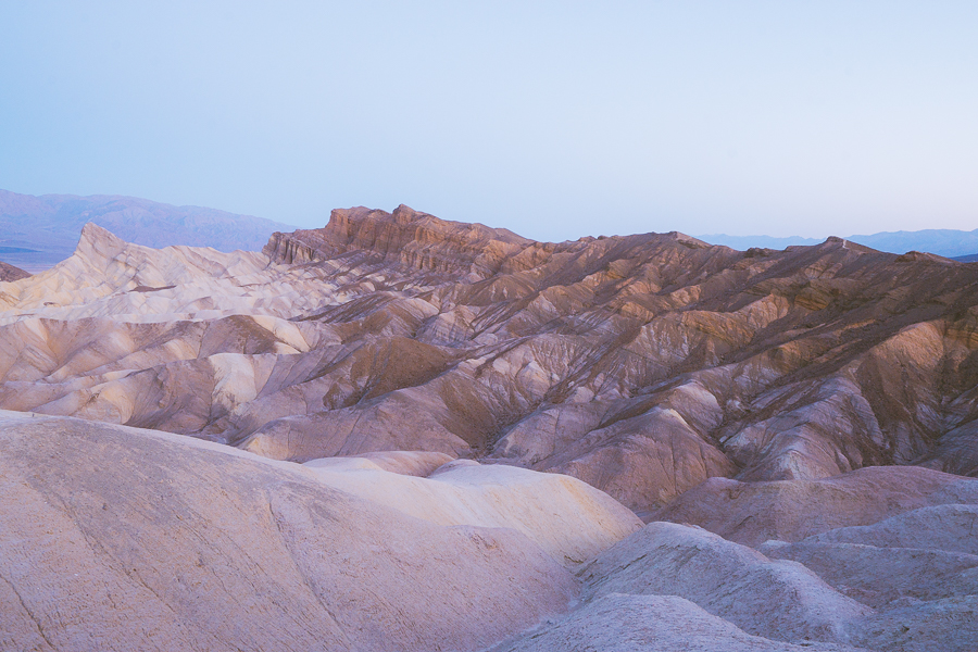
Enjoy the Sunrise at Zabriskie Point
- Elevation Gain: 50 feet
- Mileage: 0.4 miles (out and back)
- Difficulty: Easy
- Trail Guide: Link
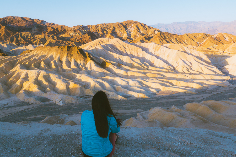
Just 4.6 miles separates Zabriskie Point and the tourist hub of Furnace Creek. As such, this is easily one of the most accessible sunrise spots in the park. To make things even better, the hike to this mystical viewpoint is very easy and will take you around 10 minutes to complete.
If you’re a photographer at heart, have your camera gear ready to go: it’s one of the most popular sunrise spots for a reason. As the sun peaks over the horizon behind you, the landscape is painted in a vivid array of violets, pinks, golds, and reds.
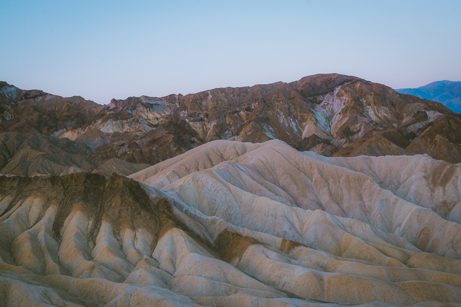
It’s a sight few viewpoints can outdo, so getting there early and finding a comfortable spot is essential. As the light begins to increase, you’ll get a clearer view of the salt flats below and Panamint Mountain towering in the distance.
The most notable landmark from this viewpoint will be Manly Beacon, as the spire shoots up above the Death Valley badlands.
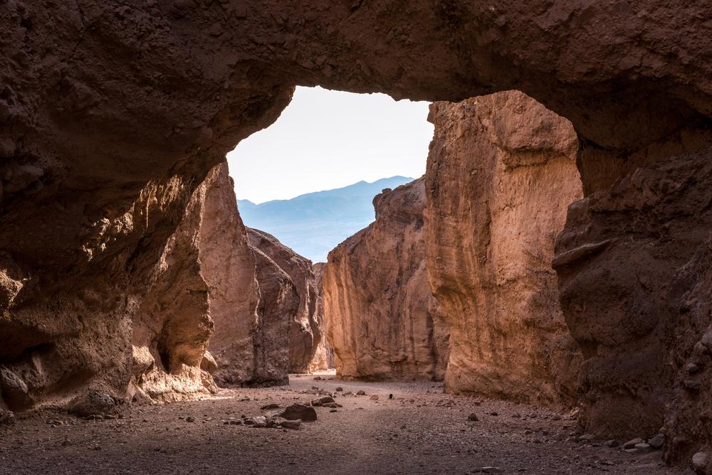
Hike Golden Canyon, Gower Gulch, and Badlands Loop
- Elevation Gain: 1,082 feet
- Mileage: 6.4 miles (loop)
- Difficulty: Moderate
- Trail Guide: Link
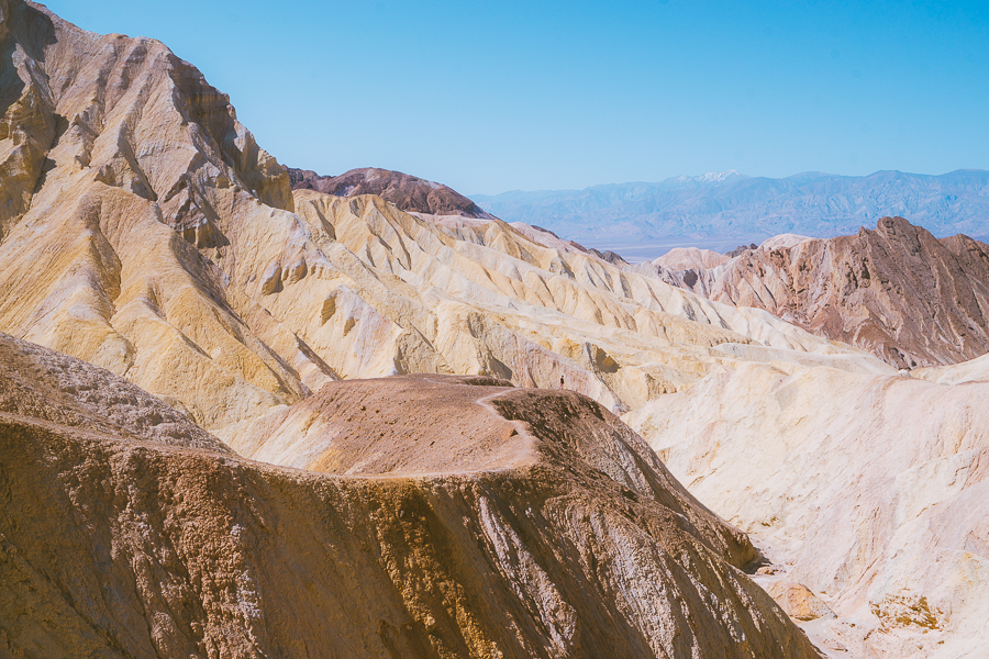
Luckily, you don’t need to drive to this next trail, as the Golden Canyon hike kicks off from the Zabriskie Point parking lot. Starting early is also a good idea, as the trail gets super busy throughout the day.
You can expect some scrambling and uphill battles during this trek, but you’ll also see some iconic attractions along the way. Aside from passing Zabriskie Point, you’ll venture through the colorful badlands that rest just below the viewpoint.
It may seem eerily familiar, and that’s largely thanks to Star Wars, which used these very badlands as a filming location. Roughly 1.6 miles into the hike, you’ll reach the summit of Manly Beacon before continuing on past the aptly named Red Cathedral cliff face.
The trail then loops around to the Golden Canyon stretch, where the dramatic scenery continues to come. After this, the second half of the trail is a steady uphill climb back to Zabriskie Point, which can be difficult for some.
Top Tip: If you’re doing well on time, consider making a slight detour to the Twenty Mule Team Canyon. It’s a captivating 20 to 30-minute dirt road drive just 4.6 miles south of Zabriskie Point.
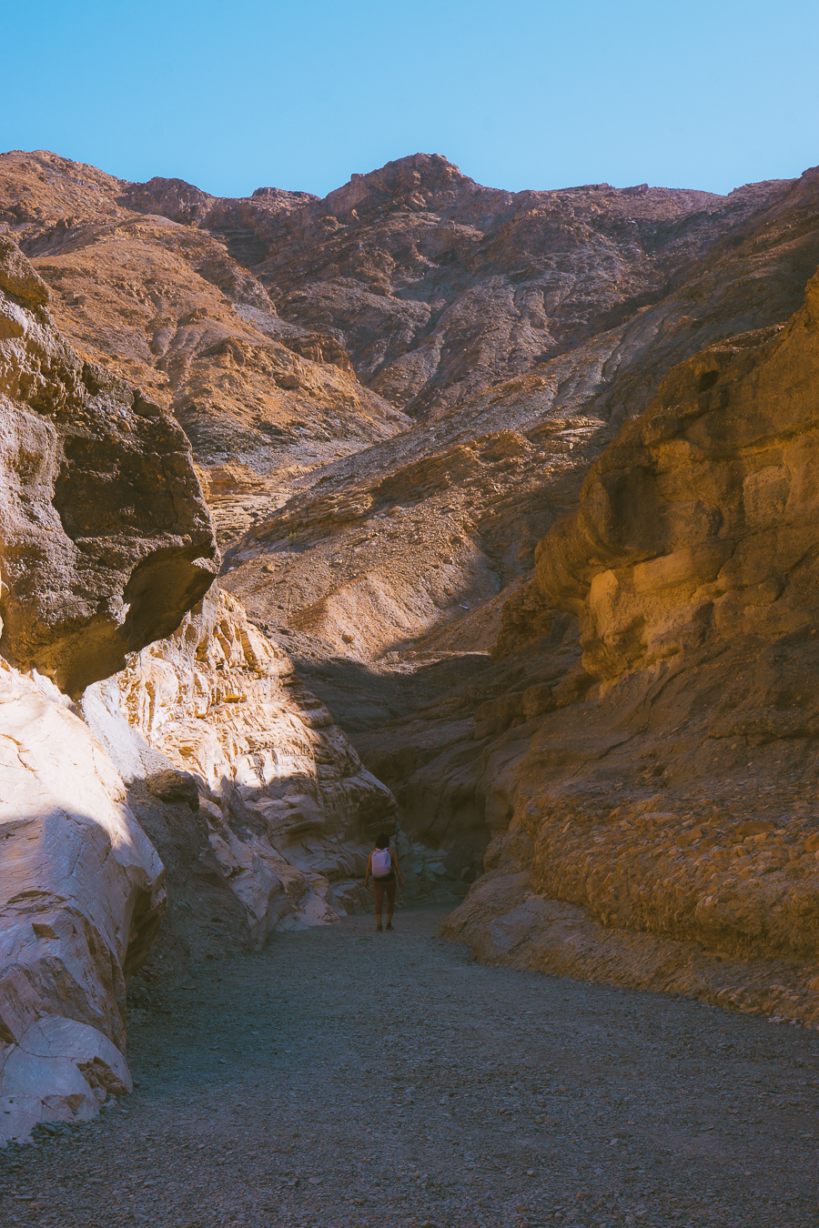
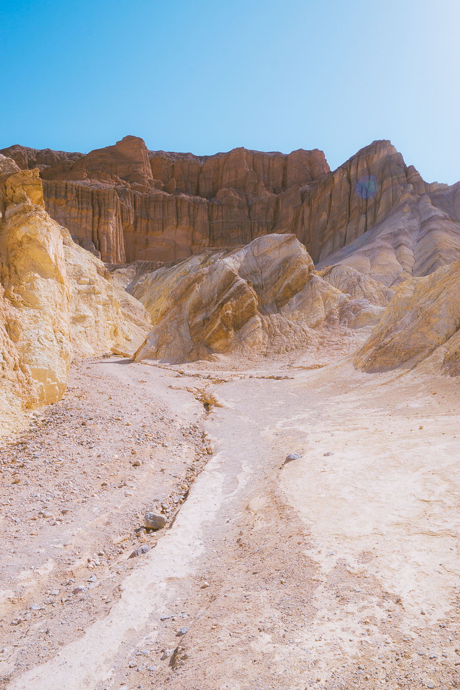
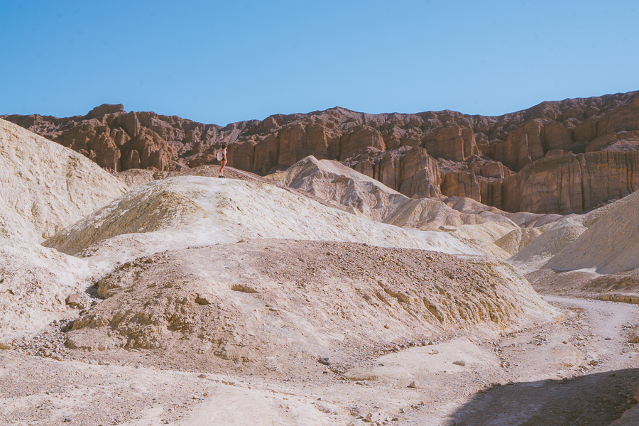
Admire Mosaic Canyon
- Elevation Gain: 958 feet
- Mileage: 3.3 miles (out-and-back)
- Difficulty: Moderate
- Trail Guide: Link
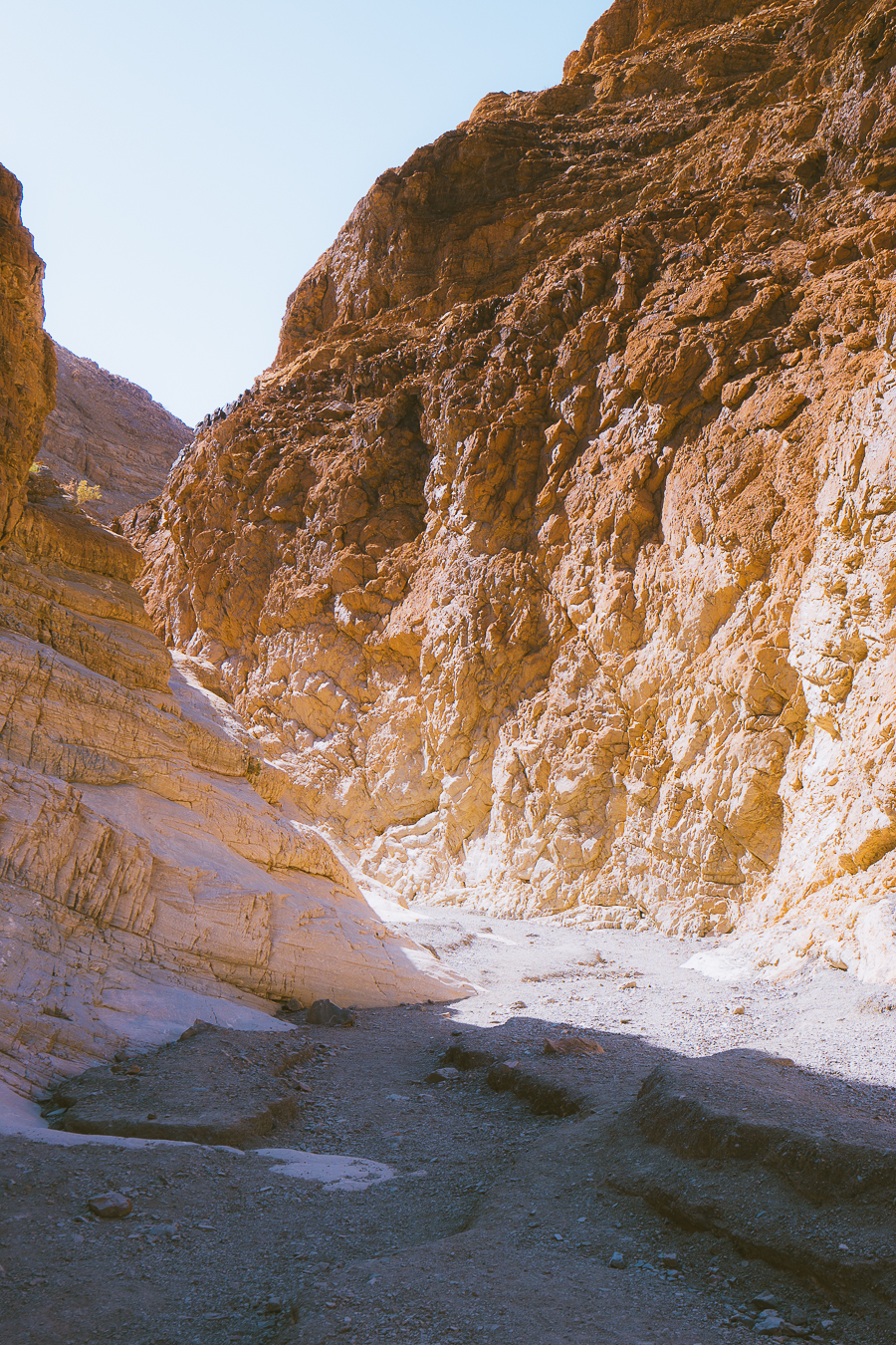
It’s roughly a 35-minute drive from Zabriskie Point to the Mosaic Canyon trailhead, where a truly extraordinary experience awaits. The thick marble slabs (known as breccia) that line the canyon walls mean this trail stays fairly cool throughout the day.
Aside from the temperature benefits of this trek, there’s also a whole world of magical rock formations for you to discover. It’s an out-and-back trail that leads you through the heart of the badlands.
You can expect this meandering trail to take you around two hours to complete as you traverse through the dry falls of this canyon. It leads you all the way to an ambient amphitheater and impassable dry fall towering 25ft overhead.
It’s a pretty tiresome trek to the final dry fall due to the steep gradient of the hike — which hits 12% at some points.
Top Tip: This trail is susceptible to flash flooding during rains. Keep an eye on the weather forecast before visiting this trail.
Soak in the Sunset at Mesquite Flat Sand Dunes
- Elevation Gain: 206 feet
- Mileage: 2.8 miles (out-and-back)
- Difficulty: Easy
- Trail Guide: Link
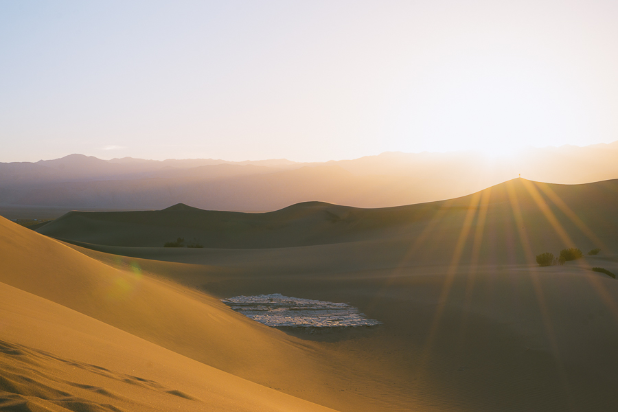
End your day with a vivid sunset at the Mesquite Flat Sand Dunes, just 1.5 miles from Mosaic Canyon. This out-and-back trail offers otherwordly views of the expansive sand dunes, reminiscent of those you would see in Great Sand Dunes National Park.
While there’s no set trail or marked path, you’ll need to trek for around a mile to reach the tallest of the dunes. It makes for a really fun experience that adults and kids alike can enjoy.
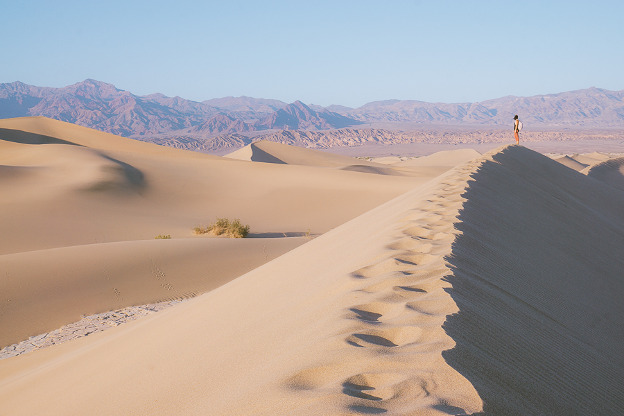
Whether you choose to keep your best hiking shoes on or feel the sand beneath your feet is up to you. One thing to keep in mind is that these dunes are still a part of a delicate ecosystem. So it’s best to walk gently and avoid any growing vegetation if possible.
Aim to get to the tallest dune before sunset and find a comfortable spot. The sunsets here paint the sky in beautiful shades of lilac, orange, and deep purples as the navy blue night starts to appear.
Top Tip: If you’re up for it, stay at the dunes beyond sunset and admire the stars. It’s one of the best places in the park for stargazing.
Day Two Death Valley Itinerary
Day two is all about visiting the most iconic attractions in the park. These include Artist’s Palette, Devil’s Golf Course, and Badwater Basin. You can also enjoy the lovely hiking trails at each location, which aren’t as strenuous as the treks on day one.
See the Sunrise at Artist Palette
- Elevation Gain: 108 feet
- Mileage: 0.3 miles (out-and-back)
- Difficulty: Easy
- Trail Guide: Link
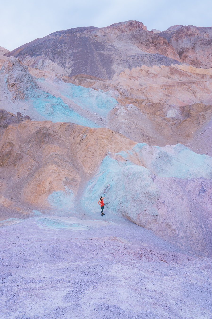
If you thought the sunrise views at Zabriskie Point couldn’t be topped, then just wait for the unmistakably beautiful sunrise at Artist’s Palette. This isn’t a viewpoint overlooking Death Valley but rather one looking into the colorful hills beyond.
The trail itself is short and fairly easy, although there are a few steep sections as you reach the end of the hike. As the sun rises in the distance, the variation of color is something you’d expect to see on another planet.
A combination of ash, lava, magma-heated water, and minerals brought about this dazzling valley that comes alive during sunrise. Expect to see pinks, reds, browns, blues, lavenders, and even greens, with each color increasing in intensity as the sun rises.
Simply put, you won’t forget this magical start to your day anytime soon.
Grab Your Free Car Camping Checklist! 🚗🌲
Ready to elevate your car camping game? Snag our essential checklist to ensure you’ve got everything you need for a stress-free, fun-filled adventure! Perfect for beginners and seasoned campers alike. Download now and hit the road prepared! 🌟🎒
Visit the Devil’s Golf Course
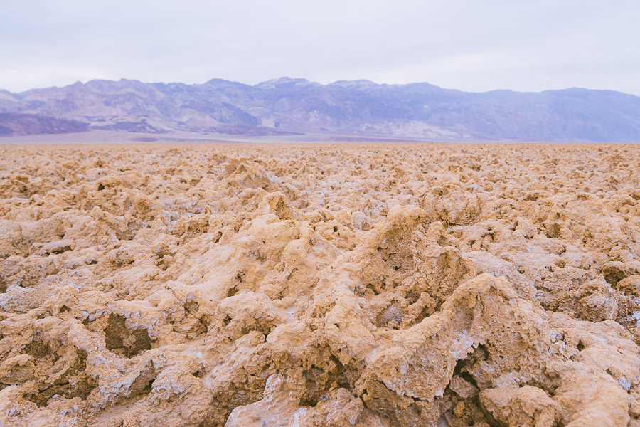
Just 4.9 miles from Artist’s Palette along Badwater Road, you’ll find the peculiar sight of Devil’s Golf Course. Now, it may sound crazy, but this is a large salt pan that looks… well… nothing like a typical salt pan.
You may know a salt pan to be this expansive flat region covered in cracking salt. Well, Devil’s Golf Course definitely is an expansive region of the desert, but replace flat cracking salt with sharp, jagged rock and salt sediments.
It’s a truly dumbfounding sight and something worth getting out of the car and exploring for a bit. You’ll be able to snap some truly bizarre photographs you can only find here.
Top Tip: There are loads of bugs at Devil’s Golf Course for some reason, so be sure to bring bug spray.
Take on the Natural Bridge Trail
- Elevation Gain: 450 feet
- Mileage: 1.4 miles (out-and-back)
- Difficulty: Easy
- Trail Guide: Link
Roughly 5.2 miles from Devil’s Golf Course, you’ll find the trailhead for Natural Bridge Canyon. This is a relatively easy trail that shows you the real power of nature and the erosive capabilities of water and wind.
The canyon has been carved away by millions of years of rain and pounding winds, which eventually left behind a truly exceptional natural bridge. You’ll see this striking attraction just 0.4 miles into the hike.
You can take in the natural beauty of this landmark — with a camera in hand, of course — before continuing along the trail. While you can turn back if you like, there are still two dry falls for you to see. These dry falls open up to some lovely shaded spaces, perfect for a relaxing picnic before heading back to the trailhead.
Note: Although the elevation of this trail is fairly easy to handle, there are some narrow and uneven sections. Make sure you’re aware of where you step so you don’t injure yourself.
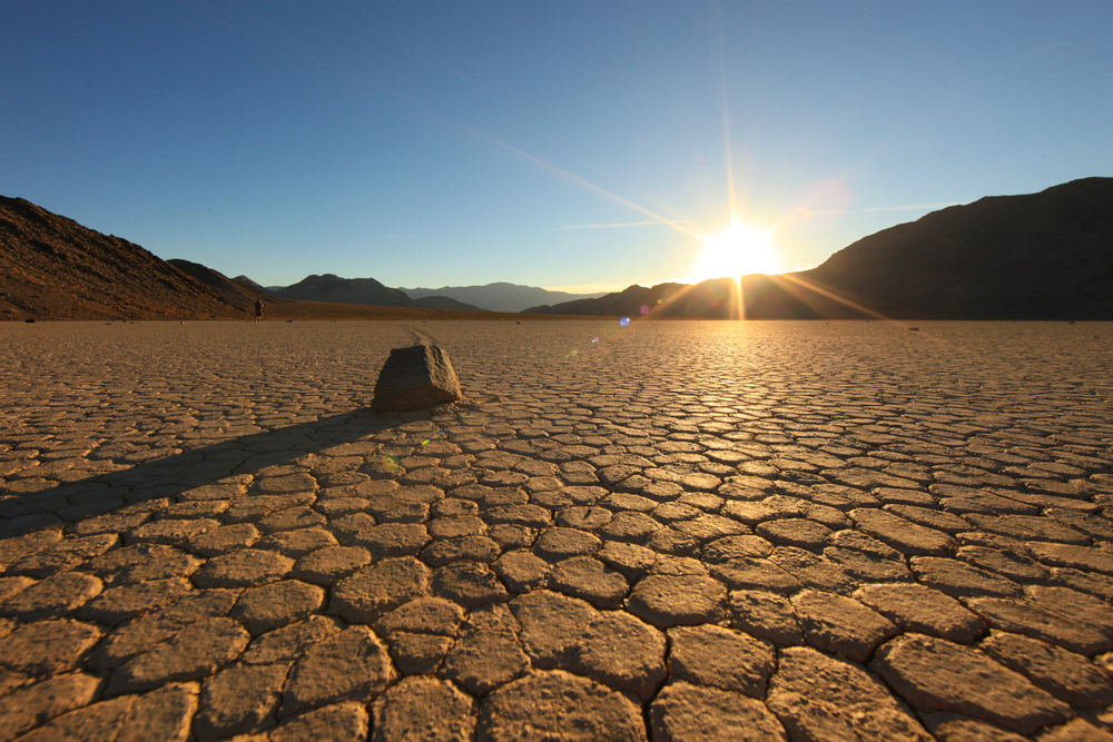
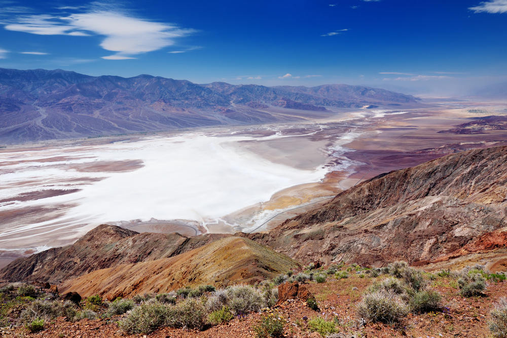
Step Into the Badwater Basin
- Elevation Gain: 7 feet
- Mileage: 1-5 miles (out-and-back)
- Difficulty: Easy
- Trail Guide: Link
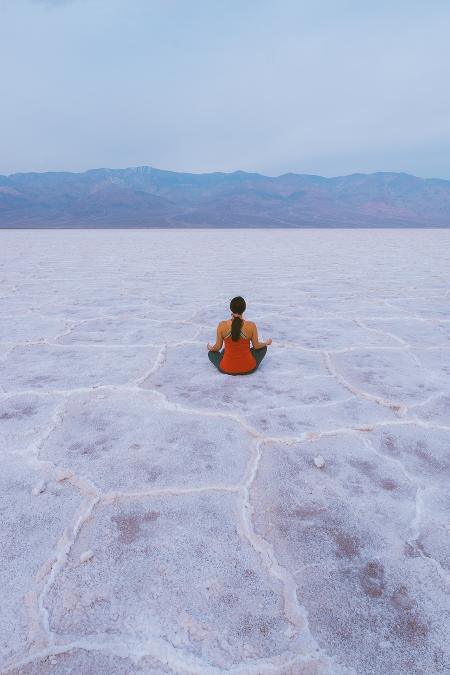
If you’re looking to visit the lowest point in Death Valley National Park and North America, take a 3.1-mile drive from the Natural Bridge trailhead. At 282 feet below sea level, Badwater Basin is a truly remarkable spot to visit.
Pair its record-breaking elevation with the fact it’s an expansive salt flat surrounded by dramatic rugged mountain ranges, and you’re in for a real treat. The hike itself has little to no elevation, so it’s a very easy trek.
While it’s a five-mile from one side of the basin to the other, you can choose how far you’d like to go. Just be mindful that the salt border will collapse if you stand off them, so keep an eye on where you place for feet.
It’s a truly remarkable sight to see in Death Valley and something your camera won’t be able to get enough of. This trail doesn’t offer shade, though, so avoid hiking at midday, and remember to leave enough time for the sunset views a the last destination for day two.
Visit Dante’s View
To end day two on a high, admiring the sunset at Dante’s View is an absolute must. It’s about an hour’s drive from Badwater Basin to the viewpoint, but it’s definitely worth the little bit of travel time.
It’s one of the most popular sunset spots in the park, so you’ll want to get to the viewpoint at least thirty minutes before dusk.
From here, you’ll be able to see the two extremes of this magical national park. The lowest point in the park —Badwater Basin — is unmissable thanks to its pearl-white surface. On the other end of the spectrum, the highest point in Death Valley — Telescope Peak — can be seen overlooking the glistening salt flat.
It’s a region of two extremes and a sight that becomes even more spectacular come sunset.
Download my free Outdoor Photography Guide
Day Three Death Valley Itinerary
While you could cut this into a Death Valley 2-day itinerary, you’d miss out on a few more fantastic attractions. Day three takes you on a journey from the park’s western side to its northern star attraction, the Ubahebe Crater.
See an Oasis at Darwin Falls
- Elevation Gain: 450 feet
- Mileage: 2 miles (out-and-back)
- Difficulty: Moderate
- Trail Guide: Link
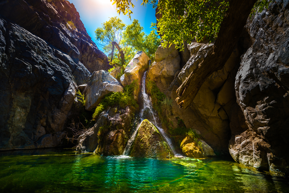
A lot of this itinerary’s activities have taken place in the eastern and central regions of the park, so it’s high time you see Death Valley’s western gems. Not many would expect to hear the sound of cascading water in the driest region in the US — the Mojave Desert — but stranger things have happened.
Darwin Falls is one of the few year-round waterfalls in Death Valley, so you’re almost guaranteed to see this oasis in full flow. While the trail isn’t marked per se, it’s fairly easy to follow as you wind your way alongside the desert wash.
There are a couple of river crossings you’ll need to make as the sound of rushing water intensifies. You’ll also notice the lush vegetation getting greener and greener the closer you get to the falls.
Once there, simply relax and enjoy the sounds and sight of birds and dragonflies as they dance around the paradise in the desert.
Note: You are not allowed to swim in the river, so please respect the National Park Service rules.
Enjoy Some History at Scotty’s Castle
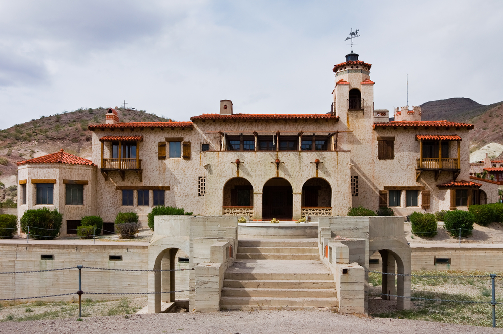
After a refreshing hike at Darwin Falls, hit the road on an hour-and-a-half drive to Scotty’s Castle. The drive alone offers some magical sightseeing opportunities along the CA-190. Probably the most picturesque and photo-worthy section is the 16-mile stretch from Towne Pass to Stovepipe Wells.
Built in 1922, Scotty’s Castle is a historic landmark hidden deep in Grapevine Canyon. It perfectly encapsulates the highs of the 1920s and the lows of the 1930s, as the Great Depression left the building unfinished.
Its historic hardships don’t end there either, as a severe flood in 2015 destroyed much of the opulent building. Restorations are underway, and the landmark is only expected to be open to the public again in 2025.
That said, the Death Valley National History Association offers private guided tours of Scotty’s Castle, with tickets costing $25 per person.
Admire Ubehebe Crater
- Elevation Gain: 357 feet
- Mileage: 1.8 miles (loop)
- Difficulty: Moderate
- Trail Guide: Link
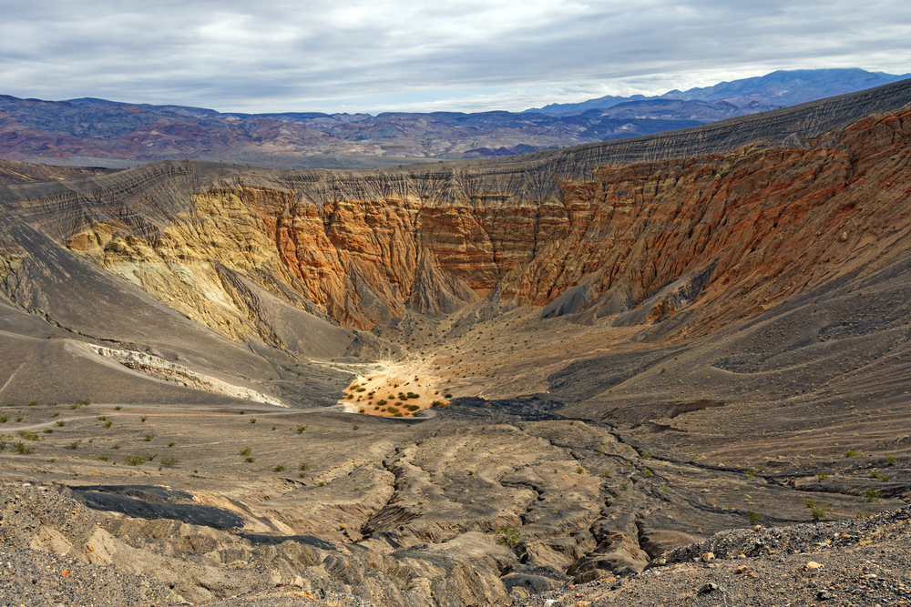
To end your trip to Death Valley, you simply have to visit the Ubehebe Crater.
It’s a massive 0.5-mile wide and 600 ft deep crater that you may think was formed by a meteor, but it actually wasn’t. It’s unbelievable to think a build-up of steam underground created enough pressure to explode and make this huge crater, but that’s exactly what happened.
While you can view Ubehebe from your car, it’s best to enjoy the looped hike around the crater. You can hike down to the center of the crater, where unforgettable views await. But this must be done with caution, as the loose gravel and steep incline make it fairly difficult to climb.
While you can tackle this trail either clockwise or anti-clockwise, it’s best to do the latter as it means the steep incline is completed early into the hike.
How Many Days in Death Valley Is Enough?
There’s no right or wrong answer, but a Death Valley 3-day itinerary is the most ideal. It gives you enough time to explore the national park without being rushed or missing out on a magical attraction.
While spending 2 days in Death Valley is definitely doable, you’ll probably have to cut down some of the park’s hikes. There’s nothing wrong with this, but one of the main reasons for visiting is the stunning hikes through Death Valley’s ethereal landscapes.
Now, if you’re really short on time and can only visit Death Valley in one day, there’s only one way you can do this. Some people prefer to join a one-day guided tour. While this Las Vegas to Death Valley excursion will cover all the main attractions in the park, it only skims the surface.
Simply put, three or more days is the optimal amount of time to allocate to your Death Valley trip.
FAQs About Visiting Death Valley
You may still have a few questions before heading on your trip to Death Valley National Park. Here are all the answers to need to the most common questions.
Why Is Death Valley so Expensive?
In short, gas and goods are expensive due to the risks involved in their transportation. Considering this is both the lowest point in North America and the hottest, issues associated with melting tires and cars overheating can arise.
Try and fill up your cars and stock up on food before entering the park.
Is it Better to Visit Death Valley or Joshua Tree?
Death Valley is better for experiencing unique landscapes and epic hikes. On the other hand, Joshua Tree’s hikes provide you with magical desert wildlife, including birds and plants. Each park offers a unique experience and really depends on what you want to see.
How Long Does a Death Valley Road Trip Take?
If you drive from East to West through the park or vice versa, it can take you no longer than two hours. While this is a fairly short travel time in the grand scheme of things, this excludes stops to take on hikes, visit viewpoints, and epic attractions.
Is it Safe to Hike in Summer in Death Valley?
It is highly advised you don’t hike in Death Valley during summer. It‘s highly likely you can suffer from heat stroke, dehydration, and fatigue. Doing anything outdoors in Death Valley in summer is almost impossible, so instead, aim to visit in the winter months or spring. I went in the spring and felt a bit faint from hiking, so I can’t imagine the summer months.
Is There Cell Phone Reception in Death Valley?
Generally speaking, the park has very poor cell phone coverage. This is why having a pre-downloaded map is essential. The spots with decent cell phone reception are tourist hotspots like Furnace Creek, Stovepipe Wells, and Panamint Springs.
It’s also important you always hike with someone due to the lack of cell phone reception.
Final Thoughts on Planning the Perfect Death Valley Vacation
So there you have it, a complete Death Valley guide that is sure to leave you inspired. As far as what to do in Death Valley goes, it’s fair to say the top activities include hiking and driving.
To end off, rather avoid visiting Death Valley in summer, if you can. After all, it’s one of the best national parks to visit in winter for so many reasons.